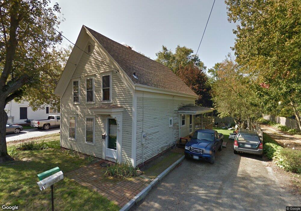
12 Maple Ave Eliot, ME 03903
South Eliot NeighborhoodEstimated Value: $554,883 - $812,000
4
Beds
2
Baths
1,764
Sq Ft
$381/Sq Ft
Est. Value
About This Home
This home is located at 12 Maple Ave, Eliot, ME 03903 and is currently estimated at $671,471, approximately $380 per square foot. 12 Maple Ave is a home located in York County with nearby schools including Marshwood High School.
Ownership History
Date
Name
Owned For
Owner Type
Purchase Details
Closed on
May 5, 2006
Sold by
Dorr E John Est and Dorr John E
Bought by
Dorr John E and Holcomb Liane S
Current Estimated Value
Create a Home Valuation Report for This Property
The Home Valuation Report is an in-depth analysis detailing your home's value as well as a comparison with similar homes in the area
Home Values in the Area
Average Home Value in this Area
Purchase History
| Date | Buyer | Sale Price | Title Company |
|---|---|---|---|
| Dorr John E | -- | -- |
Source: Public Records
Tax History
| Year | Tax Paid | Tax Assessment Tax Assessment Total Assessment is a certain percentage of the fair market value that is determined by local assessors to be the total taxable value of land and additions on the property. | Land | Improvement |
|---|---|---|---|---|
| 2024 | $4,138 | $349,200 | $201,300 | $147,900 |
| 2023 | $4,066 | $331,900 | $190,900 | $141,000 |
| 2022 | $4,016 | $331,900 | $190,900 | $141,000 |
| 2021 | $3,971 | $317,900 | $182,200 | $135,700 |
| 2020 | $4,331 | $294,600 | $173,600 | $121,000 |
| 2019 | $5,979 | $294,600 | $173,600 | $121,000 |
| 2018 | $5,915 | $294,600 | $173,600 | $121,000 |
| 2017 | $314 | $294,600 | $173,600 | $121,000 |
| 2016 | $5,144 | $294,600 | $173,600 | $121,000 |
| 2015 | $4,124 | $294,600 | $173,600 | $121,000 |
| 2014 | $4,065 | $294,600 | $173,600 | $121,000 |
| 2013 | $3,880 | $294,600 | $173,600 | $121,000 |
Source: Public Records
Map
Nearby Homes
- 96 Spinnaker Way
- 14 Birch St
- 5 Spinney Way Unit 9
- 45 Shearwater Dr
- 37 Shearwater Dr Unit 1906
- 25 Oak Terrace
- 27 Oak Terrace
- 18 Shipping Ln
- 22 Summer Ln
- 1360 Woodbury Ave
- 525 Maplewood Ave Unit 9
- 80 Woodlawn Cir
- 8 Caslyn Dr
- 35 Badgers Island W Unit 203
- 35 Badgers Island W Unit 301
- 35 Badgers Island W Unit 302
- 35 Badgers Island W Unit 103
- 238 Deer St Unit 305
- 238 Deer St Unit 206
- 238 Deer St Unit 205
Your Personal Tour Guide
Ask me questions while you tour the home.