Estimated Value: $1,038,000 - $1,236,000
4
Beds
3
Baths
2,710
Sq Ft
$420/Sq Ft
Est. Value
About This Home
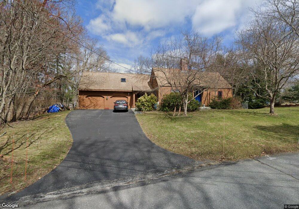
This home is located at 12 Meadow Brook Rd, Acton, MA 01720 and is currently estimated at $1,138,825, approximately $420 per square foot. 12 Meadow Brook Rd is a home located in Middlesex County with nearby schools including Acton-Boxborough Regional High School and Oak Meadow Montessori School.
Ownership History
Date
Name
Owned For
Owner Type
Purchase Details
Closed on
Dec 23, 2021
Sold by
Niple Edward R
Bought by
2021 Edward R Niple T
Current Estimated Value
Purchase Details
Closed on
May 18, 1988
Sold by
Buono Angelo A
Bought by
Niple Edward R
Home Financials for this Owner
Home Financials are based on the most recent Mortgage that was taken out on this home.
Original Mortgage
$100,000
Interest Rate
10.13%
Mortgage Type
Purchase Money Mortgage
Create a Home Valuation Report for This Property
The Home Valuation Report is an in-depth analysis detailing your home's value as well as a comparison with similar homes in the area
Home Values in the Area
Average Home Value in this Area
Purchase History
| Date | Buyer | Sale Price | Title Company |
|---|---|---|---|
| 2021 Edward R Niple T | -- | None Available | |
| Niple Edward R | $260,000 | -- |
Source: Public Records
Mortgage History
| Date | Status | Borrower | Loan Amount |
|---|---|---|---|
| Previous Owner | Niple Edward R | $80,000 | |
| Previous Owner | Niple Edward R | $100,000 |
Source: Public Records
Tax History Compared to Growth
Tax History
| Year | Tax Paid | Tax Assessment Tax Assessment Total Assessment is a certain percentage of the fair market value that is determined by local assessors to be the total taxable value of land and additions on the property. | Land | Improvement |
|---|---|---|---|---|
| 2025 | $17,003 | $991,400 | $355,300 | $636,100 |
| 2024 | $15,990 | $959,200 | $355,300 | $603,900 |
| 2023 | $16,271 | $926,600 | $322,700 | $603,900 |
| 2022 | $14,679 | $754,700 | $280,600 | $474,100 |
| 2021 | $14,193 | $701,600 | $260,100 | $441,500 |
| 2020 | $13,060 | $678,800 | $260,100 | $418,700 |
| 2019 | $12,604 | $650,700 | $260,100 | $390,600 |
| 2018 | $12,434 | $641,600 | $260,100 | $381,500 |
| 2017 | $12,229 | $641,600 | $260,100 | $381,500 |
| 2016 | $11,498 | $597,900 | $260,100 | $337,800 |
| 2015 | $11,384 | $597,600 | $260,100 | $337,500 |
| 2014 | $11,104 | $570,900 | $260,100 | $310,800 |
Source: Public Records
Map
Nearby Homes
- 524 Main St
- 491 Main St
- 709 Main St
- 23 John Swift Rd
- 159 Skyline Dr Unit 159
- 388 Great Rd Unit B14
- 386 Great Rd Unit A8
- 11 Horseshoe Dr
- 390 Great Rd Unit A2
- 420 Great Rd Unit B3
- 407 Great Rd Unit 9
- 134 Pope Rd
- 1 Bayberry Rd
- 484 Great Rd
- 484 Great Rd
- 5 Oakwood Rd
- 9 Breezy Point Rd
- 4 Huron Rd
- 1 Quarry Rd
- 8 Laurel Ct
- 10 Meadow Brook Rd
- 5 Putnam Rd
- 110 & 112 Nagog Hill Rd
- 9 Meadow Brook Rd
- 11 Meadow Brook Rd
- 3 Putnam Rd
- 112 Nagog Hill Rd
- 110 Nagog Hill Rd
- 114 Nagog Hill Rd
- 106 Nagog Hill Rd
- 7 Meadow Brook Rd
- 118 Nagog Hill Rd
- 8 Putnam Rd
- 6 Meadowbrook Rd
- 6 Meadow Brook Rd
- 4 Putnam Rd
- 54 Woodbury Ln
- 10 Putnam Rd
- 9 Putnam Rd
- 98 Nagog Hill Rd