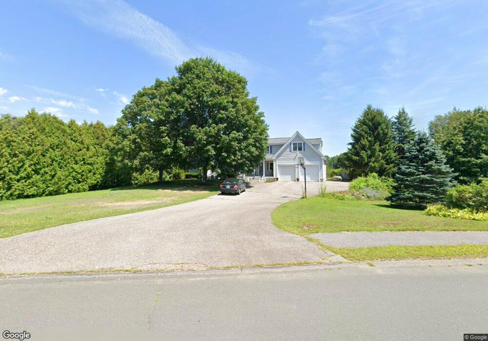
12 Meadow Dr Littleton, MA 01460
Estimated Value: $957,449 - $1,269,000
3
Beds
3
Baths
2,804
Sq Ft
$387/Sq Ft
Est. Value
About This Home
This home is located at 12 Meadow Dr, Littleton, MA 01460 and is currently estimated at $1,083,862, approximately $386 per square foot. 12 Meadow Dr is a home located in Middlesex County with nearby schools including Shaker Lane Elementary School, Russell Street Elementary School, and Littleton Middle School.
Create a Home Valuation Report for This Property
The Home Valuation Report is an in-depth analysis detailing your home's value as well as a comparison with similar homes in the area
Home Values in the Area
Average Home Value in this Area
Tax History Compared to Growth
Tax History
| Year | Tax Paid | Tax Assessment Tax Assessment Total Assessment is a certain percentage of the fair market value that is determined by local assessors to be the total taxable value of land and additions on the property. | Land | Improvement |
|---|---|---|---|---|
| 2025 | $124 | $833,200 | $245,300 | $587,900 |
| 2024 | $12,372 | $833,700 | $245,300 | $588,400 |
| 2023 | $11,708 | $720,500 | $225,900 | $494,600 |
| 2022 | $11,028 | $622,700 | $225,900 | $396,800 |
| 2021 | $10,154 | $573,700 | $210,900 | $362,800 |
| 2020 | $10,021 | $563,900 | $205,300 | $358,600 |
| 2019 | $9,835 | $539,200 | $175,400 | $363,800 |
| 2018 | $9,752 | $537,600 | $175,400 | $362,200 |
| 2017 | $9,757 | $537,600 | $175,400 | $362,200 |
| 2016 | $9,441 | $533,700 | $175,400 | $358,300 |
| 2015 | $9,267 | $512,000 | $156,100 | $355,900 |
Source: Public Records
Map
Nearby Homes
- 4 Powers Rd
- 25 Grist Mill Rd
- 84 Powers Rd
- 35 Queen Rd
- 25 Laurel Rd
- 20 Dean Ln Unit 20
- 511 Tumbling Hawk Unit 511
- 517 Tumbling Hawk
- 522 Tumbling Hawk
- 150 Goldsmith St
- 237 Brown Bear Crossing Unit 237
- 484 Great Road -6
- 484 Great Road -4
- 484 Great Road -3
- 601 Old Stone Brook
- 422 Great Elm Way
- 9 Breezy Point Rd
- 445 Old Stone Brook
- 115 Goldsmith St
- 38 George St