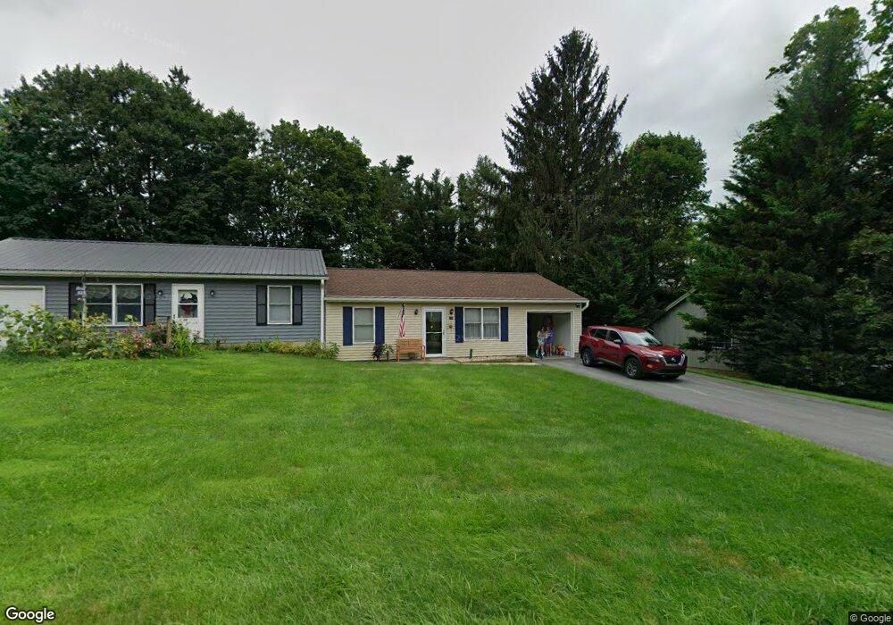
12 Memory Ln Stewartstown, PA 17363
Estimated Value: $173,000 - $218,000
2
Beds
1
Bath
844
Sq Ft
$229/Sq Ft
Est. Value
About This Home
This home is located at 12 Memory Ln, Stewartstown, PA 17363 and is currently estimated at $193,294, approximately $229 per square foot. 12 Memory Ln is a home located in York County with nearby schools including South Eastern Intermediate School, South Eastern Middle School, and Kennard-Dale High School.
Ownership History
Date
Name
Owned For
Owner Type
Purchase Details
Closed on
Feb 11, 2011
Sold by
Edrington Robert C and Edrington Linda L
Bought by
Wisnom Gordon S
Current Estimated Value
Home Financials for this Owner
Home Financials are based on the most recent Mortgage that was taken out on this home.
Original Mortgage
$77,250
Interest Rate
4.9%
Mortgage Type
New Conventional
Purchase Details
Closed on
Jul 3, 1996
Bought by
Edrington Robert C and Edrington Linda L
Create a Home Valuation Report for This Property
The Home Valuation Report is an in-depth analysis detailing your home's value as well as a comparison with similar homes in the area
Home Values in the Area
Average Home Value in this Area
Purchase History
| Date | Buyer | Sale Price | Title Company |
|---|---|---|---|
| Wisnom Gordon S | $103,000 | None Available | |
| Edrington Robert C | $50,000 | -- |
Source: Public Records
Mortgage History
| Date | Status | Borrower | Loan Amount |
|---|---|---|---|
| Previous Owner | Wisnom Gordon S | $77,250 |
Source: Public Records
Tax History Compared to Growth
Tax History
| Year | Tax Paid | Tax Assessment Tax Assessment Total Assessment is a certain percentage of the fair market value that is determined by local assessors to be the total taxable value of land and additions on the property. | Land | Improvement |
|---|---|---|---|---|
| 2025 | $2,829 | $88,420 | $29,060 | $59,360 |
| 2024 | $2,829 | $88,420 | $29,060 | $59,360 |
| 2023 | $2,829 | $88,420 | $29,060 | $59,360 |
| 2022 | $2,829 | $88,420 | $29,060 | $59,360 |
| 2021 | $2,741 | $88,420 | $29,060 | $59,360 |
| 2020 | $2,741 | $88,420 | $29,060 | $59,360 |
| 2019 | $2,732 | $88,420 | $29,060 | $59,360 |
| 2018 | $2,732 | $88,420 | $29,060 | $59,360 |
| 2017 | $2,732 | $88,420 | $29,060 | $59,360 |
| 2016 | $0 | $88,420 | $29,060 | $59,360 |
| 2015 | -- | $88,420 | $29,060 | $59,360 |
| 2014 | -- | $88,420 | $29,060 | $59,360 |
Source: Public Records
Map
Nearby Homes
- 13 Baneberry St
- 82 Piston Ct
- 17 Charles Ave
- 94 Piston Ct
- 9 W Pennsylvania Ave
- 2 S Main St
- 103 Hershey Cir
- 231 Cool Spring Ln
- 10 Black Oak Ct
- 150 Patterson Dr Unit 47
- 160 Patterson Dr Unit 48
- 4341 Forbes Dr
- 180 Patterson Dr Unit 50
- 4303 Forbes Dr
- 18007 Dave Anne Cir
- 18010 Dave Anne Cir
- 18183 Piedmont Rd
- 0 Bridgeview Rd Unit PAYK2080146
- 4389 Hess Rd
- 8287 Pleasant Valley Rd
- 45 High St
- 43 High St
- 9 Memory Ln
- 41 High St
- 7 Memory Ln
- 1 Aster St
- 1 Aster St Unit PARKER HERITAGE
- 49 High St
- W Seiling Rd
- 2 Cloverfield St
- 39 High St
- 32 High St
- 3 Aster St
- 53 High St Unit F
- 53 High St Unit 53E
- 53 High St Unit D
- 53 High St Unit B
- 53 High St Unit A
- 53 High St Unit C
- 53 High St Unit 53B