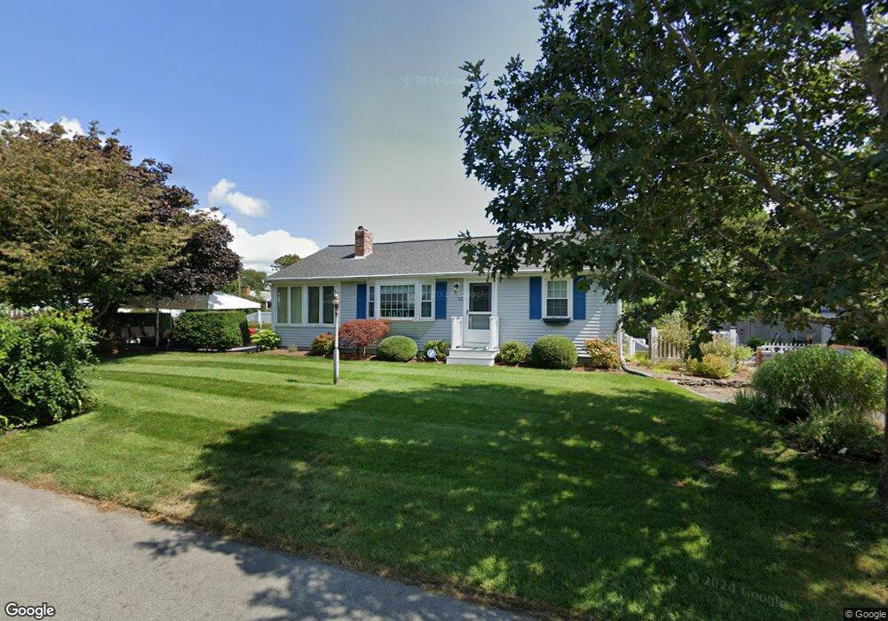
12 Michaels Ave Dennis Port, MA 02639
Dennis Port NeighborhoodEstimated Value: $504,000 - $616,000
3
Beds
1
Bath
1,001
Sq Ft
$571/Sq Ft
Est. Value
About This Home
This home is located at 12 Michaels Ave, Dennis Port, MA 02639 and is currently estimated at $571,843, approximately $571 per square foot. 12 Michaels Ave is a home located in Barnstable County with nearby schools including Dennis-Yarmouth Regional High School and St. Pius X. School.
Ownership History
Date
Name
Owned For
Owner Type
Purchase Details
Closed on
Nov 30, 2023
Sold by
Sabourin Robert J
Bought by
Robert J Sabourin T J and Robert Sabourin
Current Estimated Value
Purchase Details
Closed on
Apr 1, 2011
Sold by
Sabourin Kemberly and Bryant Barbara
Bought by
Sabourin Kimberly T C and Sabourin Robert J
Purchase Details
Closed on
Jan 9, 1998
Sold by
Hollenbach John A and Hollenbach Loraine L
Bought by
Sabourin Kimberly and Bryant Barbara
Home Financials for this Owner
Home Financials are based on the most recent Mortgage that was taken out on this home.
Original Mortgage
$75,000
Interest Rate
7.09%
Mortgage Type
Purchase Money Mortgage
Purchase Details
Closed on
Jul 8, 1991
Sold by
Mary F Est Kushmich
Bought by
Hollenback John A and Hollenback Laraine
Home Financials for this Owner
Home Financials are based on the most recent Mortgage that was taken out on this home.
Original Mortgage
$92,000
Interest Rate
9.37%
Mortgage Type
Purchase Money Mortgage
Create a Home Valuation Report for This Property
The Home Valuation Report is an in-depth analysis detailing your home's value as well as a comparison with similar homes in the area
Home Values in the Area
Average Home Value in this Area
Purchase History
| Date | Buyer | Sale Price | Title Company |
|---|---|---|---|
| Robert J Sabourin T J | -- | None Available | |
| Sabourin Kimberly T C | -- | -- | |
| Sabourin Kimberly | $115,000 | -- | |
| Hollenback John A | $115,000 | -- |
Source: Public Records
Mortgage History
| Date | Status | Borrower | Loan Amount |
|---|---|---|---|
| Previous Owner | Hollenback John A | $75,000 | |
| Previous Owner | Hollenback John A | $95,000 | |
| Previous Owner | Hollenback John A | $92,000 |
Source: Public Records
Tax History Compared to Growth
Tax History
| Year | Tax Paid | Tax Assessment Tax Assessment Total Assessment is a certain percentage of the fair market value that is determined by local assessors to be the total taxable value of land and additions on the property. | Land | Improvement |
|---|---|---|---|---|
| 2025 | $2,336 | $539,500 | $205,700 | $333,800 |
| 2024 | $2,183 | $497,200 | $197,800 | $299,400 |
| 2023 | $2,111 | $452,100 | $179,800 | $272,300 |
| 2022 | $1,986 | $354,600 | $162,000 | $192,600 |
| 2021 | $2,050 | $340,000 | $181,500 | $158,500 |
| 2020 | $1,846 | $302,600 | $158,800 | $143,800 |
| 2019 | $1,761 | $285,400 | $155,700 | $129,700 |
| 2018 | $2,728 | $266,300 | $148,200 | $118,100 |
| 2017 | $1,549 | $251,900 | $137,600 | $114,300 |
| 2016 | $1,600 | $245,000 | $148,200 | $96,800 |
| 2015 | $1,568 | $245,000 | $148,200 | $96,800 |
| 2014 | $1,431 | $225,300 | $127,000 | $98,300 |
Source: Public Records
Map
Nearby Homes
- 19 Standish Way
- 71 Main St
- 4 Coffey Ln
- 80 Michaels Ave
- 12 Spoonbill Rd
- 125 Main St Unit 3
- 22 Wixon Rd
- 31 Easy St
- 15 Woodside Park Rd
- 72 Bassett Ln
- 268 Main St
- 95 Center St
- 26 Center St
- 61 Trotters Ln
- 3 Pinefield Ln
- 37 Ocean Dr Unit 2
- 64 Beaten Rd
- 20 Aunt Debbys Rd
- 78 Upper County Rd Unit A&B
- 78 Upper County Rd