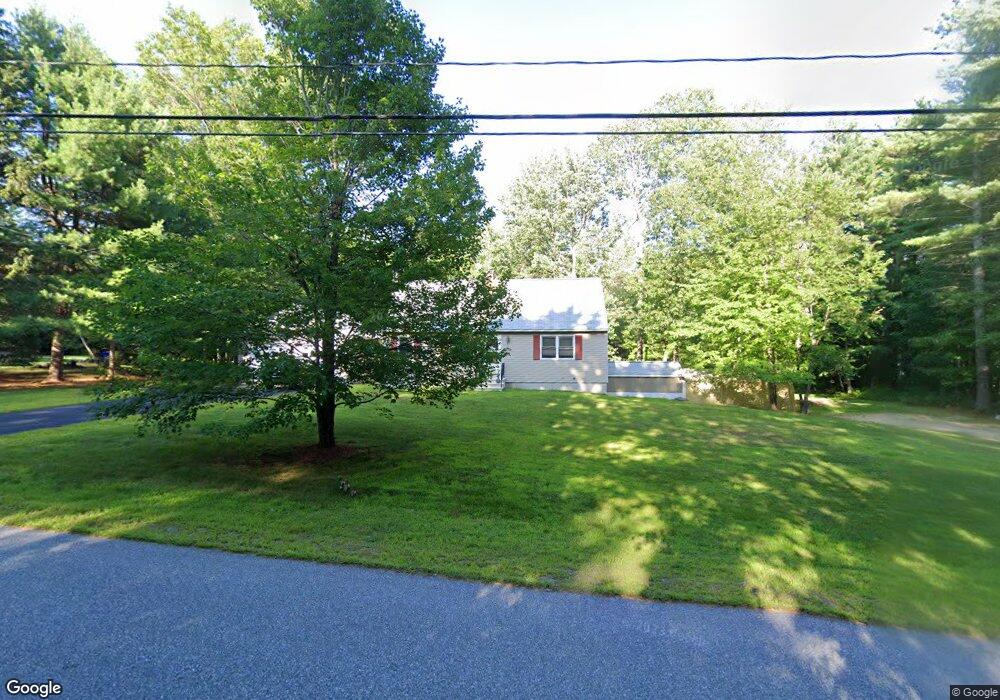
12 Mo Sett Ave Goffstown, NH 03045
Estimated Value: $462,218 - $553,000
3
Beds
2
Baths
1,404
Sq Ft
$374/Sq Ft
Est. Value
About This Home
This home is located at 12 Mo Sett Ave, Goffstown, NH 03045 and is currently estimated at $524,555, approximately $373 per square foot. 12 Mo Sett Ave is a home with nearby schools including Mountain View Middle School and Goffstown High School.
Ownership History
Date
Name
Owned For
Owner Type
Purchase Details
Closed on
Dec 15, 2018
Sold by
James Jr & M A Anderson Ret
Bought by
Anderson Margaret A
Current Estimated Value
Purchase Details
Closed on
Jul 26, 2001
Sold by
Mcquillian Ellen
Bought by
Medeiros James M and Medeiros Donna L
Home Financials for this Owner
Home Financials are based on the most recent Mortgage that was taken out on this home.
Original Mortgage
$100,000
Interest Rate
7.18%
Create a Home Valuation Report for This Property
The Home Valuation Report is an in-depth analysis detailing your home's value as well as a comparison with similar homes in the area
Home Values in the Area
Average Home Value in this Area
Purchase History
| Date | Buyer | Sale Price | Title Company |
|---|---|---|---|
| Anderson Margaret A | -- | -- | |
| Medeiros James M | $155,500 | -- |
Source: Public Records
Mortgage History
| Date | Status | Borrower | Loan Amount |
|---|---|---|---|
| Previous Owner | Medeiros James M | $185,000 | |
| Previous Owner | Medeiros James M | $100,000 |
Source: Public Records
Tax History
| Year | Tax Paid | Tax Assessment Tax Assessment Total Assessment is a certain percentage of the fair market value that is determined by local assessors to be the total taxable value of land and additions on the property. | Land | Improvement |
|---|---|---|---|---|
| 2025 | $8,974 | $429,800 | $185,100 | $244,700 |
| 2024 | $8,554 | $418,500 | $185,100 | $233,400 |
| 2023 | $7,893 | $418,500 | $185,100 | $233,400 |
| 2022 | $7,330 | $278,600 | $122,300 | $156,300 |
| 2021 | $6,915 | $278,600 | $122,300 | $156,300 |
| 2020 | $6,915 | $278,600 | $122,300 | $156,300 |
| 2019 | $6,848 | $278,600 | $122,300 | $156,300 |
| 2018 | $5,182 | $278,600 | $122,300 | $156,300 |
| 2017 | $6,455 | $235,400 | $100,900 | $134,500 |
| 2016 | $5,971 | $225,900 | $100,900 | $125,000 |
| 2015 | $6,052 | $214,900 | $94,800 | $120,100 |
| 2014 | $5,770 | $213,700 | $94,800 | $118,900 |
Source: Public Records
Map
Nearby Homes
- 41 Mathew Cir
- 20 Country Way
- 33 Elva Dr
- 11 E Dunbarton Rd
- 64 Peppermint St
- 19 My Way
- 179 Donald Dr
- 11-1 Chatel Rd
- 87 Juniper Dr
- 6B Dearborn Cir
- 8B Dearborn Cir
- 7A Dearborn Cir
- 4B Dearborn Cir
- 5C Dearborn Cir
- 25 Forestedge Way Unit 25
- 0 Mast Rd Unit 49 5054665
- 264 Woodview Way
- 211 Woodview Way
- 109 Woodview Way
- 2 Shore Dr
Your Personal Tour Guide
Ask me questions while you tour the home.