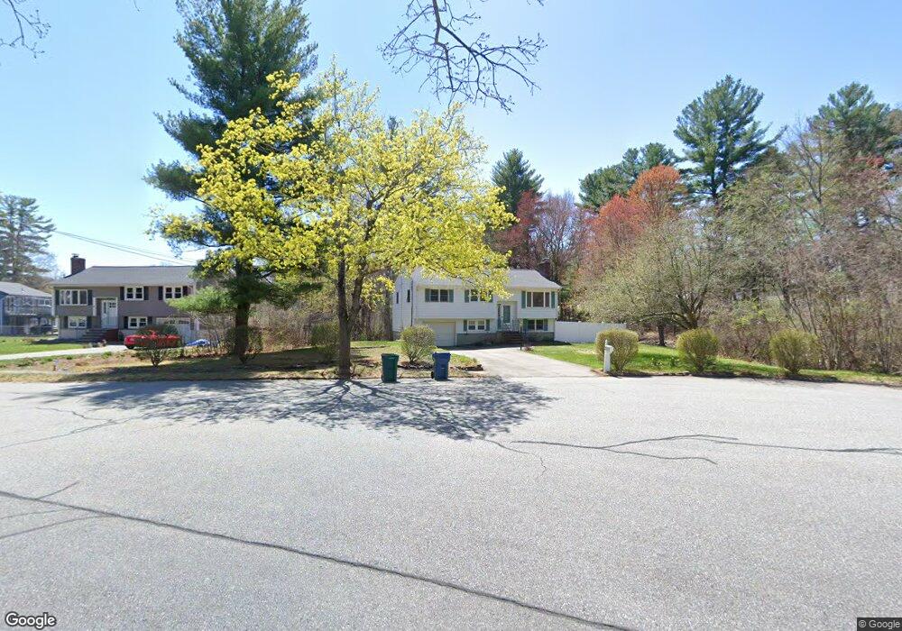
12 Morningside Dr Unit SF Billerica, MA 01821
Estimated Value: $672,000 - $882,000
3
Beds
1
Bath
2,200
Sq Ft
$339/Sq Ft
Est. Value
About This Home
This home is located at 12 Morningside Dr Unit SF, Billerica, MA 01821 and is currently estimated at $745,185, approximately $338 per square foot. 12 Morningside Dr Unit SF is a home located in Middlesex County with nearby schools including Billerica Memorial High School.
Ownership History
Date
Name
Owned For
Owner Type
Purchase Details
Closed on
Jun 1, 2006
Sold by
Schubert-Dow Elizabeth R and Dow Ted D
Bought by
Sundararajan Sudakar and Ramachandran Umadevi T
Current Estimated Value
Purchase Details
Closed on
Sep 30, 2003
Sold by
Owen Gregory L and Owen Karen M
Bought by
Schubert Elizabeth R and Dow Ted D
Purchase Details
Closed on
Aug 28, 1996
Sold by
Odonnell Patrick and Odonnell Teresa
Bought by
Rogato David and Rogato Sheryle
Create a Home Valuation Report for This Property
The Home Valuation Report is an in-depth analysis detailing your home's value as well as a comparison with similar homes in the area
Home Values in the Area
Average Home Value in this Area
Purchase History
| Date | Buyer | Sale Price | Title Company |
|---|---|---|---|
| Sundararajan Sudakar | $340,000 | -- | |
| Schubert Elizabeth R | $324,900 | -- | |
| Rogato David | $162,900 | -- |
Source: Public Records
Mortgage History
| Date | Status | Borrower | Loan Amount |
|---|---|---|---|
| Open | Rogato David | $257,600 | |
| Closed | Rogato David | $270,000 |
Source: Public Records
Tax History Compared to Growth
Tax History
| Year | Tax Paid | Tax Assessment Tax Assessment Total Assessment is a certain percentage of the fair market value that is determined by local assessors to be the total taxable value of land and additions on the property. | Land | Improvement |
|---|---|---|---|---|
| 2025 | $6,355 | $558,900 | $290,400 | $268,500 |
| 2024 | $5,811 | $514,700 | $281,100 | $233,600 |
| 2023 | $5,702 | $480,400 | $255,900 | $224,500 |
| 2022 | $5,179 | $409,700 | $218,600 | $191,100 |
| 2021 | $8,623 | $377,200 | $192,000 | $185,200 |
| 2020 | $4,802 | $369,700 | $184,500 | $185,200 |
| 2019 | $3,520 | $348,500 | $184,500 | $164,000 |
| 2018 | $18,088 | $317,800 | $164,000 | $153,800 |
| 2017 | $4,251 | $301,700 | $162,300 | $139,400 |
| 2016 | $4,212 | $297,900 | $158,500 | $139,400 |
| 2015 | $4,115 | $293,100 | $153,700 | $139,400 |
| 2014 | $4,167 | $291,600 | $148,900 | $142,700 |
Source: Public Records
Map
Nearby Homes
- 1501 Whipple Rd
- 31 Marie St
- 48 Whipple Rd
- 51 Whipple Rd
- 31 Harjean Rd
- 77 Whipple Rd
- 1042 Chandler St
- 70 Ronald Dr
- 43 Palm Dr
- 3 Primrose Rd
- 42 Fairmeadow Rd
- 29 Oregon Rd
- 1138 Whipple Rd
- 95 Bellflower Rd
- 8 Boisvert Rd
- 6 Stonebury Way Unit 6
- 2801 Pouliot Place
- 29 Fox Hill Rd
- 548 Chandler St
- 1455 Main St Unit 8
- 12 Morningside Dr
- 8 Morningside Dr
- 6 Morningside Dr
- 4 Morningside Dr
- 11 Morningside Dr
- 9 Morningside Dr
- 13 Morningside Dr
- 1 Newport Dr
- 324 Andover Rd
- 3 Newport Dr
- 332 Andover Rd
- 3 Morningside Dr
- 320 Andover Rd
- 5 Newport Dr
- 5 Morningside Dr
- 343 Andover Rd
- 7 Newport Dr
- 2 Newport Dr
- 316 Andover Rd
- 1-28 Brookside Dr