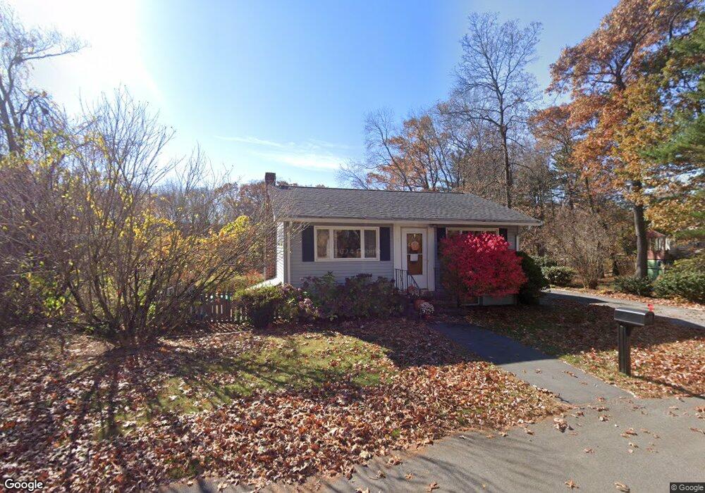
12 N Martin Rd Amesbury, MA 01913
Estimated Value: $429,000 - $579,000
2
Beds
2
Baths
672
Sq Ft
$744/Sq Ft
Est. Value
About This Home
This home is located at 12 N Martin Rd, Amesbury, MA 01913 and is currently estimated at $499,650, approximately $743 per square foot. 12 N Martin Rd is a home located in Essex County with nearby schools including Amesbury High School and Amesbury Seventh-Day Adventist School.
Ownership History
Date
Name
Owned For
Owner Type
Purchase Details
Closed on
Nov 9, 2017
Sold by
Boltas Frances L
Bought by
North Martin Road Rt
Current Estimated Value
Home Financials for this Owner
Home Financials are based on the most recent Mortgage that was taken out on this home.
Original Mortgage
$101,470
Outstanding Balance
$84,982
Interest Rate
3.83%
Mortgage Type
Unknown
Estimated Equity
$414,668
Purchase Details
Closed on
Mar 26, 2001
Sold by
Grinnell Rene and Labbe Armand J
Bought by
Boltas Frances L
Create a Home Valuation Report for This Property
The Home Valuation Report is an in-depth analysis detailing your home's value as well as a comparison with similar homes in the area
Home Values in the Area
Average Home Value in this Area
Purchase History
| Date | Buyer | Sale Price | Title Company |
|---|---|---|---|
| North Martin Road Rt | -- | -- | |
| Boltas Frances L | -- | -- | |
| Boltas Frances L | $186,000 | -- |
Source: Public Records
Mortgage History
| Date | Status | Borrower | Loan Amount |
|---|---|---|---|
| Open | Boltas Frances L | $101,470 | |
| Closed | North Martin Road Rt | $101,470 | |
| Previous Owner | Boltas Frances L | $70,000 | |
| Previous Owner | Boltas Frances L | $30,000 | |
| Previous Owner | Boltas Frances L | $20,000 |
Source: Public Records
Tax History
| Year | Tax Paid | Tax Assessment Tax Assessment Total Assessment is a certain percentage of the fair market value that is determined by local assessors to be the total taxable value of land and additions on the property. | Land | Improvement |
|---|---|---|---|---|
| 2025 | $6,336 | $414,100 | $198,100 | $216,000 |
| 2024 | $5,989 | $382,900 | $186,800 | $196,100 |
| 2023 | $5,858 | $358,500 | $162,400 | $196,100 |
| 2022 | $5,678 | $321,000 | $141,300 | $179,700 |
| 2021 | $5,172 | $283,400 | $109,100 | $174,300 |
| 2020 | $4,625 | $269,200 | $105,000 | $164,200 |
| 2019 | $4,587 | $249,700 | $105,000 | $144,700 |
| 2018 | $4,708 | $247,900 | $100,000 | $147,900 |
| 2017 | $4,427 | $221,900 | $100,000 | $121,900 |
| 2016 | $4,372 | $215,600 | $100,000 | $115,600 |
| 2015 | $4,244 | $206,600 | $100,000 | $106,600 |
| 2014 | $3,886 | $185,300 | $100,000 | $85,300 |
Source: Public Records
Map
Nearby Homes
- 7 Hoyt Ave
- 19 S Hunt Rd
- 47 Cutter Ln Unit 47
- 19 Cutter Ln Unit 19
- 60 Merrimac St Unit 504
- 15 Wells Ave
- 1 Hillside Ave Unit 3
- 253 Main St
- 4 Greenwood St
- 4 Larnard Ct
- 20 Lincoln Ct
- 21 Pond Hill Rd
- 19 Maple St Unit 21
- 382 Main St
- 21 River St
- 8 Winter St
- 24 1st St
- 14 2nd St
- 48 Orchard St
- 3 Tremont Ave Unit A
Your Personal Tour Guide
Ask me questions while you tour the home.