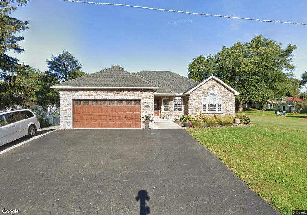
12 N Red Maple St Selinsgrove, PA 17870
Estimated Value: $142,285 - $262,000
--
Bed
--
Bath
--
Sq Ft
0.3
Acres
About This Home
This home is located at 12 N Red Maple St, Selinsgrove, PA 17870 and is currently estimated at $212,571. 12 N Red Maple St is a home located in Snyder County with nearby schools including Selinsgrove Area Elementary School, Selinsgrove Intermediate School, and Selinsgrove Area Middle School.
Ownership History
Date
Name
Owned For
Owner Type
Purchase Details
Closed on
May 1, 2014
Sold by
Vito Vito and Tocco Debbie L
Bought by
Gold Fred A and Gold Edris G
Current Estimated Value
Purchase Details
Closed on
Sep 12, 2008
Sold by
Tacco Vito
Bought by
Wind Galen M
Home Financials for this Owner
Home Financials are based on the most recent Mortgage that was taken out on this home.
Original Mortgage
$55,134
Interest Rate
6.43%
Mortgage Type
Unknown
Create a Home Valuation Report for This Property
The Home Valuation Report is an in-depth analysis detailing your home's value as well as a comparison with similar homes in the area
Home Values in the Area
Average Home Value in this Area
Purchase History
| Date | Buyer | Sale Price | Title Company |
|---|---|---|---|
| Gold Fred A | -- | -- | |
| Wind Galen M | $56,000 | Unknown |
Source: Public Records
Mortgage History
| Date | Status | Borrower | Loan Amount |
|---|---|---|---|
| Previous Owner | Wind Galen M | $55,134 |
Source: Public Records
Tax History Compared to Growth
Tax History
| Year | Tax Paid | Tax Assessment Tax Assessment Total Assessment is a certain percentage of the fair market value that is determined by local assessors to be the total taxable value of land and additions on the property. | Land | Improvement |
|---|---|---|---|---|
| 2025 | $3,956 | $40,730 | $4,650 | $36,080 |
| 2024 | $3,841 | $40,730 | $4,650 | $36,080 |
| 2023 | $970 | $40,730 | $4,650 | $36,080 |
| 2022 | $3,658 | $40,730 | $4,650 | $36,080 |
| 2021 | $3,658 | $40,730 | $4,650 | $36,080 |
| 2020 | $3,658 | $40,730 | $4,650 | $36,080 |
| 2019 | $3,658 | $40,730 | $4,650 | $36,080 |
| 2018 | $704 | $7,840 | $4,650 | $3,190 |
| 2017 | $696 | $7,840 | $4,650 | $3,190 |
| 2016 | $120 | $4,650 | $4,650 | $0 |
| 2015 | $10,143 | $4,650 | $4,650 | $0 |
| 2014 | $10,143 | $19,220 | $4,650 | $14,570 |
Source: Public Records
Map
Nearby Homes
- 25 Banyan St
- 20 Banyan St
- 2103 N Susquehanna Trail
- 5 Runyan Rd
- 2677 N Old Trail
- 71 N Oakwood Ln
- Phase 4 N Oakwood Ln
- 0 Roosevelt Ave
- 1262 N Old Trail
- 3266 N Old Trail Unit 3268
- 594 Augusta Dr
- 0 Mill Rd
- 7 Lost Creek Dr
- 14 Helen St
- The Abilene Plan at Springfield
- The Clarksville Plan at The Woods At Shoals Creek - The Woods at Shoals Creek
- The Fenwick Plan at The Woods At Shoals Creek - The Woods at Shoals Creek
- The Greenville Plan at The Woods At Shoals Creek - The Woods at Shoals Creek
- The Knoxville Plan at Springfield
- The Roanoke Plan at Autumn Ridge