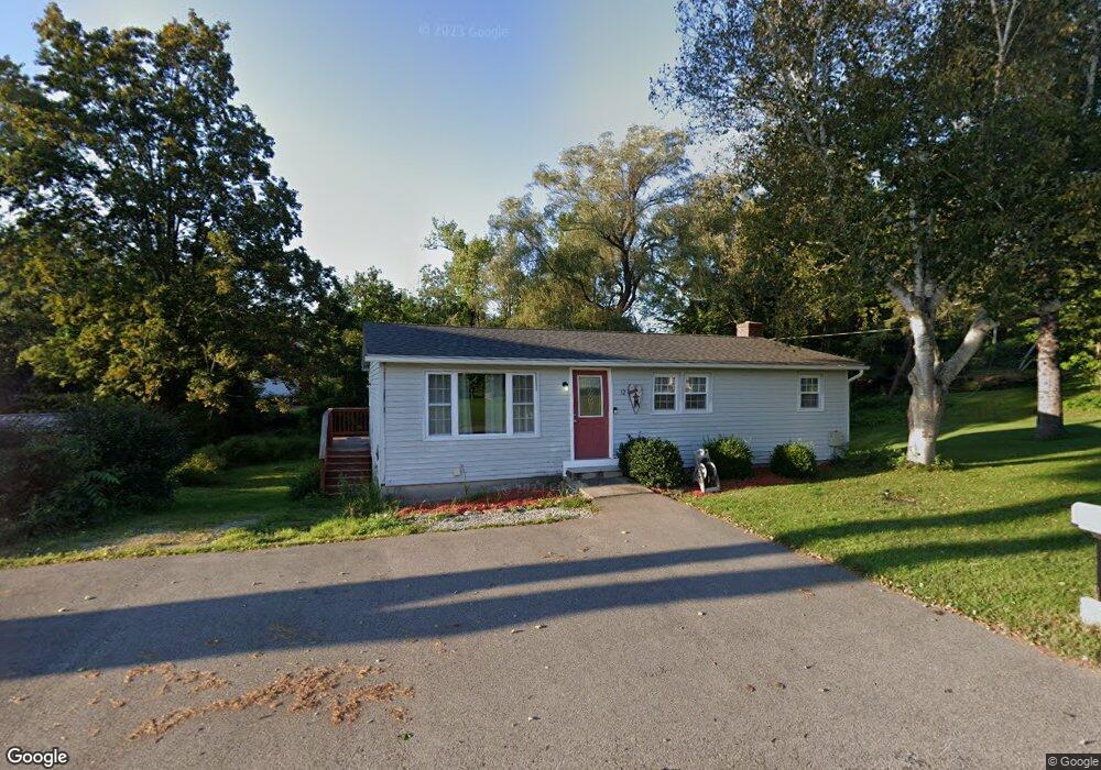
12 N Sturbridge Rd Charlton, MA 01507
Estimated Value: $287,000 - $421,000
3
Beds
1
Bath
960
Sq Ft
$351/Sq Ft
Est. Value
About This Home
This home is located at 12 N Sturbridge Rd, Charlton, MA 01507 and is currently estimated at $336,667, approximately $350 per square foot. 12 N Sturbridge Rd is a home located in Worcester County with nearby schools including Shepherd Hill Regional High School.
Ownership History
Date
Name
Owned For
Owner Type
Purchase Details
Closed on
Feb 6, 2019
Sold by
Lse Ara Llc
Bought by
Sturbridge Barn 63 Assoc
Current Estimated Value
Home Financials for this Owner
Home Financials are based on the most recent Mortgage that was taken out on this home.
Original Mortgage
$550,000
Outstanding Balance
$480,589
Interest Rate
4.4%
Mortgage Type
New Conventional
Estimated Equity
-$143,922
Purchase Details
Closed on
Sep 8, 2016
Sold by
12 North Sturbridge Rd and 12 Williams
Bought by
Fournier Karen M and Cannata Carl
Purchase Details
Closed on
Apr 22, 2010
Sold by
Mitchell Brian W and Mitchell Lee
Bought by
12 N Sturbridge Road R and Williams
Purchase Details
Closed on
Apr 25, 1986
Bought by
12 N Sturbridge Rd Rt
Create a Home Valuation Report for This Property
The Home Valuation Report is an in-depth analysis detailing your home's value as well as a comparison with similar homes in the area
Home Values in the Area
Average Home Value in this Area
Purchase History
| Date | Buyer | Sale Price | Title Company |
|---|---|---|---|
| Sturbridge Barn 63 Assoc | -- | -- | |
| Sturbridge Barn 63 Assoc | -- | -- | |
| Fournier Karen M | $57,000 | -- | |
| Fournier Karen M | $57,000 | -- | |
| 12 N Sturbridge Road R | -- | -- | |
| 12 N Sturbridge Road R | -- | -- | |
| 12 N Sturbridge Road R | -- | -- | |
| 12 N Sturbridge Rd Rt | -- | -- |
Source: Public Records
Mortgage History
| Date | Status | Borrower | Loan Amount |
|---|---|---|---|
| Open | Sturbridge Barn 63 Assoc | $550,000 | |
| Closed | Sturbridge Barn 63 Assoc | $550,000 | |
| Previous Owner | 12 N Sturbridge Rd Rt | $50,000 | |
| Previous Owner | 12 N Sturbridge Rd Rt | $96,300 |
Source: Public Records
Tax History Compared to Growth
Tax History
| Year | Tax Paid | Tax Assessment Tax Assessment Total Assessment is a certain percentage of the fair market value that is determined by local assessors to be the total taxable value of land and additions on the property. | Land | Improvement |
|---|---|---|---|---|
| 2025 | $2,779 | $249,700 | $75,700 | $174,000 |
| 2024 | $2,705 | $238,500 | $75,700 | $162,800 |
| 2023 | $2,677 | $220,000 | $73,100 | $146,900 |
| 2022 | $2,578 | $194,000 | $66,600 | $127,400 |
| 2021 | $2,411 | $160,600 | $63,100 | $97,500 |
| 2020 | $2,361 | $158,000 | $60,500 | $97,500 |
| 2019 | $2,334 | $158,000 | $60,500 | $97,500 |
| 2018 | $2,133 | $158,000 | $60,500 | $97,500 |
| 2017 | $2,009 | $142,500 | $55,500 | $87,000 |
| 2016 | $1,964 | $142,500 | $55,500 | $87,000 |
| 2015 | $1,912 | $142,500 | $55,500 | $87,000 |
| 2014 | $1,867 | $147,500 | $59,100 | $88,400 |
Source: Public Records
Map
Nearby Homes
- 199 Center Depot Rd
- 9 Knollwood Dr
- 65 Old Spencer Rd
- 208 Sunset Dr
- 7 Little Muggett Rd
- Lot 0 N Sturbridge Rd
- 38 Stevens Park Rd
- 3 Cranberry Meadow Shore Rd
- 68 Borkum Rd
- 86 Jolicoeur Ave
- 102 Worcester Rd
- 45 Jennings Rd
- 49 Jennings Rd
- 0 Trolley Crossing Rd
- Lot 3 0 N Sullivan Rd
- Lot 6 0 N Sullivan Rd
- Lot 5 0 N Sullivan Rd
- Lot 4 0 N Sullivan Rd
- 204 Brookfield Rd
- 5 Carpenter Hill Rd
- 0 N Sturbridge Rd Unit 72243312
- 0 N Sturbridge Rd Unit 71361124
- 0 N Sturbridge Rd Unit 71658622
- 0 N Sturbridge Rd Unit 71658636
- 0 N Sturbridge Rd Unit G700760
- 0 N Sturbridge Rd Unit G700759
- 0 N Sturbridge Rd Unit 71942230
- 0 N Sturbridge Rd Unit 72103867
- 0 N Sturbridge Rd Unit 73360138
- 0 N Sturbridge Rd Unit 73245477
- 0 N Sturbridge Rd Unit 73043986
- 0 N Sturbridge Rd Unit 72879387
- 0 N Sturbridge Rd Unit 72690785
- 7A N Sturbridge Rd
- 7 N Sturbridge Rd
- 14 N Sturbridge Rd
- 13 N Sturbridge Rd
- Lot 13 Spencer Rd
- Lot 9 Spencer Rd
- Lot 14 Spencer Rd