Estimated Value: $603,000 - $710,000
2
Beds
1
Bath
1,526
Sq Ft
$416/Sq Ft
Est. Value
About This Home
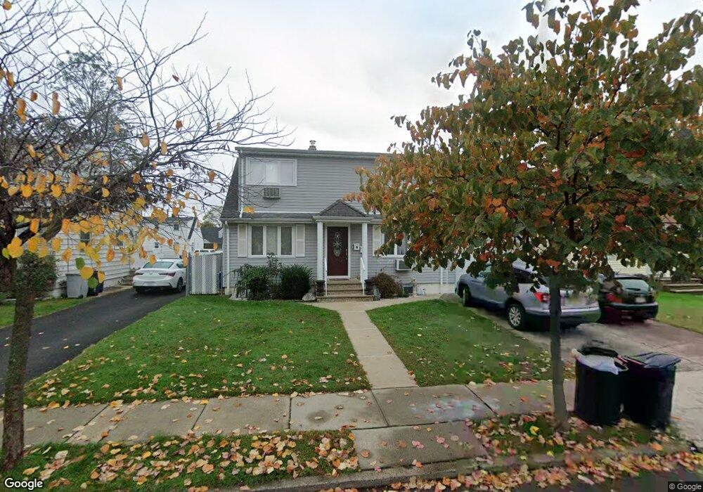
This home is located at 12 N Woodside Ave Unit 2, Lodi, NJ 07644 and is currently estimated at $634,371, approximately $415 per square foot. 12 N Woodside Ave Unit 2 is a home located in Bergen County with nearby schools including Wilson Elementary School, Thomas Jefferson Middle School, and Lodi High School.
Ownership History
Date
Name
Owned For
Owner Type
Purchase Details
Closed on
Apr 19, 2019
Sold by
Morgado Maria
Bought by
Fernandes Maria and Fernandes Tiago A
Current Estimated Value
Home Financials for this Owner
Home Financials are based on the most recent Mortgage that was taken out on this home.
Original Mortgage
$287,000
Outstanding Balance
$251,811
Interest Rate
4.2%
Mortgage Type
New Conventional
Estimated Equity
$382,560
Purchase Details
Closed on
Nov 22, 2000
Sold by
Campagna Albert
Bought by
Campagna Ignazio and Campagna Caterina
Purchase Details
Closed on
Dec 5, 1995
Sold by
Mlynarz Robert
Bought by
Campagna Albert
Home Financials for this Owner
Home Financials are based on the most recent Mortgage that was taken out on this home.
Original Mortgage
$132,000
Interest Rate
7.43%
Create a Home Valuation Report for This Property
The Home Valuation Report is an in-depth analysis detailing your home's value as well as a comparison with similar homes in the area
Home Values in the Area
Average Home Value in this Area
Purchase History
| Date | Buyer | Sale Price | Title Company |
|---|---|---|---|
| Fernandes Maria | -- | -- | |
| Campagna Ignazio | $124,491 | -- | |
| -- | $124,500 | -- | |
| Campagna Albert | $172,500 | -- |
Source: Public Records
Mortgage History
| Date | Status | Borrower | Loan Amount |
|---|---|---|---|
| Open | Fernandes Maria | $287,000 | |
| Previous Owner | Campagna Albert | $132,000 |
Source: Public Records
Tax History Compared to Growth
Tax History
| Year | Tax Paid | Tax Assessment Tax Assessment Total Assessment is a certain percentage of the fair market value that is determined by local assessors to be the total taxable value of land and additions on the property. | Land | Improvement |
|---|---|---|---|---|
| 2025 | $10,974 | $327,400 | $167,400 | $160,000 |
| 2024 | $10,726 | $327,400 | $167,400 | $160,000 |
| 2023 | $10,686 | $327,400 | $167,400 | $160,000 |
| 2022 | $10,686 | $327,400 | $167,400 | $160,000 |
| 2021 | $10,821 | $327,400 | $167,400 | $160,000 |
| 2020 | $10,755 | $327,400 | $167,400 | $160,000 |
| 2019 | $10,608 | $327,400 | $167,400 | $160,000 |
| 2018 | $10,627 | $327,400 | $167,400 | $160,000 |
| 2017 | $10,614 | $327,400 | $167,400 | $160,000 |
| 2016 | $10,614 | $327,400 | $167,400 | $160,000 |
| 2015 | $10,487 | $327,400 | $167,400 | $160,000 |
| 2014 | $10,454 | $327,400 | $167,400 | $160,000 |
Source: Public Records
Map
Nearby Homes
- 268 Church St
- 100 Charlton Ave
- 238 Bell Ave
- 175 Union St
- 32 Pasadena Ave
- 212 Paterson Ave
- 149 Paterson Ave
- 252 Paterson Ave
- 225 Albert St
- 206 Albert St
- 34 Lasalle Ave
- 460 Boulevard
- 513 Boulevard
- 102 Liberty St Unit A
- 14 James Ct
- 15 2nd St
- 80 Macarthur Ave
- 116 Spring St
- 111 Autumn St
- 12 Macarthur Ave
- 12 N Woodside Ave
- 14 N Woodside Ave
- 10 N Woodside Ave
- 5 Davis Dr
- 16 N Woodside Ave
- 7 Davis Dr
- 8 N Woodside Ave
- 3 Davis Dr
- 9 Davis Dr
- 6 N Woodside Ave
- 18 N Woodside Ave
- 11 N Woodside Ave
- 9 N Woodside Ave
- 13 N Woodside Ave
- 1 Davis Dr
- 11 Davis Dr
- 7 N Woodside Ave
- 15 N Woodside Ave
- 4 N Woodside Ave
- 6 Davis Dr