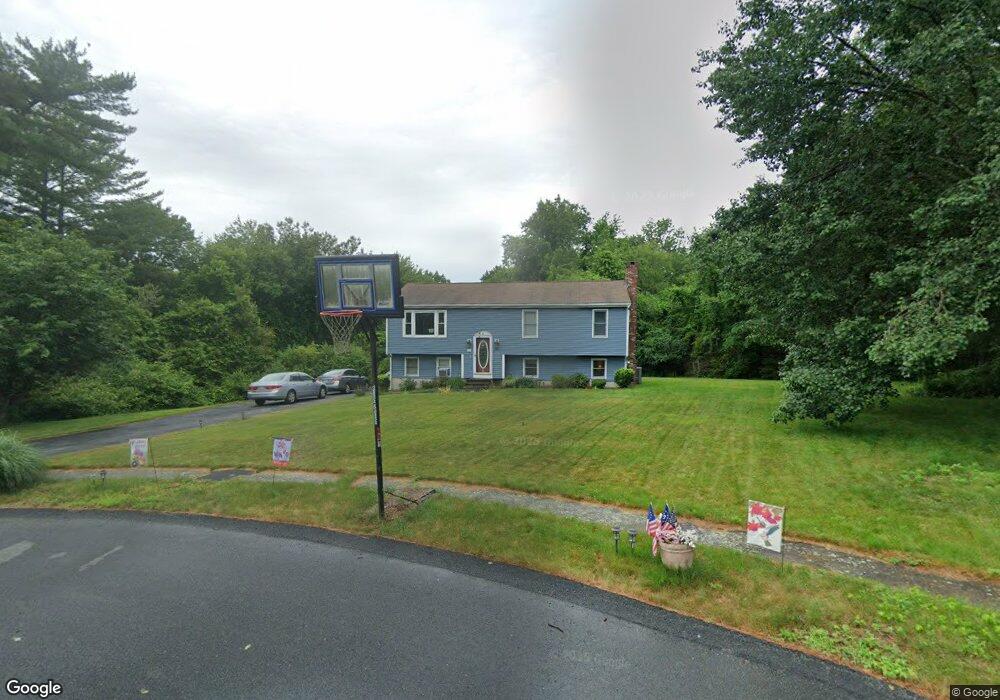
12 Natalie Dr East Bridgewater, MA 02333
Estimated Value: $597,000 - $654,000
3
Beds
2
Baths
1,092
Sq Ft
$576/Sq Ft
Est. Value
About This Home
This home is located at 12 Natalie Dr, East Bridgewater, MA 02333 and is currently estimated at $629,351, approximately $576 per square foot. 12 Natalie Dr is a home located in Plymouth County with nearby schools including Central Elementary School, Gordon W Mitchell Middle School, and East Bridgewater Jr./Sr. High School.
Ownership History
Date
Name
Owned For
Owner Type
Purchase Details
Closed on
Sep 29, 2000
Sold by
Dellamano Joseph M and Parenteau Deanna M
Bought by
Coburn John P and Coburn Nancy J
Current Estimated Value
Purchase Details
Closed on
Dec 6, 1993
Sold by
Dee & Jay Rt and Colby Dana H-
Bought by
Dellamano Joseph M and Colby Dana H-
Create a Home Valuation Report for This Property
The Home Valuation Report is an in-depth analysis detailing your home's value as well as a comparison with similar homes in the area
Home Values in the Area
Average Home Value in this Area
Purchase History
| Date | Buyer | Sale Price | Title Company |
|---|---|---|---|
| Coburn John P | $223,000 | -- | |
| Dellamano Joseph M | $127,685 | -- |
Source: Public Records
Mortgage History
| Date | Status | Borrower | Loan Amount |
|---|---|---|---|
| Open | Dellamano Joseph M | $118,145 | |
| Closed | Dellamano Joseph M | $60,800 | |
| Open | Dellamano Joseph M | $197,500 |
Source: Public Records
Tax History Compared to Growth
Tax History
| Year | Tax Paid | Tax Assessment Tax Assessment Total Assessment is a certain percentage of the fair market value that is determined by local assessors to be the total taxable value of land and additions on the property. | Land | Improvement |
|---|---|---|---|---|
| 2025 | $7,006 | $512,500 | $211,800 | $300,700 |
| 2024 | $6,825 | $493,100 | $203,800 | $289,300 |
| 2023 | $6,758 | $467,700 | $203,800 | $263,900 |
| 2022 | $6,408 | $410,800 | $185,400 | $225,400 |
| 2021 | $6,177 | $362,300 | $178,200 | $184,100 |
| 2020 | $6,150 | $355,700 | $176,300 | $179,400 |
| 2019 | $5,962 | $339,500 | $168,500 | $171,000 |
| 2018 | $5,824 | $324,300 | $168,500 | $155,800 |
| 2017 | $5,691 | $311,000 | $160,600 | $150,400 |
| 2016 | $5,508 | $303,300 | $160,600 | $142,700 |
| 2015 | $5,408 | $304,500 | $159,900 | $144,600 |
| 2014 | $5,220 | $300,500 | $156,600 | $143,900 |
Source: Public Records
Map
Nearby Homes
- 1121 Auburn St
- 877 Auburnville Way Unit D4
- 728 Auburn St Unit F6
- 25 Plain St
- 26 Alger St
- 307 Homeland Dr
- 618 Auburn St
- 262 Homeland Dr
- 848 N Bedford St Phase III
- 848 N Bedford St Phase IV
- 848 N
- 848 N Bedford St
- 99 Alger St
- 205 Bedford St
- 416 Highland St
- 70 Surrey Ln
- 70 Surrey Ln
- 32 Joyce Terrace
- 11 Glenwood St
- 611 N Bedford St
- 14 Natalie Dr
- 10 Natalie Dr
- 6 Johnson Farm Ln
- 4 Johnson Farm Ln
- 2 Johnson Farm Ln
- 8 Natalie Dr
- 8 Johnson Farm Ln
- Lot 1-5 Johnson Farm Ln
- Lot 5 Johnson Farm Ln
- 7 Natalie Dr
- 9 Johnson Farm Ln
- 9 Johnson Farm Ln
- 7 Johnson Farm Ln
- 5 Natalie Dr
- 4 Natalie Dr
- 5 Squire Alden Way
- 368 Winter St
- 2 Natalie Dr
- 12 Squire Alden Way
- 340 Winter St