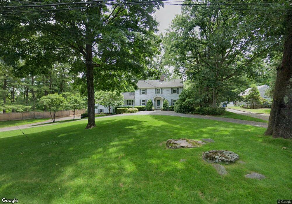
12 Norholt Dr New Canaan, CT 06840
Estimated Value: $1,696,790 - $2,042,000
4
Beds
3
Baths
2,802
Sq Ft
$686/Sq Ft
Est. Value
About This Home
This home is located at 12 Norholt Dr, New Canaan, CT 06840 and is currently estimated at $1,921,448, approximately $685 per square foot. 12 Norholt Dr is a home located in Fairfield County with nearby schools including East Elementary School, Saxe Middle School, and New Canaan High School.
Ownership History
Date
Name
Owned For
Owner Type
Purchase Details
Closed on
Aug 1, 1996
Sold by
Queally Paul B and Queally Anne Marie
Bought by
Berta Joseph and Andes Shelly
Current Estimated Value
Home Financials for this Owner
Home Financials are based on the most recent Mortgage that was taken out on this home.
Original Mortgage
$396,000
Interest Rate
7.25%
Mortgage Type
Unknown
Purchase Details
Closed on
Dec 1, 1987
Sold by
Man Merrill Lynch
Bought by
Rinaldi Angelo
Home Financials for this Owner
Home Financials are based on the most recent Mortgage that was taken out on this home.
Original Mortgage
$160,000
Interest Rate
11.59%
Create a Home Valuation Report for This Property
The Home Valuation Report is an in-depth analysis detailing your home's value as well as a comparison with similar homes in the area
Home Values in the Area
Average Home Value in this Area
Purchase History
| Date | Buyer | Sale Price | Title Company |
|---|---|---|---|
| Berta Joseph | $495,000 | -- | |
| Rinaldi Angelo | $424,000 | -- |
Source: Public Records
Mortgage History
| Date | Status | Borrower | Loan Amount |
|---|---|---|---|
| Open | Rinaldi Angelo | $391,405 | |
| Closed | Rinaldi Angelo | $396,000 | |
| Previous Owner | Rinaldi Angelo | $202,000 | |
| Previous Owner | Rinaldi Angelo | $160,000 |
Source: Public Records
Tax History Compared to Growth
Tax History
| Year | Tax Paid | Tax Assessment Tax Assessment Total Assessment is a certain percentage of the fair market value that is determined by local assessors to be the total taxable value of land and additions on the property. | Land | Improvement |
|---|---|---|---|---|
| 2025 | $14,806 | $887,110 | $571,760 | $315,350 |
| 2024 | $14,318 | $887,110 | $571,760 | $315,350 |
| 2023 | $14,747 | $778,610 | $631,610 | $147,000 |
| 2022 | $14,303 | $778,610 | $631,610 | $147,000 |
| 2021 | $14,140 | $778,610 | $631,610 | $147,000 |
| 2020 | $14,140 | $778,610 | $631,610 | $147,000 |
| 2019 | $14,202 | $778,610 | $631,610 | $147,000 |
| 2018 | $12,588 | $742,210 | $615,650 | $126,560 |
| 2017 | $12,373 | $742,210 | $615,650 | $126,560 |
| 2016 | $12,105 | $742,210 | $615,650 | $126,560 |
| 2015 | $12,291 | $742,210 | $615,650 | $126,560 |
| 2014 | $11,534 | $742,210 | $615,650 | $126,560 |
Source: Public Records
Map
Nearby Homes
- 240 Rosebrook Rd
- 101 Parade Hill Rd
- 52 Garibaldi Ln
- 49 Ludlowe Rd
- 61 Smith Ridge Rd
- 145 River St
- 565 Oenoke Ridge
- 262 Brushy Ridge Rd
- 114 Ferris Hill Rd
- 544 Oenoke Ridge
- 232 Sleepy Hollow Rd
- 99 Wardwell Dr
- 758 Smith Ridge Rd
- 79 Locust Ave Unit 212
- 85 Locust Ave Unit 516
- 42 Forest St Unit A
- 17 Wardwell Dr
- 30L Huckleberry Hill Rd
- 96 East Ave Unit C
- 60 East Ave
- 22 Norholt Dr
- 3 Norholt Dr
- 288 Smith Ridge Rd
- 31 Norholt Dr
- 306 Smith Ridge Rd
- 346 Smith Ridge Rd
- 303 Smith Ridge Rd
- 289 Smith Ridge Rd
- 306 Smith Ridge Rd
- 34 Norholt Dr
- 296 Smith Ridge Rd
- 321 Smith Ridge Rd
- 51 Norholt Dr
- 323 Smith Ridge Rd
- 364 Smith Ridge Rd
- 279 Smith Ridge Rd
- 270 Smith Ridge Rd
- 62 Norholt Dr
- 51 Twin Pond Ln
- 370 Smith Ridge Rd