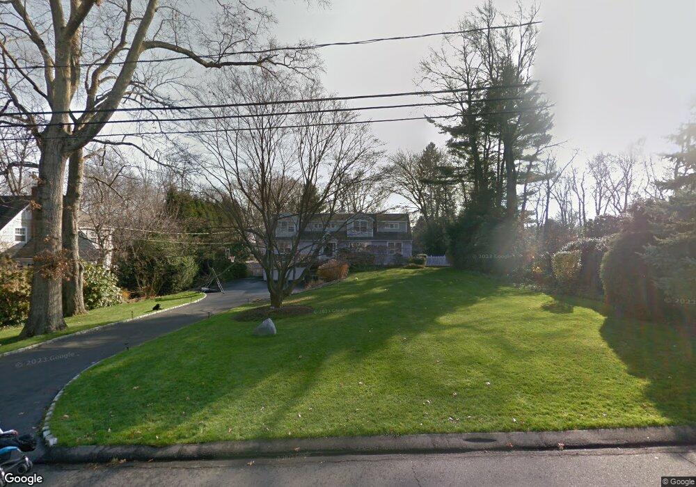
12 Oak Crest Darien, CT 06820
Estimated Value: $2,123,000 - $3,009,664
4
Beds
4
Baths
3,363
Sq Ft
$760/Sq Ft
Est. Value
About This Home
This home is located at 12 Oak Crest, Darien, CT 06820 and is currently estimated at $2,556,166, approximately $760 per square foot. 12 Oak Crest is a home located in Fairfield County with nearby schools including Royle Elementary School, Middlesex Middle School, and Darien High School.
Ownership History
Date
Name
Owned For
Owner Type
Purchase Details
Closed on
Mar 2, 2001
Sold by
Toscano Daniel and Toscano Tresa
Bought by
Bowman William P and Bowman Catherine R
Current Estimated Value
Purchase Details
Closed on
Nov 9, 1995
Sold by
Hobbs Steven and Hobbs Elizabeth
Bought by
Mercado Tresa and Toscano Daniel
Purchase Details
Closed on
Apr 26, 1991
Sold by
Longley Mary
Bought by
Hobbs Steven and Hobbs Elizabeth
Create a Home Valuation Report for This Property
The Home Valuation Report is an in-depth analysis detailing your home's value as well as a comparison with similar homes in the area
Home Values in the Area
Average Home Value in this Area
Purchase History
| Date | Buyer | Sale Price | Title Company |
|---|---|---|---|
| Bowman William P | $1,025,000 | -- | |
| Mercado Tresa | $630,000 | -- | |
| Hobbs Steven | $476,200 | -- |
Source: Public Records
Mortgage History
| Date | Status | Borrower | Loan Amount |
|---|---|---|---|
| Open | Hobbs Steven | $601,450 | |
| Closed | Hobbs Steven | $625,000 | |
| Closed | Hobbs Steven | $400,000 |
Source: Public Records
Tax History
| Year | Tax Paid | Tax Assessment Tax Assessment Total Assessment is a certain percentage of the fair market value that is determined by local assessors to be the total taxable value of land and additions on the property. | Land | Improvement |
|---|---|---|---|---|
| 2025 | $23,488 | $1,517,320 | $1,085,350 | $431,970 |
| 2024 | $22,289 | $1,517,320 | $1,085,350 | $431,970 |
| 2023 | $19,909 | $1,130,570 | $775,250 | $355,320 |
| 2022 | $19,480 | $1,130,570 | $775,250 | $355,320 |
| 2021 | $19,039 | $1,130,570 | $775,250 | $355,320 |
| 2020 | $18,496 | $1,130,570 | $775,250 | $355,320 |
| 2019 | $18,620 | $1,130,570 | $775,250 | $355,320 |
| 2018 | $18,301 | $1,138,130 | $773,220 | $364,910 |
| 2017 | $18,392 | $1,138,130 | $773,220 | $364,910 |
| 2016 | $17,948 | $1,138,130 | $773,220 | $364,910 |
| 2015 | $17,470 | $1,138,130 | $773,220 | $364,910 |
| 2014 | $17,083 | $1,138,130 | $773,220 | $364,910 |
Source: Public Records
Map
Nearby Homes
- 6 Ward Ln Unit 6
- 25 Lakeside Ave
- 10 Stony Brook Rd
- 9 Point o Woods Rd S
- 7 Buttonwood Ln
- 19 Circle Rd
- 20 Locust Hill Rd
- 2 Settlers Trail Unit 2
- 29 Richmond Dr
- 12 Dellwood Rd
- 171 Raymond St
- 26 Holly Ln
- 2 Red Rose Cir
- 5 Shields Ln
- 97 Richards Ave Unit B10
- 105 Richards Ave Unit 1407
- 18 Winding Ln
- 223 Middlesex Rd
- 3 Revere Rd
- 561 Middlesex Rd
Your Personal Tour Guide
Ask me questions while you tour the home.