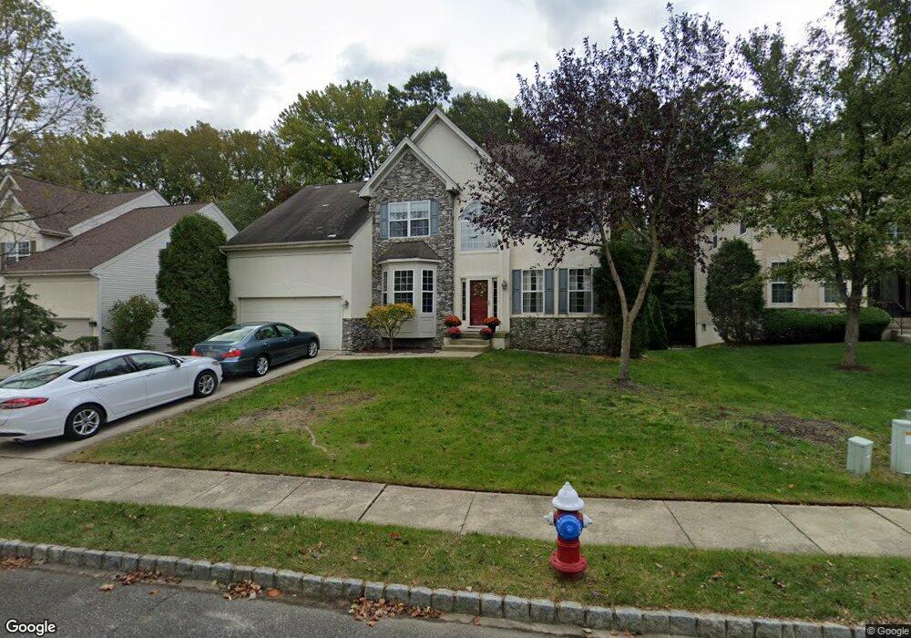
12 Oakhurst Ln Mount Laurel, NJ 08054
Estimated Value: $703,000 - $782,000
--
Bed
--
Bath
2,729
Sq Ft
$272/Sq Ft
Est. Value
About This Home
This home is located at 12 Oakhurst Ln, Mount Laurel, NJ 08054 and is currently estimated at $741,964, approximately $271 per square foot. 12 Oakhurst Ln is a home located in Burlington County with nearby schools including Larchmont Elementary School, Mount Laurel Hartford School, and T.E. Harrington Middle School.
Ownership History
Date
Name
Owned For
Owner Type
Purchase Details
Closed on
Jun 27, 2003
Sold by
Spaventa Michael R and Odonnell Jean Marie
Bought by
Mccord Derek and Mccord Stacy
Current Estimated Value
Home Financials for this Owner
Home Financials are based on the most recent Mortgage that was taken out on this home.
Original Mortgage
$322,700
Outstanding Balance
$139,159
Interest Rate
5.45%
Mortgage Type
Purchase Money Mortgage
Estimated Equity
$602,805
Purchase Details
Closed on
Aug 25, 1999
Sold by
Orleans Corp
Bought by
Spaventa Michael R and Odonnell Jean Marie
Home Financials for this Owner
Home Financials are based on the most recent Mortgage that was taken out on this home.
Original Mortgage
$226,100
Interest Rate
7.5%
Create a Home Valuation Report for This Property
The Home Valuation Report is an in-depth analysis detailing your home's value as well as a comparison with similar homes in the area
Home Values in the Area
Average Home Value in this Area
Purchase History
| Date | Buyer | Sale Price | Title Company |
|---|---|---|---|
| Mccord Derek | $410,000 | Chicago Title Insurance Co | |
| Spaventa Michael R | $282,720 | Settlers Title Agency |
Source: Public Records
Mortgage History
| Date | Status | Borrower | Loan Amount |
|---|---|---|---|
| Open | Mccord Derek | $322,700 | |
| Previous Owner | Spaventa Michael R | $226,100 |
Source: Public Records
Tax History Compared to Growth
Tax History
| Year | Tax Paid | Tax Assessment Tax Assessment Total Assessment is a certain percentage of the fair market value that is determined by local assessors to be the total taxable value of land and additions on the property. | Land | Improvement |
|---|---|---|---|---|
| 2025 | $13,272 | $420,400 | $137,000 | $283,400 |
| 2024 | $12,772 | $420,400 | $137,000 | $283,400 |
| 2023 | $12,772 | $420,400 | $137,000 | $283,400 |
| 2022 | $12,730 | $420,400 | $137,000 | $283,400 |
| 2021 | $12,490 | $420,400 | $137,000 | $283,400 |
| 2020 | $12,246 | $420,400 | $137,000 | $283,400 |
| 2019 | $12,120 | $420,400 | $137,000 | $283,400 |
| 2018 | $12,028 | $420,400 | $137,000 | $283,400 |
| 2017 | $11,717 | $420,400 | $137,000 | $283,400 |
| 2016 | $11,540 | $420,400 | $137,000 | $283,400 |
| 2015 | $11,405 | $420,400 | $137,000 | $283,400 |
| 2014 | $11,292 | $420,400 | $137,000 | $283,400 |
Source: Public Records
Map
Nearby Homes
- 18 Langcliffe Ct
- 210 Stratton Ct
- 143 Banwell Ln
- 914 Hainesport Mount Laurel Rd
- 130 Banwell Ln
- 115 Banwell Ln
- 216 Martins Way Unit 216
- 3503 Fenwick Ln Unit 3503
- 3603 Fenwick Ln Unit 3603
- 3605 Fenwick Ln Unit 3605
- 2605 A Yarmouth La
- 805A Ralston Dr Unit 805A
- 5 Hampton Ct
- 358B Willow Turn Unit 358B
- 438B Willow Turn
- 36 Whitechapel Dr
- 540A Willow Turn Unit A
- 302B Harwood Ct
- 18 Rosemary Way
- Ballad Plan at Longbridge Farms - Longbridge Farms Townhomes