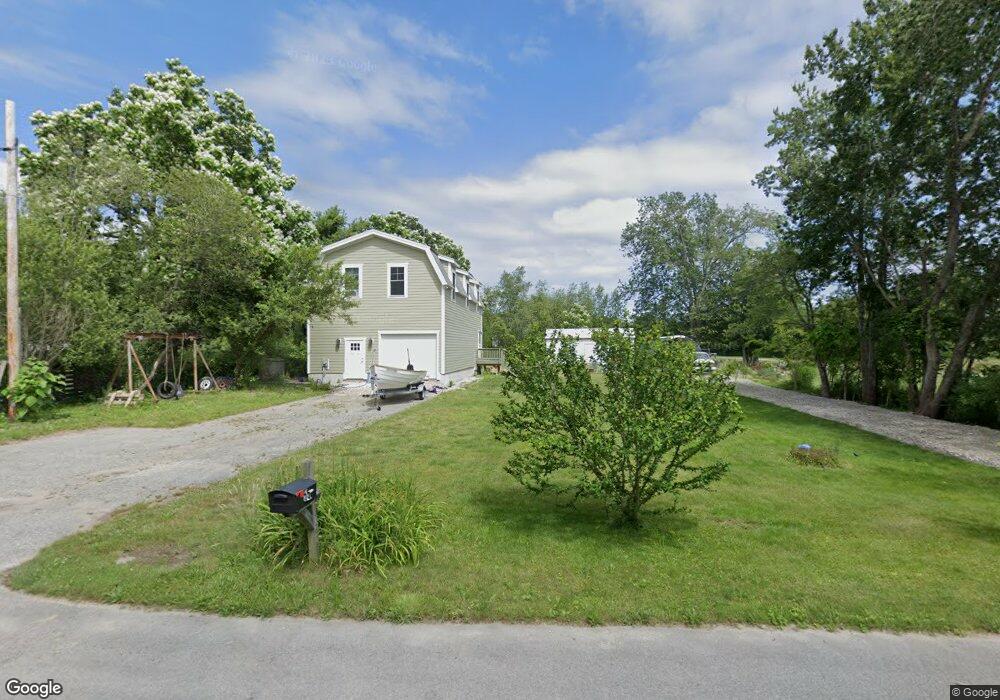
12 Oliver Ln Westport, MA 02790
Estimated Value: $840,798 - $1,059,000
3
Beds
--
Bath
2,732
Sq Ft
$359/Sq Ft
Est. Value
About This Home
This home is located at 12 Oliver Ln, Westport, MA 02790 and is currently estimated at $980,933, approximately $359 per square foot. 12 Oliver Ln is a home with nearby schools including Alice A. Macomber Primary School, Westport Elementary School, and Westport Middle-High School.
Ownership History
Date
Name
Owned For
Owner Type
Purchase Details
Closed on
Jan 2, 2013
Sold by
Long Built Homes Inc
Bought by
Hathaway Ryan T and Pimentel-Hathaway Ann I
Current Estimated Value
Home Financials for this Owner
Home Financials are based on the most recent Mortgage that was taken out on this home.
Original Mortgage
$349,500
Outstanding Balance
$241,053
Interest Rate
3.35%
Mortgage Type
New Conventional
Estimated Equity
$739,880
Create a Home Valuation Report for This Property
The Home Valuation Report is an in-depth analysis detailing your home's value as well as a comparison with similar homes in the area
Home Values in the Area
Average Home Value in this Area
Purchase History
| Date | Buyer | Sale Price | Title Company |
|---|---|---|---|
| Hathaway Ryan T | $527,630 | -- |
Source: Public Records
Mortgage History
| Date | Status | Borrower | Loan Amount |
|---|---|---|---|
| Open | Hathaway Ryan T | $349,500 |
Source: Public Records
Tax History Compared to Growth
Tax History
| Year | Tax Paid | Tax Assessment Tax Assessment Total Assessment is a certain percentage of the fair market value that is determined by local assessors to be the total taxable value of land and additions on the property. | Land | Improvement |
|---|---|---|---|---|
| 2025 | $5,784 | $776,400 | $109,700 | $666,700 |
| 2024 | $5,838 | $755,300 | $101,700 | $653,600 |
| 2023 | $5,743 | $703,800 | $96,900 | $606,900 |
| 2022 | $5,250 | $639,600 | $96,900 | $542,700 |
| 2021 | $5,250 | $609,000 | $88,100 | $520,900 |
| 2020 | $4,298 | $509,900 | $84,600 | $425,300 |
| 2019 | $4,140 | $500,600 | $84,600 | $416,000 |
| 2018 | $4,136 | $506,200 | $92,100 | $414,100 |
| 2017 | $4,088 | $512,900 | $98,400 | $414,500 |
| 2016 | $3,679 | $465,100 | $93,400 | $371,700 |
| 2015 | $3,691 | $465,400 | $107,100 | $358,300 |
Source: Public Records
Map
Nearby Homes
- 128 Old Bedford Rd
- 125 Angell St
- 34 Alsop St
- 33 William St
- 25 Beaulieu St
- 6 Beaulieu St
- 219 Earle St Unit 3
- 217 Earle St Unit 2
- 215 Earle St Unit 1
- 85 Reney St
- 37 Eaton St
- 172 Earle St
- 89 Lafayette St
- 1792 Pleasant St Unit 1808
- 10 Choate St
- 9 Register Ave
- 31 Choate St
- 529 Eastern Ave
- 383 Alden St
- 3 Diane Way
- 8 Oliver Ln
- 55 Adirondack Ln
- 55 Adirondack Ln Unit House
- 63 Adirondack Ln
- 45 Adirondack Ln
- 0 Frontage St
- 17 Adirondack Ln
- 34 Frontage St
- 10 Adirondack Ln
- 24 Frontage St Unit 1 South
- 24 Frontage St Unit 1 North
- 24 Frontage St
- 24-28 Frontage Rd
- 148 Old Bedford Rd Unit 150
- 140 Old Bedford Rd
- Lot 31A Frontage St
- 85 Old Bedford Rd
- 75 Old Bedford Rd
- 93 Old Bedford Rd
- 44C Old Bedford Rd