Estimated Value: $439,000 - $513,000
2
Beds
1
Bath
1,049
Sq Ft
$458/Sq Ft
Est. Value
About This Home
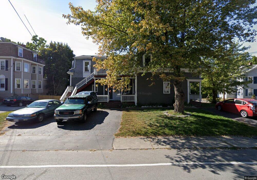
This home is located at 12 Pearl St Unit 2, Ayer, MA 01432 and is currently estimated at $480,757, approximately $458 per square foot. 12 Pearl St Unit 2 is a home located in Middlesex County with nearby schools including Page Hilltop School, Lura A. White Elementary School, and Ayer Shirley Regional Middle School.
Ownership History
Date
Name
Owned For
Owner Type
Purchase Details
Closed on
Aug 30, 1999
Sold by
12 Pearl St Rt
Bought by
Seminiano Juancho B and Seminiano Victoria M
Current Estimated Value
Home Financials for this Owner
Home Financials are based on the most recent Mortgage that was taken out on this home.
Original Mortgage
$124,700
Outstanding Balance
$36,146
Interest Rate
7.53%
Mortgage Type
Purchase Money Mortgage
Estimated Equity
$444,611
Purchase Details
Closed on
Feb 19, 1987
Sold by
Barons Family Rt
Bought by
Vigliotti Robert G
Home Financials for this Owner
Home Financials are based on the most recent Mortgage that was taken out on this home.
Original Mortgage
$109,000
Interest Rate
9.24%
Mortgage Type
Purchase Money Mortgage
Create a Home Valuation Report for This Property
The Home Valuation Report is an in-depth analysis detailing your home's value as well as a comparison with similar homes in the area
Home Values in the Area
Average Home Value in this Area
Purchase History
| Date | Buyer | Sale Price | Title Company |
|---|---|---|---|
| Seminiano Juancho B | $138,575 | -- | |
| Vigliotti Robert G | $115,000 | -- |
Source: Public Records
Mortgage History
| Date | Status | Borrower | Loan Amount |
|---|---|---|---|
| Open | Vigliotti Robert G | $124,700 | |
| Previous Owner | Vigliotti Robert G | $139,938 | |
| Previous Owner | Vigliotti Robert G | $109,000 |
Source: Public Records
Tax History Compared to Growth
Tax History
| Year | Tax Paid | Tax Assessment Tax Assessment Total Assessment is a certain percentage of the fair market value that is determined by local assessors to be the total taxable value of land and additions on the property. | Land | Improvement |
|---|---|---|---|---|
| 2025 | $4,462 | $373,100 | $126,200 | $246,900 |
| 2024 | $3,930 | $320,800 | $126,200 | $194,600 |
| 2023 | $3,687 | $296,900 | $118,000 | $178,900 |
| 2022 | $3,716 | $276,900 | $103,300 | $173,600 |
| 2021 | $3,428 | $242,400 | $94,600 | $147,800 |
| 2020 | $3,285 | $233,000 | $91,000 | $142,000 |
| 2019 | $3,024 | $221,900 | $86,700 | $135,200 |
| 2018 | $2,951 | $204,500 | $84,100 | $120,400 |
| 2017 | $2,677 | $186,000 | $71,500 | $114,500 |
| 2016 | $2,393 | $164,700 | $78,000 | $86,700 |
| 2015 | $2,408 | $164,700 | $83,200 | $81,500 |
| 2014 | $2,392 | $169,900 | $83,200 | $86,700 |
Source: Public Records
Map
Nearby Homes
- 28 West St Unit 6B
- 9 Nashua St
- 0 High St
- 8 High St
- 14 Brook St
- 21 High St
- 17 Grove St
- 27 Grove St
- 41 E Main St
- 25 Groton School Rd Unit 14
- 25 Groton School Rd Unit 23
- 63 E Main St
- 16 Jonathan Dr
- 184 W Main St Unit B2
- 108 E Main St Unit 2
- 7 Groveland St
- 38 Pine Ridge Dr
- 24 Harvard Rd Unit C
- 26 Harvard Rd Unit C
- 17 Douglas Dr
- 12 Pearl St
- 7 Groton St
- 9 Pearl St
- 9 Pearl St Unit 4
- 8 Groton St
- 18 Lawton St
- 20 Lawton St
- 16 Lawton St
- 10 Lawton St
- 10 Lawton St Unit 2,10
- 10 Lawton St Unit 2
- 14 Lawton St Unit A
- 14 Lawton St Unit B
- 14 Lawton St Unit A
- 14 Lawton St
- 5 Pearl St
- 19 Pearl St
- 19 Pearl St Unit 2
- 19 Pearl St Unit 4
- 19 Pearl St Unit 3