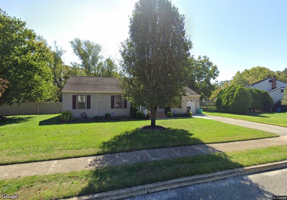
12 Pheasant Dr Sicklerville, NJ 08081
Estimated Value: $338,000 - $383,000
3
Beds
2
Baths
1,700
Sq Ft
$216/Sq Ft
Est. Value
About This Home
This home is located at 12 Pheasant Dr, Sicklerville, NJ 08081 and is currently estimated at $366,856, approximately $215 per square foot. 12 Pheasant Dr is a home located in Camden County with nearby schools including Winslow Township High School and South Jersey Christian Academy.
Ownership History
Date
Name
Owned For
Owner Type
Purchase Details
Closed on
Oct 16, 2002
Sold by
Romano Sandra M
Bought by
Strickland Joseph W
Current Estimated Value
Home Financials for this Owner
Home Financials are based on the most recent Mortgage that was taken out on this home.
Original Mortgage
$133,000
Interest Rate
6.02%
Purchase Details
Closed on
Oct 27, 1999
Sold by
Costello Kathleen D
Bought by
Romano Sandra M
Home Financials for this Owner
Home Financials are based on the most recent Mortgage that was taken out on this home.
Original Mortgage
$111,350
Interest Rate
7.73%
Create a Home Valuation Report for This Property
The Home Valuation Report is an in-depth analysis detailing your home's value as well as a comparison with similar homes in the area
Home Values in the Area
Average Home Value in this Area
Purchase History
| Date | Buyer | Sale Price | Title Company |
|---|---|---|---|
| Strickland Joseph W | $140,000 | -- | |
| Romano Sandra M | $131,000 | -- |
Source: Public Records
Mortgage History
| Date | Status | Borrower | Loan Amount |
|---|---|---|---|
| Previous Owner | Strickland Joseph W | $133,000 | |
| Previous Owner | Romano Sandra M | $111,350 |
Source: Public Records
Tax History
| Year | Tax Paid | Tax Assessment Tax Assessment Total Assessment is a certain percentage of the fair market value that is determined by local assessors to be the total taxable value of land and additions on the property. | Land | Improvement |
|---|---|---|---|---|
| 2025 | $7,028 | $180,100 | $44,000 | $136,100 |
| 2024 | $6,842 | $180,100 | $44,000 | $136,100 |
| 2023 | $6,842 | $180,100 | $44,000 | $136,100 |
| 2022 | $6,631 | $180,100 | $44,000 | $136,100 |
| 2021 | $6,556 | $180,100 | $44,000 | $136,100 |
| 2020 | $6,498 | $180,100 | $44,000 | $136,100 |
| 2019 | $6,458 | $180,100 | $44,000 | $136,100 |
| 2018 | $6,370 | $180,100 | $44,000 | $136,100 |
| 2017 | $6,257 | $180,100 | $44,000 | $136,100 |
| 2016 | $6,177 | $180,100 | $44,000 | $136,100 |
| 2015 | $6,087 | $180,100 | $44,000 | $136,100 |
| 2014 | $5,952 | $180,100 | $44,000 | $136,100 |
Source: Public Records
Map
Nearby Homes
- 0 Davis Ave Unit NJCD2101572
- 116 Blue Meadow Ln
- 0 Grove St S
- 110 Christmas Tree Ct
- 13 Cardinal Ln
- 000 Blue Anchor Rd
- 0 S Route 73
- 142 S Route 73
- 4 Catherine Ct
- 19 N Central Ave
- 10 Alberts Ave
- 2 Debras Ln
- 22 Debras Ln
- 10 Washburne Ave
- 114 Braddock Ave
- 133 Steelton Rd
- 15 W Mary Ln
- 110 N Route 73
- 139 Route 73 N
- 22 Mills Dr
Your Personal Tour Guide
Ask me questions while you tour the home.