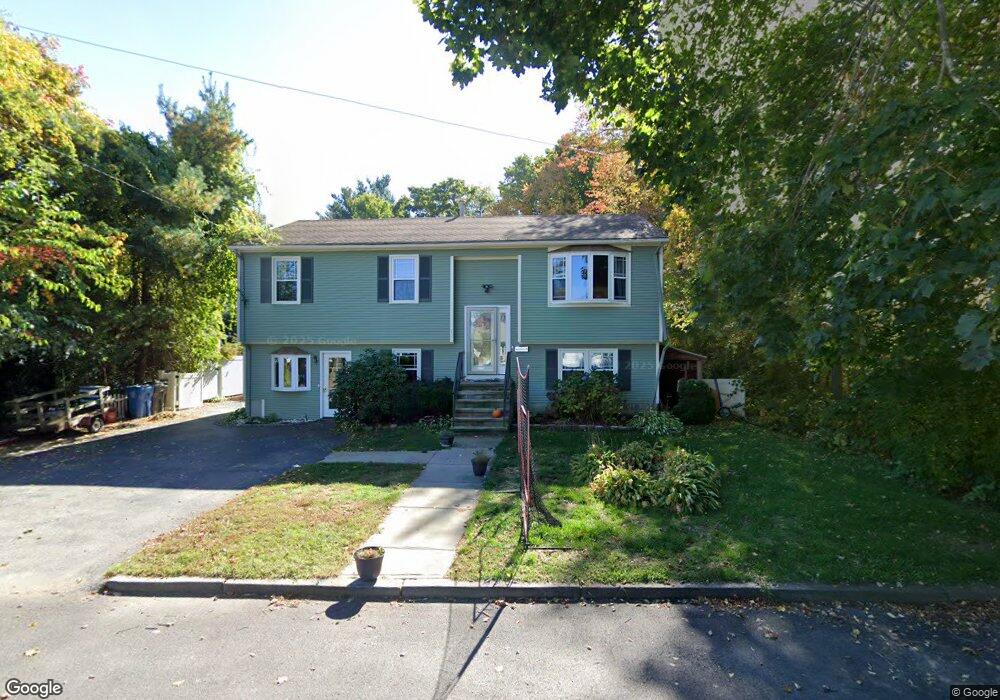
12 Pond View Rd Cranston, RI 02920
Thornton NeighborhoodEstimated Value: $499,914 - $598,000
3
Beds
2
Baths
1,086
Sq Ft
$499/Sq Ft
Est. Value
About This Home
This home is located at 12 Pond View Rd, Cranston, RI 02920 and is currently estimated at $542,229, approximately $499 per square foot. 12 Pond View Rd is a home located in Providence County with nearby schools including Stone Hill School, Western Hills Middle School, and Cranston High School West.
Ownership History
Date
Name
Owned For
Owner Type
Purchase Details
Closed on
Mar 1, 2018
Sold by
Sylvestre Brian P and Sylvestre Sandra L
Bought by
Leveillee Bryan S and Leveillee Ashley
Current Estimated Value
Home Financials for this Owner
Home Financials are based on the most recent Mortgage that was taken out on this home.
Original Mortgage
$293,000
Outstanding Balance
$245,590
Interest Rate
4.04%
Mortgage Type
FHA
Estimated Equity
$296,639
Purchase Details
Closed on
Apr 29, 1998
Sold by
First Federal Sb
Bought by
Sylvestre Norman R
Create a Home Valuation Report for This Property
The Home Valuation Report is an in-depth analysis detailing your home's value as well as a comparison with similar homes in the area
Home Values in the Area
Average Home Value in this Area
Purchase History
| Date | Buyer | Sale Price | Title Company |
|---|---|---|---|
| Leveillee Bryan S | $293,000 | -- | |
| Sylvestre Norman R | $86,000 | -- |
Source: Public Records
Mortgage History
| Date | Status | Borrower | Loan Amount |
|---|---|---|---|
| Open | Sylvestre Norman R | $293,000 | |
| Previous Owner | Sylvestre Norman R | $195,000 |
Source: Public Records
Tax History
| Year | Tax Paid | Tax Assessment Tax Assessment Total Assessment is a certain percentage of the fair market value that is determined by local assessors to be the total taxable value of land and additions on the property. | Land | Improvement |
|---|---|---|---|---|
| 2025 | $6,075 | $437,700 | $133,600 | $304,100 |
| 2024 | $5,957 | $437,700 | $133,600 | $304,100 |
| 2023 | $5,785 | $306,100 | $95,900 | $210,200 |
| 2022 | $5,666 | $306,100 | $95,900 | $210,200 |
| 2021 | $5,510 | $306,100 | $95,900 | $210,200 |
| 2020 | $5,666 | $272,800 | $95,900 | $176,900 |
| 2019 | $5,666 | $272,800 | $95,900 | $176,900 |
| 2018 | $5,535 | $272,800 | $95,900 | $176,900 |
| 2017 | $5,400 | $235,400 | $81,000 | $154,400 |
| 2016 | $5,285 | $235,400 | $81,000 | $154,400 |
| 2015 | $5,285 | $235,400 | $81,000 | $154,400 |
| 2014 | $4,879 | $213,600 | $81,000 | $132,600 |
Source: Public Records
Map
Nearby Homes
- 72 Westfield Dr
- 1757 Plainfield Pike
- 46 Lake Garden Dr
- 20 Doreen Ct
- 27 Nardolillo St
- 51 Janet Dr
- 244 Stony Acre Dr
- 1835 Plainfield Pike
- 1603 Plainfield Pike Unit G8
- 71 Elite Dr
- 75 Elite Dr
- 44 Village Ave
- 0 Macera Dr
- 74 Woodside St
- 65 Traymore St
- 129 Simmonsville Ave
- 9 Baker St
- 8 Deluca St
- 77 Rockwood Ave
- 60 Imperial Ave
Your Personal Tour Guide
Ask me questions while you tour the home.