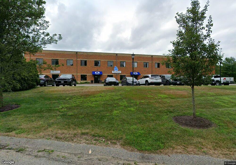
12 Resnik Rd Plymouth, MA 02360
Estimated Value: $6,806,529
--
Bed
1
Bath
2,400
Sq Ft
$2,836/Sq Ft
Est. Value
About This Home
This home is located at 12 Resnik Rd, Plymouth, MA 02360 and is currently estimated at $6,806,529, approximately $2,836 per square foot. 12 Resnik Rd is a home located in Plymouth County with nearby schools including Hedge Elementary School, Plymouth Community Intermediate, and Plymouth North High School.
Ownership History
Date
Name
Owned For
Owner Type
Purchase Details
Closed on
Aug 1, 2012
Sold by
12 Resnik Road Llc
Bought by
Legacy Resnik Llc
Current Estimated Value
Home Financials for this Owner
Home Financials are based on the most recent Mortgage that was taken out on this home.
Original Mortgage
$200,000
Outstanding Balance
$138,746
Interest Rate
3.7%
Mortgage Type
Commercial
Estimated Equity
$6,667,783
Purchase Details
Closed on
Jun 15, 2006
Sold by
4M Rt and Zaverucha Walter J
Bought by
735 Airport Road Llc
Create a Home Valuation Report for This Property
The Home Valuation Report is an in-depth analysis detailing your home's value as well as a comparison with similar homes in the area
Home Values in the Area
Average Home Value in this Area
Purchase History
| Date | Buyer | Sale Price | Title Company |
|---|---|---|---|
| Legacy Resnik Llc | $2,800,000 | -- | |
| 735 Airport Road Llc | $3,038,763 | -- |
Source: Public Records
Mortgage History
| Date | Status | Borrower | Loan Amount |
|---|---|---|---|
| Open | Legacy Resnik Llc | $200,000 | |
| Previous Owner | 735 Airport Road Llc | $670,000 | |
| Previous Owner | 735 Airport Road Llc | $226,000 | |
| Previous Owner | 735 Airport Road Llc | $1,250,000 |
Source: Public Records
Tax History Compared to Growth
Tax History
| Year | Tax Paid | Tax Assessment Tax Assessment Total Assessment is a certain percentage of the fair market value that is determined by local assessors to be the total taxable value of land and additions on the property. | Land | Improvement |
|---|---|---|---|---|
| 2025 | $54,957 | $4,330,700 | $748,100 | $3,582,600 |
| 2024 | $51,120 | $3,972,000 | $709,700 | $3,262,300 |
| 2023 | $49,924 | $3,641,400 | $652,200 | $2,989,200 |
| 2022 | $50,942 | $3,301,500 | $556,300 | $2,745,200 |
| 2021 | $49,913 | $3,088,700 | $556,300 | $2,532,400 |
| 2020 | $50,500 | $3,088,700 | $556,300 | $2,532,400 |
| 2019 | $47,893 | $2,895,600 | $537,100 | $2,358,500 |
| 2018 | $45,858 | $2,786,000 | $491,100 | $2,294,900 |
| 2017 | $44,706 | $2,696,400 | $460,400 | $2,236,000 |
| 2016 | $41,433 | $2,546,600 | $422,000 | $2,124,600 |
| 2015 | $39,574 | $2,546,600 | $422,000 | $2,124,600 |
| 2014 | $37,436 | $2,474,300 | $369,500 | $2,104,800 |
Source: Public Records
Map
Nearby Homes
- 144 Industrial Park Rd
- 27 Megansett Dr Unit 27
- 2 Mariner's Way Unit 306
- 116 Pilgrim Trail
- 14 Mariner's Way Unit 14
- 3 Alec Ln
- 6 Stone Gate Dr
- 2 Marc Dr Unit 2B2
- 5 Marc Dr Unit 8
- 5 Marc Dr Unit 5
- 6A Marc Dr Unit 7
- 91 Monks Hill Rd
- 16 Filmore St
- 18 Lombard St
- 52 Liberty St Unit L3
- 52 Liberty St Unit C5
- 48 Columbia Cir
- 25 Harvard Dr
- 19 Coachman Terrace
- 8 Westwood Rd
- 6 Resnik Rd
- 6 Resnik Rd Unit 112
- 6 Resnik Rd Unit 204
- 6 Resnik Rd Unit 113
- 6 Resnik Rd Unit 103
- 6 Resnik Rd Unit 207
- 6 Resnik Rd Unit 203
- 6 Resnik Rd Unit 110
- 6 Resnik Rd Unit 105
- 6 Resnik Rd Unit 208
- 6 Resnik Rd Unit 111
- 6 Resnik Rd Unit 201
- 6 Resnik Rd Unit 101
- 6 Resnik Rd Unit 118
- 6 Resnik Rd Unit 209
- 6 Resnik Rd Unit 102
- 6 Resnik Rd Unit 210
- 6 Resnik Rd Unit 117
- 6 Resnik Rd Unit 106
- 6 Resnik Rd Unit 202