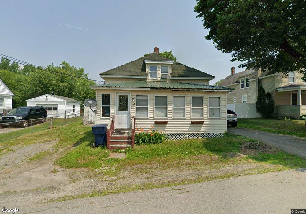
12 Robinson St Fairfield, ME 04937
Estimated Value: $172,332 - $211,000
3
Beds
2
Baths
1,137
Sq Ft
$167/Sq Ft
Est. Value
About This Home
This home is located at 12 Robinson St, Fairfield, ME 04937 and is currently estimated at $189,583, approximately $166 per square foot. 12 Robinson St is a home located in Somerset County with nearby schools including Lawrence High School, Kennebec Montessori School, and St John Catholic School.
Ownership History
Date
Name
Owned For
Owner Type
Purchase Details
Closed on
Jun 22, 2018
Sold by
Hynds Albert
Bought by
Witham Ashley B and Witham Torrey B
Current Estimated Value
Home Financials for this Owner
Home Financials are based on the most recent Mortgage that was taken out on this home.
Original Mortgage
$93,279
Interest Rate
4.8%
Mortgage Type
FHA
Purchase Details
Closed on
Aug 1, 2005
Sold by
Laiho Mary A
Bought by
Hynds Albert and Hynds Doryne
Home Financials for this Owner
Home Financials are based on the most recent Mortgage that was taken out on this home.
Original Mortgage
$73,800
Interest Rate
9%
Mortgage Type
Commercial
Create a Home Valuation Report for This Property
The Home Valuation Report is an in-depth analysis detailing your home's value as well as a comparison with similar homes in the area
Home Values in the Area
Average Home Value in this Area
Purchase History
| Date | Buyer | Sale Price | Title Company |
|---|---|---|---|
| Witham Ashley B | $95,000 | First Title & Esrow Inc | |
| Hynds Albert | -- | -- |
Source: Public Records
Mortgage History
| Date | Status | Borrower | Loan Amount |
|---|---|---|---|
| Previous Owner | Witham Ashley B | $93,279 | |
| Previous Owner | Hynds Albert | $73,800 |
Source: Public Records
Tax History Compared to Growth
Tax History
| Year | Tax Paid | Tax Assessment Tax Assessment Total Assessment is a certain percentage of the fair market value that is determined by local assessors to be the total taxable value of land and additions on the property. | Land | Improvement |
|---|---|---|---|---|
| 2023 | $1,720 | $80,000 | $15,500 | $64,500 |
| 2022 | $1,680 | $80,000 | $15,500 | $64,500 |
| 2021 | $1,760 | $80,000 | $15,500 | $64,500 |
| 2020 | $1,784 | $80,000 | $15,500 | $64,500 |
| 2019 | $1,784 | $80,000 | $15,500 | $64,500 |
| 2018 | $1,824 | $80,000 | $15,500 | $64,500 |
| 2017 | $1,824 | $80,000 | $15,500 | $64,500 |
| 2016 | $1,792 | $80,000 | $15,500 | $64,500 |
| 2015 | $1,736 | $80,000 | $15,500 | $64,500 |
| 2014 | $1,620 | $80,000 | $15,500 | $64,500 |
| 2013 | $1,620 | $80,000 | $15,500 | $64,500 |
Source: Public Records
Map
Nearby Homes
- 13 High St
- 18 Military Ave
- 24 High St
- 2 King St
- 8 Woodman Ave
- 6 Pleasant St
- 1 Industrial Rd
- 3 Bunker Ave
- 3 Evergreen Dr
- 5 Evergreen Dr
- 80 High St
- 16 Newhall St
- 1-6 Industrial Rd
- Map 36 Lots 13 14 & 17 Sheridan Dr
- 10 Sheridan Dr
- 17 Sheridan Dr
- 670 Benton Ave
- 162 College Ave
- 14 Collins St
- 5 Industrial Rd Rd