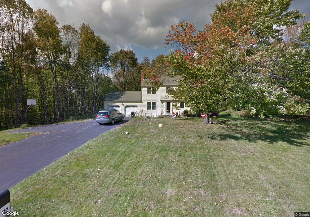
12 Rock Brook Rd Harwinton, CT 06791
Estimated Value: $420,000 - $584,000
4
Beds
3
Baths
2,428
Sq Ft
$215/Sq Ft
Est. Value
About This Home
This home is located at 12 Rock Brook Rd, Harwinton, CT 06791 and is currently estimated at $522,321, approximately $215 per square foot. 12 Rock Brook Rd is a home located in Litchfield County with nearby schools including Harwinton Consolidated School, Har-Bur Middle School, and Lewis S. Mills High School.
Ownership History
Date
Name
Owned For
Owner Type
Purchase Details
Closed on
Dec 20, 2004
Sold by
Riberdy Robert M and Riberdy Gloria V
Bought by
Atkins Adam P and Atkins Jennifer M
Current Estimated Value
Home Financials for this Owner
Home Financials are based on the most recent Mortgage that was taken out on this home.
Original Mortgage
$200,000
Interest Rate
5.68%
Purchase Details
Closed on
Jan 7, 1999
Sold by
Raynes Matthew B and Raynes Elizabeth A
Bought by
Riberdy Robert M and Riberdy Gloria
Purchase Details
Closed on
Aug 10, 1995
Sold by
Indomenico Elaine F
Bought by
Raynes Matthew B and Raynes Elizabeth A
Create a Home Valuation Report for This Property
The Home Valuation Report is an in-depth analysis detailing your home's value as well as a comparison with similar homes in the area
Home Values in the Area
Average Home Value in this Area
Purchase History
| Date | Buyer | Sale Price | Title Company |
|---|---|---|---|
| Atkins Adam P | $283,500 | -- | |
| Atkins Adam P | $283,500 | -- | |
| Riberdy Robert M | $172,000 | -- | |
| Riberdy Robert M | $172,000 | -- | |
| Raynes Matthew B | $150,000 | -- | |
| Raynes Matthew B | $150,000 | -- |
Source: Public Records
Mortgage History
| Date | Status | Borrower | Loan Amount |
|---|---|---|---|
| Open | Raynes Matthew B | $169,061 | |
| Closed | Raynes Matthew B | $200,000 |
Source: Public Records
Tax History
| Year | Tax Paid | Tax Assessment Tax Assessment Total Assessment is a certain percentage of the fair market value that is determined by local assessors to be the total taxable value of land and additions on the property. | Land | Improvement |
|---|---|---|---|---|
| 2025 | $6,228 | $270,770 | $70,930 | $199,840 |
| 2024 | $6,201 | $270,770 | $70,930 | $199,840 |
| 2023 | $4,998 | $171,160 | $50,670 | $120,490 |
| 2022 | $4,878 | $171,160 | $50,670 | $120,490 |
| 2021 | $4,467 | $155,660 | $50,670 | $104,990 |
| 2020 | $4,358 | $155,660 | $50,670 | $104,990 |
| 2019 | $4,358 | $155,660 | $50,670 | $104,990 |
| 2018 | $4,731 | $168,950 | $65,070 | $103,880 |
| 2017 | $4,697 | $168,950 | $65,070 | $103,880 |
| 2016 | $4,697 | $168,950 | $65,070 | $103,880 |
| 2015 | $4,612 | $168,950 | $65,070 | $103,880 |
| 2014 | $4,545 | $168,950 | $65,070 | $103,880 |
Source: Public Records
Map
Nearby Homes
- 7 Wilson Pond Rd
- 21 South Rd
- 60 Polly Dan Rd
- 164 Birge Park Rd
- 604 Wildcat Hill Rd
- 39 Charolais Way
- 75 Saw Mill Rd
- 191 Birch Hill Rd
- 448 Litchfield Rd
- Lot 2 Birch Hill Rd
- 184 Campville Hill Rd
- 544 Litchfield Rd
- 92 Shafer Rd
- 0 Decker Dr Unit 24148478
- 117 W Chippen Hill Rd
- 278 Preston Rd
- 385 Cotton Hill Rd
- 197 Preston Rd
- 67 E Litchfield Rd S
- 21 Oak Meadow Ln
- 179 Plymouth Rd
- 22 Rock Brook Rd
- 2 Rock Brook Rd
- 21 Rock Brook Rd
- 185 Plymouth Rd
- 157 Plymouth Rd
- 36 Rock Brook Rd
- 27 Rock Brook Rd
- 153 Plymouth Rd
- 160 Plymouth Rd
- 48 Rock Brook Rd
- 147 Plymouth Rd
- 104 Wake Robin Ln
- 37 Rock Brook Rd
- 45 Rock Brook Rd
- 133 Plymouth Rd
- 92 Wake Robin Ln
- 99 Wake Robin Ln
- 111 Shingle Mill Rd
- 128 Shingle Mill Rd