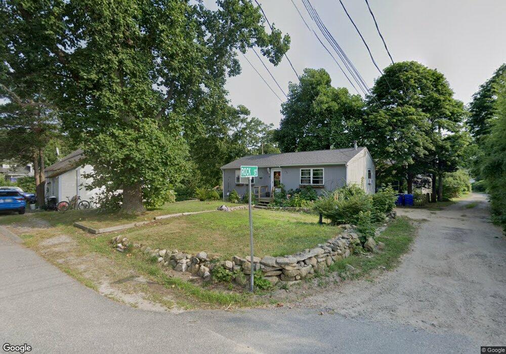
12 Rock Rd Bourne, MA 2532
Monument Beach NeighborhoodEstimated Value: $448,784 - $521,000
1
Bed
1
Bath
675
Sq Ft
$711/Sq Ft
Est. Value
About This Home
This home is located at 12 Rock Rd, Bourne, MA 2532 and is currently estimated at $479,946, approximately $711 per square foot. 12 Rock Rd is a home located in Barnstable County with nearby schools including Bourne High School, St Margaret Regional School, and Cadence Academy Preschool - Bourne.
Ownership History
Date
Name
Owned For
Owner Type
Purchase Details
Closed on
Feb 8, 2024
Sold by
Dietlin David A and Dietlin Patt M
Bought by
Dietlin Rt and Dietlin
Current Estimated Value
Purchase Details
Closed on
Dec 31, 2001
Sold by
Perry Lewis H and Perry Eleanor H
Bought by
Dietlin David A and Dietlin Patt M
Home Financials for this Owner
Home Financials are based on the most recent Mortgage that was taken out on this home.
Original Mortgage
$143,863
Interest Rate
6.61%
Mortgage Type
Purchase Money Mortgage
Create a Home Valuation Report for This Property
The Home Valuation Report is an in-depth analysis detailing your home's value as well as a comparison with similar homes in the area
Home Values in the Area
Average Home Value in this Area
Purchase History
| Date | Buyer | Sale Price | Title Company |
|---|---|---|---|
| Dietlin Rt | -- | None Available | |
| Dietlin Rt | -- | None Available | |
| Dietlin David A | $145,000 | -- | |
| Dietlin David A | $145,000 | -- |
Source: Public Records
Mortgage History
| Date | Status | Borrower | Loan Amount |
|---|---|---|---|
| Previous Owner | Dietlin David A | $143,863 |
Source: Public Records
Tax History Compared to Growth
Tax History
| Year | Tax Paid | Tax Assessment Tax Assessment Total Assessment is a certain percentage of the fair market value that is determined by local assessors to be the total taxable value of land and additions on the property. | Land | Improvement |
|---|---|---|---|---|
| 2025 | $2,938 | $376,200 | $202,300 | $173,900 |
| 2024 | $2,873 | $358,200 | $192,700 | $165,500 |
| 2023 | $2,813 | $319,300 | $170,500 | $148,800 |
| 2022 | $2,754 | $272,900 | $150,900 | $122,000 |
| 2021 | $2,701 | $250,800 | $137,300 | $113,500 |
| 2020 | $2,627 | $244,600 | $136,000 | $108,600 |
| 2019 | $2,325 | $221,200 | $124,200 | $97,000 |
| 2018 | $2,192 | $208,000 | $118,300 | $89,700 |
| 2017 | $2,121 | $205,900 | $117,200 | $88,700 |
| 2016 | $1,973 | $194,200 | $117,200 | $77,000 |
| 2015 | $1,956 | $194,200 | $117,200 | $77,000 |
Source: Public Records
Map
Nearby Homes