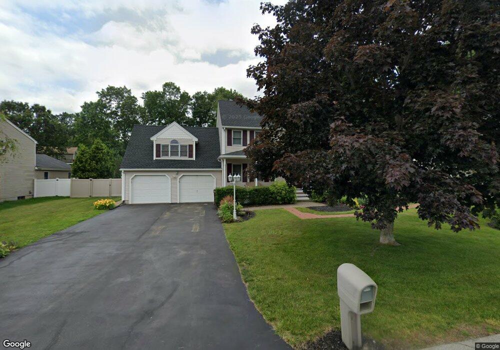
12 Rollie Shepard Dr Millbury, MA 01527
Estimated Value: $666,184 - $722,000
3
Beds
2
Baths
2,352
Sq Ft
$295/Sq Ft
Est. Value
About This Home
This home is located at 12 Rollie Shepard Dr, Millbury, MA 01527 and is currently estimated at $694,046, approximately $295 per square foot. 12 Rollie Shepard Dr is a home located in Worcester County with nearby schools including Elmwood Street Elementary School, Raymond E. Shaw Elementary School, and Millbury Junior/Senior High School.
Ownership History
Date
Name
Owned For
Owner Type
Purchase Details
Closed on
Oct 17, 2018
Sold by
Gedman Stephen W and Gedman Donna M
Bought by
Urtz Dean and Roy-Urtz Christine
Current Estimated Value
Home Financials for this Owner
Home Financials are based on the most recent Mortgage that was taken out on this home.
Original Mortgage
$300,000
Outstanding Balance
$261,618
Interest Rate
4.5%
Mortgage Type
New Conventional
Estimated Equity
$432,428
Purchase Details
Closed on
Sep 28, 1999
Sold by
Zanadu Inc
Bought by
Gedman Stephen W and Gedman Donna M
Home Financials for this Owner
Home Financials are based on the most recent Mortgage that was taken out on this home.
Original Mortgage
$81,500
Interest Rate
8.1%
Mortgage Type
Purchase Money Mortgage
Create a Home Valuation Report for This Property
The Home Valuation Report is an in-depth analysis detailing your home's value as well as a comparison with similar homes in the area
Home Values in the Area
Average Home Value in this Area
Purchase History
| Date | Buyer | Sale Price | Title Company |
|---|---|---|---|
| Urtz Dean | $400,000 | -- | |
| Urtz Dean | $400,000 | -- | |
| Gedman Stephen W | $195,000 | -- | |
| Gedman Stephen W | $195,000 | -- |
Source: Public Records
Mortgage History
| Date | Status | Borrower | Loan Amount |
|---|---|---|---|
| Open | Urtz Dean | $300,000 | |
| Closed | Urtz Dean | $300,000 | |
| Previous Owner | Gedman Stephen W | $8,000 | |
| Previous Owner | Gedman Stephen W | $100,000 | |
| Previous Owner | Gedman Stephen W | $81,500 |
Source: Public Records
Tax History Compared to Growth
Tax History
| Year | Tax Paid | Tax Assessment Tax Assessment Total Assessment is a certain percentage of the fair market value that is determined by local assessors to be the total taxable value of land and additions on the property. | Land | Improvement |
|---|---|---|---|---|
| 2025 | $7,849 | $586,200 | $119,000 | $467,200 |
| 2024 | $7,224 | $546,000 | $110,200 | $435,800 |
| 2023 | $6,640 | $459,500 | $77,400 | $382,100 |
| 2022 | $6,026 | $401,700 | $77,400 | $324,300 |
| 2021 | $5,954 | $385,900 | $77,400 | $308,500 |
| 2020 | $5,476 | $357,200 | $77,400 | $279,800 |
| 2019 | $5,522 | $348,400 | $77,000 | $271,400 |
| 2018 | $827 | $334,900 | $77,000 | $257,900 |
| 2017 | $872 | $310,300 | $77,000 | $233,300 |
| 2016 | $5,215 | $316,800 | $77,000 | $239,800 |
| 2015 | $5,048 | $306,700 | $78,200 | $228,500 |
| 2014 | $4,761 | $278,400 | $81,800 | $196,600 |
Source: Public Records
Map
Nearby Homes
- 90 Macarthur Dr
- 3 May St
- 86 Wheelock Ave
- 2 Diane St
- 12 Irene Ct
- 11 Westview Ave
- 1 Pineland Ave
- 1 Broadmeadow Ave
- 12 Alstead Path
- 46 John Dr Unit 46
- 5 Edward Dr
- 21 Lordvale Blvd Unit 406
- 28 Lincoln Ln
- 5 Lincoln Ln Unit 5
- 330 Millbury Ave
- 76 Samuel Dr
- 11 Maplewood Rd
- 123 Riverlin St
- 27 A-B Grafton St
- 64 Millbury Ave
- 14 Rollie Shepard Dr
- 10 Rollie Shepard Dr
- 43 Macarthur Dr
- 1 Montgomery Dr
- 3 Montgomery Dr
- 16 Rollie Shepard Dr
- 41 Macarthur Dr
- 8 Rollie Shepard Dr
- 35 Macarthur Dr
- 13 Rollie Shepard Dr
- 2 Bill Graham Ln
- 11 Rollie Shepard Dr
- 18 Rollie Shepard Dr
- 15 Rollie Shepard Dr
- 5 Montgomery Dr
- 31 Macarthur Dr
- 47 Macarthur Dr
- 2 Montgomery Dr
- 1 Bill Graham Ln
- 9 Rollie Shepard Dr