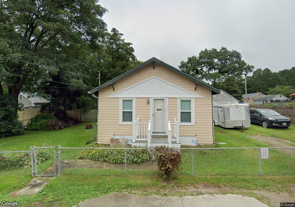
12 S Berryman St Westport, MA 02790
North Westport NeighborhoodEstimated Value: $293,712 - $402,000
1
Bed
--
Bath
838
Sq Ft
$437/Sq Ft
Est. Value
About This Home
This home is located at 12 S Berryman St, Westport, MA 02790 and is currently estimated at $365,928, approximately $436 per square foot. 12 S Berryman St is a home located in Bristol County with nearby schools including Alice A. Macomber Primary School, Westport Elementary School, and Westport Middle-High School.
Ownership History
Date
Name
Owned For
Owner Type
Purchase Details
Closed on
Sep 30, 1998
Sold by
Alexander Manuel F and Alexander Claudette A
Bought by
Sanford Susan E
Current Estimated Value
Home Financials for this Owner
Home Financials are based on the most recent Mortgage that was taken out on this home.
Original Mortgage
$104,934
Interest Rate
6.89%
Mortgage Type
Purchase Money Mortgage
Create a Home Valuation Report for This Property
The Home Valuation Report is an in-depth analysis detailing your home's value as well as a comparison with similar homes in the area
Home Values in the Area
Average Home Value in this Area
Purchase History
| Date | Buyer | Sale Price | Title Company |
|---|---|---|---|
| Sanford Susan E | $107,500 | -- |
Source: Public Records
Mortgage History
| Date | Status | Borrower | Loan Amount |
|---|---|---|---|
| Open | Sanford Susan E | $129,750 | |
| Closed | Sanford Susan E | $104,934 | |
| Previous Owner | Sanford Susan E | $87,200 |
Source: Public Records
Tax History Compared to Growth
Tax History
| Year | Tax Paid | Tax Assessment Tax Assessment Total Assessment is a certain percentage of the fair market value that is determined by local assessors to be the total taxable value of land and additions on the property. | Land | Improvement |
|---|---|---|---|---|
| 2025 | $1,828 | $245,400 | $142,400 | $103,000 |
| 2024 | $1,864 | $241,100 | $131,900 | $109,200 |
| 2023 | $1,719 | $210,700 | $119,600 | $91,100 |
| 2022 | $1,609 | $189,700 | $113,600 | $76,100 |
| 2021 | $1,688 | $195,800 | $103,300 | $92,500 |
| 2020 | $1,540 | $182,700 | $94,000 | $88,700 |
| 2019 | $1,484 | $179,500 | $94,000 | $85,500 |
| 2018 | $1,298 | $158,900 | $80,700 | $78,200 |
| 2017 | $1,297 | $162,700 | $86,300 | $76,400 |
| 2016 | $1,252 | $158,300 | $81,900 | $76,400 |
| 2015 | $1,266 | $159,600 | $94,000 | $65,600 |
Source: Public Records
Map
Nearby Homes
- 16 S Berryman St
- 15 S Breault St
- 9 Kyle Jacob Rd
- 565 Highland Ave
- 116 Gifford Rd
- 96 Forge Rd
- 27 Dias Ave
- 20 Faulkner St
- 29 Union Ave
- 21 Evergreen St
- 55 Lakeside Ave
- 735 Reed Rd
- 818 Reed Rd
- 3 Roller Coaster Way Unit Lot 1
- 1276 Old Fall River Rd
- 100 D Dr
- 461 Reed Rd
- 19 Charles Joseph Dr
- 2 Donna Marie Dr
- 3 Diane Way