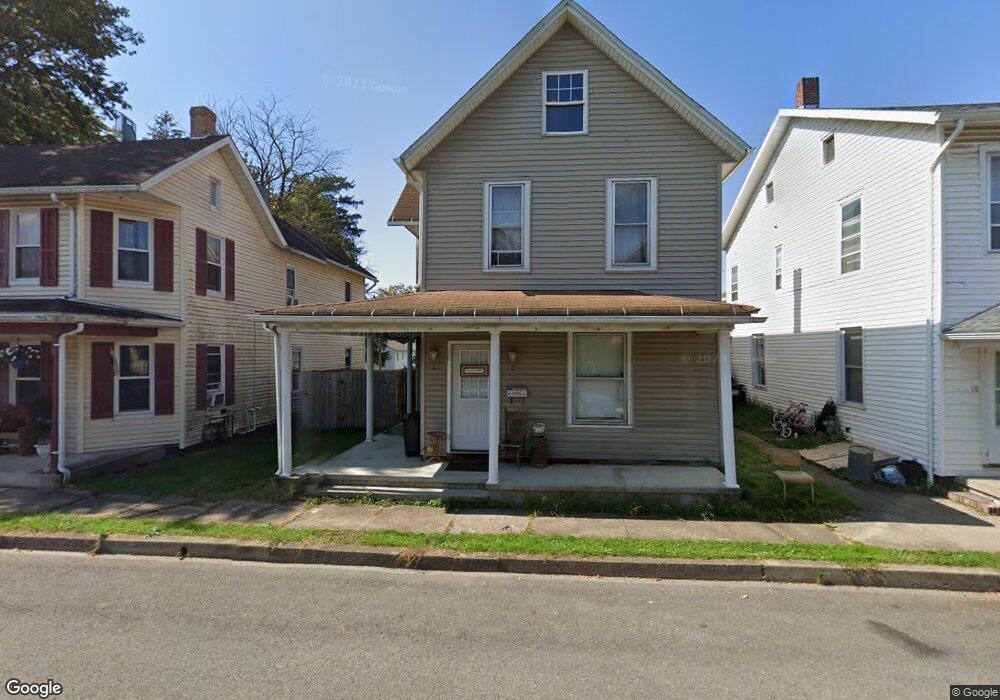
12 S High St Selinsgrove, PA 17870
Estimated Value: $81,136 - $210,000
3
Beds
2
Baths
1,612
Sq Ft
$106/Sq Ft
Est. Value
About This Home
This home is located at 12 S High St, Selinsgrove, PA 17870 and is currently estimated at $170,284, approximately $105 per square foot. 12 S High St is a home located in Snyder County with nearby schools including Selinsgrove Area Elementary School, Selinsgrove Intermediate School, and Selinsgrove Area Middle School.
Ownership History
Date
Name
Owned For
Owner Type
Purchase Details
Closed on
Feb 1, 2017
Sold by
Sampsell Raymond L and Sampsell Tracy A
Bought by
Sampsell Raymond L
Current Estimated Value
Purchase Details
Closed on
Nov 1, 2011
Sold by
Fannie Mae
Bought by
Sampsell Raymond L and Sampsell Tracey
Purchase Details
Closed on
Jul 1, 2011
Sold by
Sheriff Of Snyder County Co
Bought by
Federal National Mortgage Association
Create a Home Valuation Report for This Property
The Home Valuation Report is an in-depth analysis detailing your home's value as well as a comparison with similar homes in the area
Home Values in the Area
Average Home Value in this Area
Purchase History
| Date | Buyer | Sale Price | Title Company |
|---|---|---|---|
| Sampsell Raymond L | -- | Attorney | |
| Sampsell Raymond L | $42,000 | -- | |
| Federal National Mortgage Association | $1,357 | -- |
Source: Public Records
Mortgage History
| Date | Status | Borrower | Loan Amount |
|---|---|---|---|
| Closed | Federal National Mortgage Association | $0 |
Source: Public Records
Tax History Compared to Growth
Tax History
| Year | Tax Paid | Tax Assessment Tax Assessment Total Assessment is a certain percentage of the fair market value that is determined by local assessors to be the total taxable value of land and additions on the property. | Land | Improvement |
|---|---|---|---|---|
| 2025 | $1,336 | $11,170 | $1,560 | $9,610 |
| 2024 | $1,255 | $11,170 | $1,560 | $9,610 |
| 2023 | $501 | $11,170 | $1,560 | $9,610 |
| 2022 | $1,204 | $11,170 | $1,560 | $9,610 |
| 2021 | $1,193 | $11,170 | $1,560 | $9,610 |
| 2020 | $1,187 | $11,170 | $1,560 | $9,610 |
| 2019 | $1,182 | $11,170 | $1,560 | $9,610 |
| 2018 | $1,171 | $11,170 | $1,560 | $9,610 |
| 2017 | $1,159 | $11,170 | $1,560 | $9,610 |
| 2016 | $623 | $11,170 | $1,560 | $9,610 |
| 2015 | $41,120 | $11,170 | $1,560 | $9,610 |
| 2014 | $41,120 | $11,170 | $1,560 | $9,610 |
Source: Public Records
Map
Nearby Homes
- 211 W Pine St
- 207 Orange St Unit 209
- 00 S Market St
- 223 E Pine St
- 500 N Orange St
- 511 N 10th St
- 722 N 8th St
- Lot 1 522 Route S
- 321 Pleasant Dr
- 12 Minton Dr
- 0 Wedgewood Dr
- 20 Quarry Rd
- 9130 State Route 147
- 456 State School Rd
- 00 Market
- 1262 N Old Trail
- 732 Salem Rd
- 85 Old Colony Rd
- 0 Mill Rd
- 34 Oakmont Ct
- 16 S High St Unit 18
- 10 S High St
- 8 S High St
- 8 S High St
- 6 S High St
- 14 S High St
- 18 S High St Unit B
- 18 S High St
- 4 S High St
- 101 W Pine St
- 17 S High St
- 5 S High St Unit 7
- 110 University Ave
- 11 S Liberty Aly
- 100 S High St
- 14 University Ave
- 11 S High St
- 101 S High St
- 102 S High St
- 111 University Ave