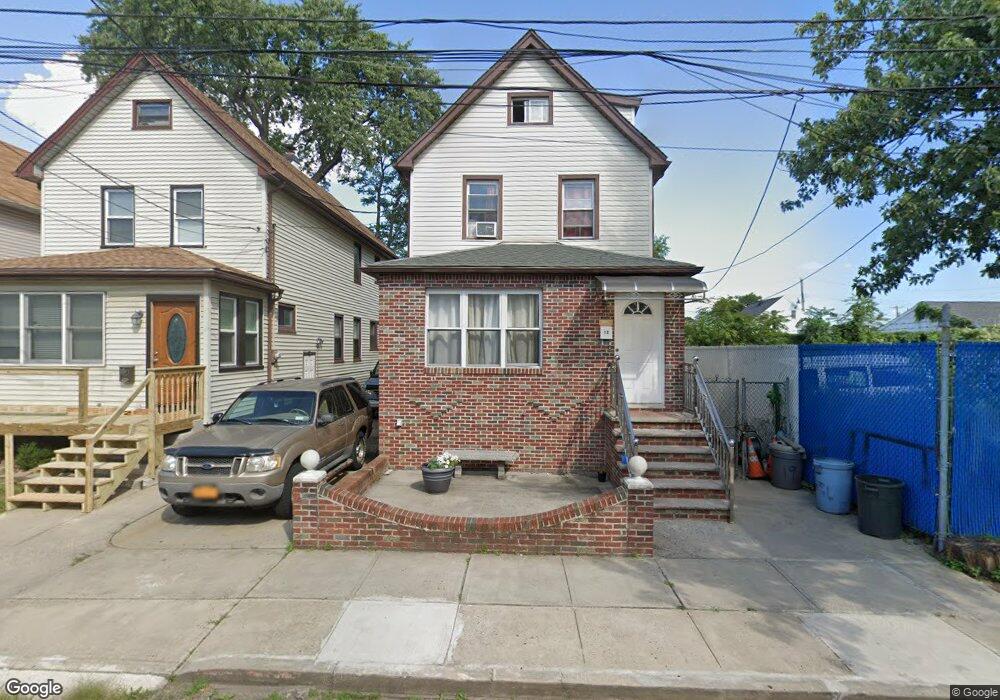
12 Samuel Place Staten Island, NY 10303
Mariners Harbor NeighborhoodEstimated Value: $513,000 - $623,000
--
Bed
4
Baths
1,638
Sq Ft
$343/Sq Ft
Est. Value
About This Home
This home is located at 12 Samuel Place, Staten Island, NY 10303 and is currently estimated at $561,555, approximately $342 per square foot. 12 Samuel Place is a home located in Richmond County with nearby schools including P.S. 44 Thomas C Brown, I.S. 51 Edwin Markham, and Port Richmond High School.
Ownership History
Date
Name
Owned For
Owner Type
Purchase Details
Closed on
Jul 19, 2006
Sold by
Marks Donald
Bought by
Chen Qian Y and Lo Ting N
Current Estimated Value
Home Financials for this Owner
Home Financials are based on the most recent Mortgage that was taken out on this home.
Original Mortgage
$200,000
Outstanding Balance
$119,716
Interest Rate
6.8%
Mortgage Type
Seller Take Back
Estimated Equity
$441,839
Purchase Details
Closed on
Nov 22, 1999
Sold by
Marks Larry and Marks Donald
Bought by
Marks Donald
Create a Home Valuation Report for This Property
The Home Valuation Report is an in-depth analysis detailing your home's value as well as a comparison with similar homes in the area
Home Values in the Area
Average Home Value in this Area
Purchase History
| Date | Buyer | Sale Price | Title Company |
|---|---|---|---|
| Chen Qian Y | $200,000 | Lawyers Title Insurance Corp | |
| Marks Donald | -- | Commonwealth Land Title Ins |
Source: Public Records
Mortgage History
| Date | Status | Borrower | Loan Amount |
|---|---|---|---|
| Open | Chen Qian Y | $200,000 |
Source: Public Records
Tax History Compared to Growth
Tax History
| Year | Tax Paid | Tax Assessment Tax Assessment Total Assessment is a certain percentage of the fair market value that is determined by local assessors to be the total taxable value of land and additions on the property. | Land | Improvement |
|---|---|---|---|---|
| 2025 | $4,728 | $29,880 | $7,015 | $22,865 |
| 2024 | $4,728 | $28,560 | $6,924 | $21,636 |
| 2023 | $4,510 | $22,208 | $6,894 | $15,314 |
| 2022 | $3,957 | $25,440 | $8,400 | $17,040 |
| 2021 | $4,409 | $25,020 | $8,400 | $16,620 |
| 2020 | $4,401 | $26,340 | $8,400 | $17,940 |
| 2019 | $4,104 | $25,260 | $8,400 | $16,860 |
| 2018 | $3,773 | $18,507 | $8,385 | $10,122 |
| 2017 | $3,559 | $17,460 | $8,400 | $9,060 |
| 2016 | $3,872 | $19,368 | $8,292 | $11,076 |
| 2015 | $3,502 | $18,900 | $7,020 | $11,880 |
| 2014 | $3,502 | $18,247 | $6,777 | $11,470 |
Source: Public Records
Map
Nearby Homes
- 268 Bruckner Ave Unit 268
- 56 Confederation Place
- 331 Union Ave
- 414 Wilcox St
- 22 Spirit Ln Unit 37
- 300 Andros Ave Unit A
- 300A Andros Ave
- 21 Carol Place
- 22 Confederation Place
- 12 Doreen Dr
- 257 Maple Pkwy
- 123 Amity Place
- 49 Doreen Dr
- 16 Union Ct
- 38 Eleanor Place
- 151 Amity Place
- 51 Adrianne Ln
- 336 van Name Ave
- 48 Adrianne Ln
- 32 Amador St
- 14 Samuel Place
- 16 Samuel Place
- 18 Samuel Place
- 22 Samuel Place
- 22 Samuel Place Unit 2
- 358 Harbor Rd
- 360 Harbor Rd
- 356 Harbor Rd
- 366 Harbor Rd
- 354 Harbor Rd
- 368 Harbor Rd
- 352 Harbor Rd
- 372 Harbor Rd
- 344 Harbor Rd
- 7 Dublin Place
- 1 Dublin Place
- 2151 Forest Ave
- 336 Harbor Rd
- 334 Harbor Rd
- 357 Harbor Rd