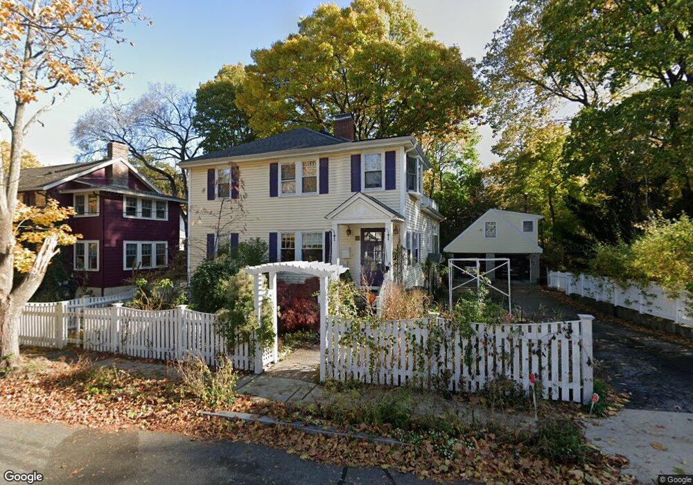
12 Shawnee Rd Arlington, MA 02476
Arlington Center NeighborhoodEstimated Value: $1,010,000 - $1,639,000
3
Beds
4
Baths
2,864
Sq Ft
$495/Sq Ft
Est. Value
About This Home
This home is located at 12 Shawnee Rd, Arlington, MA 02476 and is currently estimated at $1,416,854, approximately $494 per square foot. 12 Shawnee Rd is a home located in Middlesex County with nearby schools including Brackett Elementary School, Ottoson Middle School, and Arlington High School.
Ownership History
Date
Name
Owned For
Owner Type
Purchase Details
Closed on
Jan 23, 2024
Sold by
Vieweg-Cooperson Hldg Ft and Cooperson
Bought by
Dana A Cooperson Ret and Cooperson
Current Estimated Value
Purchase Details
Closed on
Aug 27, 2015
Sold by
Vieweg Donald F and Cooperson Dana A
Bought by
Vieweg-Cooperson Ft and Vieweg
Purchase Details
Closed on
Nov 20, 1997
Sold by
Fenochetti Herbert F
Bought by
Vieweg Donald F and Cooperson Dana A
Home Financials for this Owner
Home Financials are based on the most recent Mortgage that was taken out on this home.
Original Mortgage
$214,000
Interest Rate
7.17%
Mortgage Type
Purchase Money Mortgage
Create a Home Valuation Report for This Property
The Home Valuation Report is an in-depth analysis detailing your home's value as well as a comparison with similar homes in the area
Home Values in the Area
Average Home Value in this Area
Purchase History
| Date | Buyer | Sale Price | Title Company |
|---|---|---|---|
| Dana A Cooperson Ret | -- | None Available | |
| Vieweg-Cooperson Ft | -- | -- | |
| Vieweg Donald F | $238,000 | -- |
Source: Public Records
Mortgage History
| Date | Status | Borrower | Loan Amount |
|---|---|---|---|
| Previous Owner | Vieweg Donald F | $331,000 | |
| Previous Owner | Vieweg Donald F | $214,000 | |
| Previous Owner | Vieweg Donald F | $15,000 | |
| Previous Owner | Vieweg Donald F | $15,000 |
Source: Public Records
Tax History
| Year | Tax Paid | Tax Assessment Tax Assessment Total Assessment is a certain percentage of the fair market value that is determined by local assessors to be the total taxable value of land and additions on the property. | Land | Improvement |
|---|---|---|---|---|
| 2025 | $12,766 | $1,185,300 | $574,400 | $610,900 |
| 2024 | $11,870 | $1,120,900 | $551,400 | $569,500 |
| 2023 | $11,235 | $1,002,200 | $482,500 | $519,700 |
| 2022 | $10,659 | $933,400 | $459,500 | $473,900 |
| 2021 | $10,432 | $919,900 | $459,500 | $460,400 |
| 2020 | $10,174 | $919,900 | $459,500 | $460,400 |
| 2019 | $8,797 | $781,300 | $430,800 | $350,500 |
| 2018 | $8,561 | $705,800 | $356,100 | $349,700 |
| 2017 | $8,504 | $677,100 | $327,400 | $349,700 |
| 2016 | $8,300 | $648,400 | $298,700 | $349,700 |
| 2015 | $8,600 | $634,700 | $292,900 | $341,800 |
Source: Public Records
Map
Nearby Homes
- 93 Churchill Ave
- 115 Gloucester St
- 2 Bellevue Rd
- 14 Albermarle St Unit 14
- 4 Stony Brook Rd
- 23 Newman Way Unit 1
- 25 Walnut Terrace
- 31 Brunswick Rd
- 995 Massachusetts Ave Unit 105
- 995 Massachusetts Ave Unit 404
- 108 Radcliffe Rd
- 303 Gray St
- 36 Kenilworth Rd
- 384 Brighton St
- 1025 Massachusetts Ave Unit 404
- 1025 Massachusetts Ave Unit 204
- 1025 Massachusetts Ave Unit 304
- 1025 Massachusetts Ave Unit 211
- 1025 Massachusetts Ave Unit 205
- 1025 Massachusetts Ave Unit 210
- 7 Menotomy Rocks Dr
- 7 Menotomy Rocks Dr Unit SF
- 7 Menotomy Rocks Dr Unit 7
- 6 Shawnee Rd
- 16 Shawnee Rd
- 2 Shawnee Rd
- 15 Shawnee Rd
- 9 Shawnee Rd
- 20 Shawnee Rd
- 17 Shawnee Rd
- 35 Bonad Rd
- 31 Bonad Rd
- 23 Shawnee Rd
- 26 Shawnee Rd
- 3 Menotomy Rocks Dr
- 20 Menotomy Rocks Dr
- 38 Bonad Rd
- 42 Bonad Rd
- 16 Menotomy Rocks Dr
- 34 Bonad Rd
Your Personal Tour Guide
Ask me questions while you tour the home.