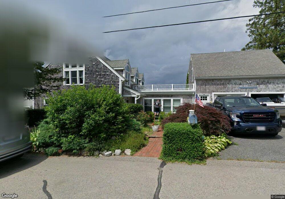
12 Shore Dr Kingston, MA 02364
Estimated Value: $1,102,621 - $1,278,000
3
Beds
3
Baths
1,728
Sq Ft
$700/Sq Ft
Est. Value
About This Home
This home is located at 12 Shore Dr, Kingston, MA 02364 and is currently estimated at $1,209,905, approximately $700 per square foot. 12 Shore Dr is a home located in Plymouth County with nearby schools including Kingston Elementary School, Silver Lake Regional High School, and Kingston Intermediate School.
Ownership History
Date
Name
Owned For
Owner Type
Purchase Details
Closed on
May 13, 2011
Sold by
Fitzgerlad John
Bought by
Joint Fitzgerald and Joint Fitzgerald
Current Estimated Value
Purchase Details
Closed on
Feb 14, 2002
Sold by
Ljs Rt and Sullivan
Bought by
Fitzgerald John
Home Financials for this Owner
Home Financials are based on the most recent Mortgage that was taken out on this home.
Original Mortgage
$225,000
Interest Rate
7.14%
Mortgage Type
Purchase Money Mortgage
Purchase Details
Closed on
Dec 11, 2001
Sold by
Ljs Rt and Sullivan
Bought by
Angell Donald and Silvia Adeine L
Purchase Details
Closed on
Nov 24, 1997
Sold by
Mclaughlin Hugh T Est and Buckley
Bought by
Mclaughlin John and Mclaughlin Kathleen A
Create a Home Valuation Report for This Property
The Home Valuation Report is an in-depth analysis detailing your home's value as well as a comparison with similar homes in the area
Home Values in the Area
Average Home Value in this Area
Purchase History
We collect this data history from publicly available records. To have your information removed, we recommend requesting removal directly through your county’s website.
| Date | Buyer | Sale Price | Title Company |
|---|---|---|---|
| Joint Fitzgerald | -- | -- | |
| Joint Fitzgerald | -- | -- | |
| Fitzgerald John | $540,000 | -- | |
| Fitzgerald John | $540,000 | -- | |
| Angell Donald | $22,250 | -- | |
| Mclaughlin John | $50,000 | -- |
Source: Public Records
Mortgage History
We collect this data history from publicly available records. To have your information removed, we recommend requesting removal directly through your county’s website.
| Date | Status | Borrower | Loan Amount |
|---|---|---|---|
| Previous Owner | Fitzgerald John | $225,000 | |
| Previous Owner | Mclaughlin John | $349,700 |
Source: Public Records
Tax History
| Year | Tax Paid | Tax Assessment Tax Assessment Total Assessment is a certain percentage of the fair market value that is determined by local assessors to be the total taxable value of land and additions on the property. | Land | Improvement |
|---|---|---|---|---|
| 2025 | $12,971 | $1,000,076 | $536,976 | $463,100 |
| 2024 | $12,542 | $986,776 | $536,976 | $449,800 |
| 2023 | $12,379 | $926,576 | $536,976 | $389,600 |
| 2022 | $12,774 | $876,115 | $516,515 | $359,600 |
| 2021 | $12,666 | $787,677 | $473,777 | $313,900 |
| 2020 | $12,357 | $759,000 | $462,100 | $296,900 |
| 2019 | $11,771 | $715,100 | $442,000 | $273,100 |
| 2018 | $11,148 | $677,700 | $442,000 | $235,700 |
| 2017 | $10,441 | $632,800 | $425,200 | $207,600 |
| 2016 | $11,447 | $650,000 | $402,100 | $247,900 |
| 2015 | $10,947 | $646,200 | $402,100 | $244,100 |
| 2014 | $10,475 | $628,000 | $384,700 | $243,300 |
Source: Public Records
Map
Nearby Homes
- 24 Holmes Ave
- 13 Atwood St
- Lot 17-3 Howlands Ln
- 44 Seabury Point Rd
- 735 Bay Rd
- 17 Howlands Ln
- 40 Landing Rd
- 9 Puritan Way
- 110 Main St
- 38 Landing Rd
- 58 Tussock Brook Rd
- 26 Bay Farm Rd
- 74 Tussock Brook Rd Unit 74
- 36 Mayflower St
- 58 Bay Farm Rd
- 54 Bay Farm Rd
- 28 Main St
- Lot 17-1 Howland's Ln
- 23 Mayflower Ln
- Unit 35 Secret Pond Way Unit 35
Your Personal Tour Guide
Ask me questions while you tour the home.