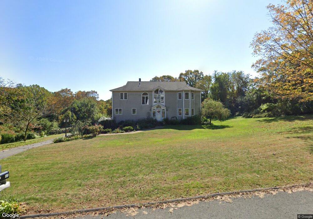
12 Smoke Rise Cir Prospect, CT 06712
Estimated Value: $551,000 - $638,000
3
Beds
3
Baths
2,886
Sq Ft
$205/Sq Ft
Est. Value
About This Home
This home is located at 12 Smoke Rise Cir, Prospect, CT 06712 and is currently estimated at $591,166, approximately $204 per square foot. 12 Smoke Rise Cir is a home located in New Haven County with nearby schools including Prospect Elementary School, Long River Middle School, and Woodland Regional High School.
Ownership History
Date
Name
Owned For
Owner Type
Purchase Details
Closed on
Jun 7, 1996
Sold by
Lobosco William A and Lobosco Martha L
Bought by
Pinho Guilherme and Pinho Amelia
Current Estimated Value
Home Financials for this Owner
Home Financials are based on the most recent Mortgage that was taken out on this home.
Original Mortgage
$60,000
Interest Rate
7.38%
Mortgage Type
Unknown
Purchase Details
Closed on
Jan 24, 1990
Sold by
Country Club Realty
Bought by
Lobasco William A
Home Financials for this Owner
Home Financials are based on the most recent Mortgage that was taken out on this home.
Original Mortgage
$228,000
Interest Rate
9.67%
Create a Home Valuation Report for This Property
The Home Valuation Report is an in-depth analysis detailing your home's value as well as a comparison with similar homes in the area
Home Values in the Area
Average Home Value in this Area
Purchase History
| Date | Buyer | Sale Price | Title Company |
|---|---|---|---|
| Pinho Guilherme | $226,000 | -- | |
| Lobasco William A | $285,000 | -- |
Source: Public Records
Mortgage History
| Date | Status | Borrower | Loan Amount |
|---|---|---|---|
| Closed | Lobasco William A | $60,000 | |
| Previous Owner | Lobasco William A | $228,000 |
Source: Public Records
Tax History Compared to Growth
Tax History
| Year | Tax Paid | Tax Assessment Tax Assessment Total Assessment is a certain percentage of the fair market value that is determined by local assessors to be the total taxable value of land and additions on the property. | Land | Improvement |
|---|---|---|---|---|
| 2025 | $9,640 | $377,020 | $112,840 | $264,180 |
| 2024 | $8,870 | $275,990 | $112,880 | $163,110 |
| 2023 | $8,810 | $275,990 | $112,880 | $163,110 |
| 2022 | $8,818 | $275,990 | $112,880 | $163,110 |
| 2021 | $8,914 | $275,990 | $112,880 | $163,110 |
| 2020 | $8,929 | $282,560 | $112,870 | $169,690 |
| 2019 | $8,745 | $282,560 | $112,870 | $169,690 |
| 2018 | $8,759 | $282,560 | $112,870 | $169,690 |
| 2017 | $8,830 | $282,560 | $112,870 | $169,690 |
| 2016 | $8,451 | $282,560 | $112,870 | $169,690 |
| 2015 | $8,245 | $282,090 | $112,860 | $169,230 |
| 2014 | $8,175 | $282,090 | $112,860 | $169,230 |
Source: Public Records
Map
Nearby Homes
- 65 Clark Hill Rd
- 4 Florence Dr
- 20 Charlene Dr
- 101 Adella St
- 15 Clark Hill Rd
- 72 Morris Rd
- 3 Rozum Cir
- 194 Maple Hill Rd
- 137 Maple Hill Rd
- 185 Eastside Blvd
- 35 Monahan Ln
- 236 Union City Rd
- 4 Damase St
- 147 Sprucedale Dr
- 17A Morris Rd
- 29 Ramsey Ave
- 66 Union City Rd
- 95 Donovan Rd
- 379 Wooster St
- 178 Peach Orchard Rd
- 8 Smoke Rise Cir
- 11 Smoke Rise Cir
- 16 Smoke Rise Cir
- 13 Smoke Rise Cir
- 7 Smoke Rise Cir
- 67 Smoke Rise Cir
- 18 Smoke Rise Cir
- 15 Smoke Rise Cir
- 69 Smoke Rise Cir
- 63 Smoke Rise Cir
- 4 Smoke Rise Cir
- 93 Clark Hill Rd
- 89 Clark Hill Rd
- 87 Clark Hill Rd
- 95 Clark Hill Rd
- 22 Smoke Rise Cir
- 19 Smoke Rise Cir
- 59 Smoke Rise Cir
- 71 Smoke Rise Cir
- 70 Smoke Rise Cir