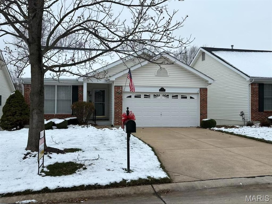
12 Soenker Cir Saint Peters, MO 63376
Highlights
- Ranch Style House
- Community Pool
- Resident Manager or Management On Site
- Hawthorn Elementary School Rated A-
- Brick Veneer
- Central Air
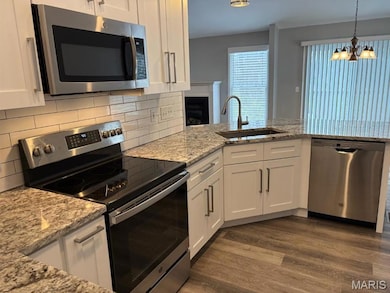
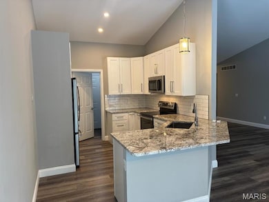
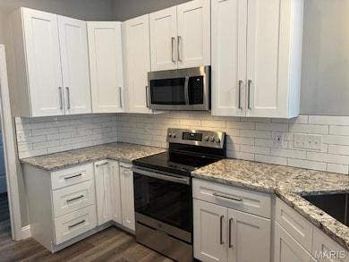
About This Home
looking for good credit and income along with excellent housekeeping. Immaculate detached villa with many updates. All appliances as well as washer/dryer provided. Fantastic location and surroundings plus community pool for summer enjoyment. Available immediately upon landlord approval. Owner/agent.
Home Details
Home Type
- Single Family
Year Built
- Built in 2002
HOA Fees
- $126 Monthly HOA Fees
Home Design
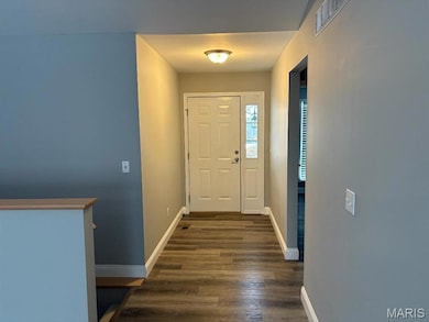
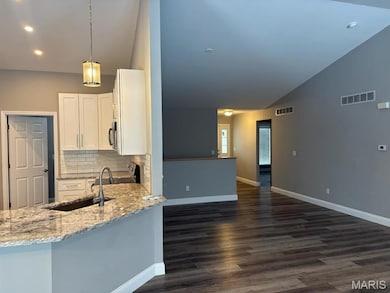
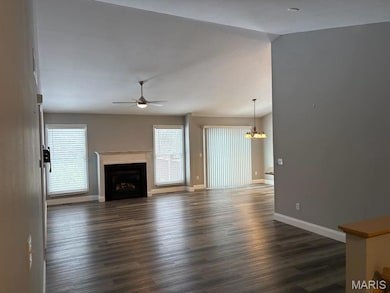
- 2,270 Sq Ft Home
- Ranch Style House
- Villa
- Brick Veneer
- Vinyl Siding
Bedrooms and Bathrooms
- 3 Bedrooms
Schools
- Hawthorn Elem. Elementary School
- Ft. Zumwalt South Middle School
- Ft. Zumwalt East High School
Utilities
- Central Air
Listing and Financial Details
- Property Available on 12/20/25
- Assessor Parcel Number 2-0107-8671-00-0006.0000000
Community Details
Overview
- Association fees include ground maintenance, common area maintenance
- Turnberry Place Association
Recreation
- Community Pool
Security
- Resident Manager or Management On Site
Map
Source: MARIS MLS
MLS Number: MIS25079105
APN: 2-0107-8671-00-0006.0000000
Disclaimer: Certain information contained herein is derived from information provided by parties other than Homes.com. All information provided is deemed reliable, but is not guaranteed to be accurate and should be independently verified.
![]() Based on information submitted to the MLS GRID. All data is obtained from various sources and may not have been verified by broker or MLS GRID. Supplied Open House Information is subject to change without notice. All information should be independently reviewed and verified for accuracy. Properties may or may not be listed by the office/agent presenting the information. Some IDX listings have been excluded from this website.
Based on information submitted to the MLS GRID. All data is obtained from various sources and may not have been verified by broker or MLS GRID. Supplied Open House Information is subject to change without notice. All information should be independently reviewed and verified for accuracy. Properties may or may not be listed by the office/agent presenting the information. Some IDX listings have been excluded from this website.
The Digital Millennium Copyright Act of 1998, 17 U.S.C. § 512 (the “DMCA”) provides recourse for copyright owners who believe that material appearing on the Internet infringes their rights under U.S. copyright law. If you believe in good faith that any content or material made available in connection with our website or services infringes your copyright, you (or your agent) may send us a notice requesting that the content or material be removed, or access to it blocked.
Notices must be sent in writing by email to DMCAnotice@MLSGrid.com.
The DMCA requires that your notice of alleged copyright infringement include the following information:
(1) description of the copyrighted work that is the subject of claimed infringement;
(2) description of the alleged infringing content and information sufficient to permit us to locate the content;
(3) contact information for you, including your address, telephone number and email address;
(4) a statement by you that you have a good faith belief that the content in the manner complained of is not authorized by the copyright owner, or its agent, or by the operation of any law;
(5) a statement by you, signed under penalty of perjury, that the information in the notification is accurate and that you have the authority to enforce the copyrights that are claimed to be infringed; and
(6) a physical or electronic signature of the copyright owner or a person authorized to act on the copyright owner’s behalf. Failure to include all of the above information may result in the delay of the processing of your complaint.
- 410 Benton Dr Unit L
- 420 Benton Dr Unit C
- 450 Benton Dr Unit E
- 3509 Sutton Dr
- 113 Berry Manor Cir
- 303 Laurel Lea Dr
- 3424 Brookwood Cir
- 436 Willow View Ln
- 440 Willow View Ln
- 45 Show Boat Cir
- 1410 Ticonderoga Dr
- 1056 Sandfort Farm Dr
- 35 Gold Run Dr Unit B
- 1171 Spencer Hill Dr
- 1504 Ticonderoga Dr
- 511 Leaning Woods St
- 528 Leaning Woods St
- 616 Walnut Woods St
- 2423 Muegge Rd
- 102 Fountainview Dr
- 100 Turnberry Place
- 2100 Pure St
- 4000 Ryleigh Reserve Ln
- 5555 Veterans Memorial Pkwy
- 5300 Mexico Rd
- 1100 Saint Peters Centre Blvd
- 100 Viva Bene Cir
- 3600 Harry s Truman Blvd
- 13 Steven Brent Ct
- 1000 Fountainview Cir
- 263 Spencer Place
- 238 W Wellspring Way
- 332 Spencer Place
- 14 Long Branch Ct
- 100 Vanderbilt Blvd
- 122 Wellspring Dr
- 130 Wellspring Dr
- 134 Wellspring Dr
- 60 Circle Way
- 778 Boca Raton Dr Unit G
