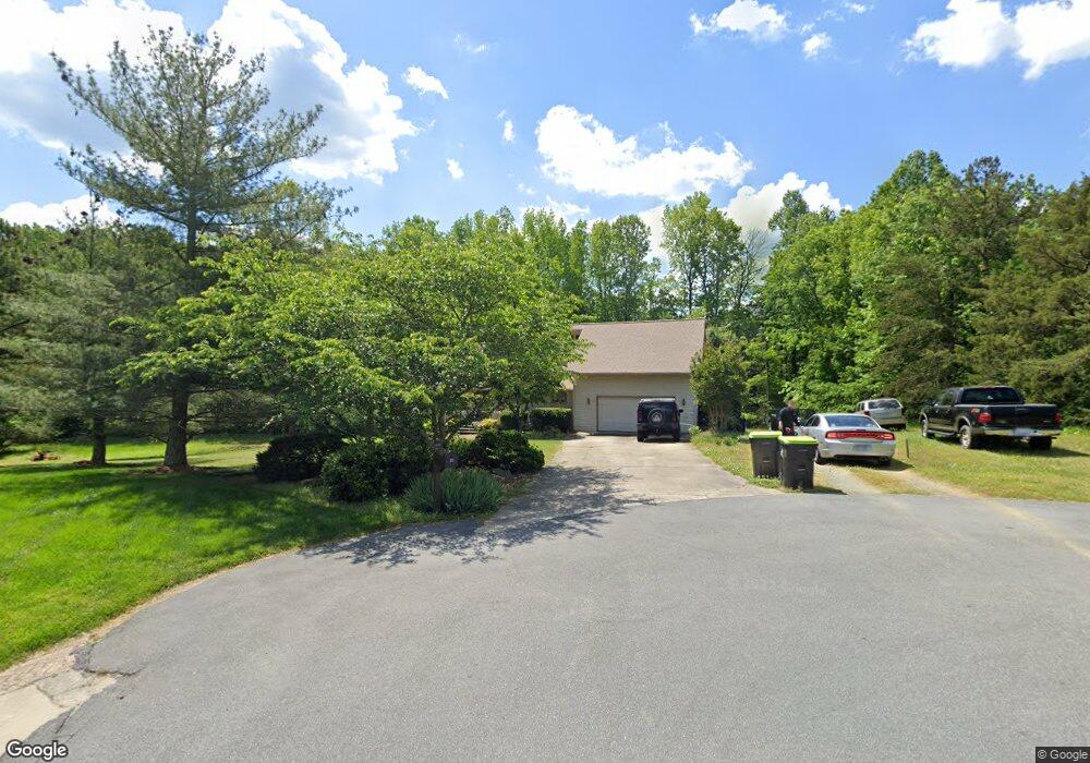
12 Splitrail Cir Thomasville, NC 27360
Estimated Value: $377,000 - $493,000
3
Beds
4
Baths
3,310
Sq Ft
$129/Sq Ft
Est. Value
About This Home
This home is located at 12 Splitrail Cir, Thomasville, NC 27360 and is currently estimated at $428,080, approximately $129 per square foot. 12 Splitrail Cir is a home located in Davidson County with nearby schools including Fair Grove Elementary School, E. Lawson Brown Middle School, and East Davidson High School.
Ownership History
Date
Name
Owned For
Owner Type
Purchase Details
Closed on
Jul 27, 2017
Sold by
Flannery John Mark and Flannery Elizabeth Gayle T
Bought by
Lackey Selena and Lackey Darrell
Current Estimated Value
Home Financials for this Owner
Home Financials are based on the most recent Mortgage that was taken out on this home.
Original Mortgage
$168,421
Outstanding Balance
$140,344
Interest Rate
3.91%
Mortgage Type
New Conventional
Estimated Equity
$287,736
Purchase Details
Closed on
Apr 8, 2004
Sold by
Vernon Cathy Maher
Bought by
Flannery John M
Purchase Details
Closed on
Mar 1, 1994
Purchase Details
Closed on
May 1, 1985
Purchase Details
Closed on
Sep 1, 1982
Create a Home Valuation Report for This Property
The Home Valuation Report is an in-depth analysis detailing your home's value as well as a comparison with similar homes in the area
Home Values in the Area
Average Home Value in this Area
Purchase History
| Date | Buyer | Sale Price | Title Company |
|---|---|---|---|
| Lackey Selena | $174,000 | None Available | |
| Flannery John M | $172,000 | -- | |
| -- | $153,000 | -- | |
| -- | $64,000 | -- | |
| -- | $7,500 | -- |
Source: Public Records
Mortgage History
| Date | Status | Borrower | Loan Amount |
|---|---|---|---|
| Open | Lackey Selena | $168,421 |
Source: Public Records
Tax History
| Year | Tax Paid | Tax Assessment Tax Assessment Total Assessment is a certain percentage of the fair market value that is determined by local assessors to be the total taxable value of land and additions on the property. | Land | Improvement |
|---|---|---|---|---|
| 2025 | $1,584 | $251,260 | $0 | $0 |
| 2024 | $1,584 | $251,260 | $0 | $0 |
| 2023 | $1,584 | $251,200 | $0 | $0 |
| 2022 | $1,584 | $251,200 | $0 | $0 |
| 2021 | $1,584 | $251,200 | $0 | $0 |
| 2020 | $1,201 | $190,540 | $0 | $0 |
| 2019 | $1,219 | $190,540 | $0 | $0 |
| 2018 | $1,219 | $190,540 | $0 | $0 |
| 2017 | $1,269 | $198,220 | $0 | $0 |
| 2016 | $1,229 | $198,220 | $0 | $0 |
| 2015 | $1,229 | $198,220 | $0 | $0 |
| 2014 | $1,254 | $202,200 | $0 | $0 |
Source: Public Records
Map
Nearby Homes
- 7449 Old Farm Rd
- 168 Game Trail
- 7352 Oak Bucket Rd
- 7435 Trotters Run
- 132 Friendly Rd
- 7356 Belmont Dr
- 152 Wall Ave
- 310 Aspen Place Ct
- 313 Aspen Place Ct
- 404 White Spruce Ct
- 308 Aspen Place Ct
- 311 Aspen Place Ct
- 309 Aspen Place Ct
- 609 Jack Pine St
- 607 Jack Pine St
- 304 Aspen Place Ct
- 305 Aspen Place Ct
- 300 Aspen Place Ct
- 415 Jack Pine St
- 411 Jack Pine St
- 8 Splitrail Cir
- 9 Splitrail Cir
- 328 Old Farm Rd
- 370 Old Farm Rd
- 229 Old Farm Rd
- 105 S Cameo Dr
- 402 Old Farm Rd
- 23 Single Tree Ln
- 0 Old Farm Rd
- 27 Single Tree Ln
- 19 Single Tree Ln
- 438 Old Farm Rd
- 0 Cameo
- 101 S Cameo Dr
- 109 S Cameo Dr
- 107 S Cameo Dr
- 31 Single Tree Ln
- 341 Old Farm Rd
- 319 Old Farm Rd
- 464 Old Farm Rd
Your Personal Tour Guide
Ask me questions while you tour the home.