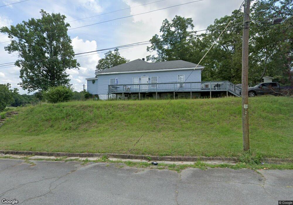
12 Spring St Manchester, GA 31816
Estimated Value: $99,652 - $124,000
3
Beds
1
Bath
1,536
Sq Ft
$73/Sq Ft
Est. Value
About This Home
This home is located at 12 Spring St, Manchester, GA 31816 and is currently estimated at $112,413, approximately $73 per square foot. 12 Spring St is a home located in Meriwether County with nearby schools including Mountain View Elementary School, Manchester Middle School, and Manchester High School.
Ownership History
Date
Name
Owned For
Owner Type
Purchase Details
Closed on
Jan 1, 2021
Sold by
Miller Melinda H
Bought by
Miller Jeremy H
Current Estimated Value
Purchase Details
Closed on
Apr 24, 2020
Sold by
Hanks Norman
Bought by
Miller Melinda
Purchase Details
Closed on
Jun 29, 2016
Sold by
Robertson William Gene
Bought by
Hanks Norman
Home Financials for this Owner
Home Financials are based on the most recent Mortgage that was taken out on this home.
Original Mortgage
$28,800
Interest Rate
3.66%
Mortgage Type
New Conventional
Purchase Details
Closed on
Feb 26, 1999
Sold by
Wriston Gloria Faye
Bought by
Robertson William Ge
Purchase Details
Closed on
Jan 1, 1992
Sold by
Wriston Allen C
Bought by
Wriston Gloria Faye
Purchase Details
Closed on
Jan 1, 1991
Bought by
Wriston Allen C
Create a Home Valuation Report for This Property
The Home Valuation Report is an in-depth analysis detailing your home's value as well as a comparison with similar homes in the area
Home Values in the Area
Average Home Value in this Area
Purchase History
We collect this data history from publicly available records. To have your information removed, we recommend requesting removal directly through your county’s website.
| Date | Buyer | Sale Price | Title Company |
|---|---|---|---|
| Miller Jeremy H | -- | -- | |
| Miller Melinda | $24,000 | -- | |
| Hanks Norman | $30,000 | -- | |
| Robertson William Ge | $44,700 | -- | |
| Wriston Gloria Faye | -- | -- | |
| Wriston Allen C | $9,600 | -- |
Source: Public Records
Mortgage History
We collect this data history from publicly available records. To have your information removed, we recommend requesting removal directly through your county’s website.
| Date | Status | Borrower | Loan Amount |
|---|---|---|---|
| Previous Owner | Hanks Norman | $28,800 |
Source: Public Records
Tax History
| Year | Tax Paid | Tax Assessment Tax Assessment Total Assessment is a certain percentage of the fair market value that is determined by local assessors to be the total taxable value of land and additions on the property. | Land | Improvement |
|---|---|---|---|---|
| 2025 | $1,416 | $30,440 | $2,280 | $28,160 |
| 2024 | $1,398 | $29,640 | $2,280 | $27,360 |
| 2023 | $930 | $19,200 | $2,280 | $16,920 |
| 2022 | $930 | $19,200 | $2,280 | $16,920 |
| 2021 | $612 | $19,200 | $2,280 | $16,920 |
| 2020 | $617 | $19,200 | $2,280 | $16,920 |
| 2019 | $619 | $19,200 | $2,280 | $16,920 |
| 2018 | $625 | $19,200 | $2,280 | $16,920 |
| 2017 | $396 | $19,200 | $2,280 | $16,920 |
| 2016 | $632 | $19,200 | $2,280 | $16,920 |
| 2015 | $633 | $19,200 | $2,280 | $16,920 |
| 2014 | $633 | $19,200 | $2,280 | $16,920 |
| 2013 | -- | $19,200 | $2,280 | $16,920 |
Source: Public Records
Map
Nearby Homes
- 4 Perkins St
- 2 Wilson St
- 1 Callaway St
- 109 E Main St
- 13 Perry St
- 4 Johnson Ave
- LOTS 6,7 & 8 E Main St
- 36 E 2nd St
- 5 Jay St
- 380 Elm St
- 322 Chalybeate St
- 312 2nd Ave
- 307 3rd Ave
- 3.26 ACRES Mountain Ridge Dr
- 311 W 3rd St
- 410 W 3rd St
- 0 Dorton Creek Dr Unit 231412
- 505 Chafin Dr
- 802 Jd Parham Dr
- 504 Webster Dr
Your Personal Tour Guide
Ask me questions while you tour the home.