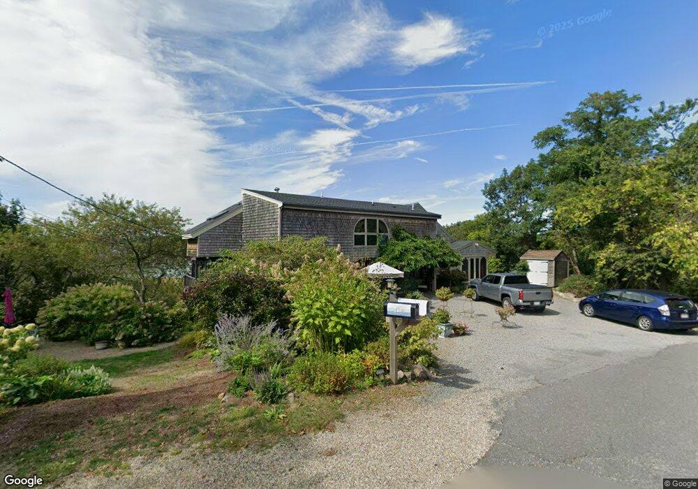
12 Squam Ln Unit 2 Gloucester, MA 01930
Riverview NeighborhoodEstimated Value: $588,000 - $738,000
2
Beds
1
Bath
1,177
Sq Ft
$564/Sq Ft
Est. Value
About This Home
This home is located at 12 Squam Ln Unit 2, Gloucester, MA 01930 and is currently estimated at $663,978, approximately $564 per square foot. 12 Squam Ln Unit 2 is a home located in Essex County with nearby schools including Plum Cove School, Ralph B O'maley Middle School, and Gloucester High School.
Ownership History
Date
Name
Owned For
Owner Type
Purchase Details
Closed on
Nov 10, 2015
Sold by
Kowaloff Edward M and Kowaloff Hollis B
Bought by
Hollis B Kowaloff Ret and Kowaloff Edward M
Current Estimated Value
Purchase Details
Closed on
Dec 18, 2007
Sold by
Cole Courtney A and Cole John W
Bought by
Kowaloff Edward M and Kowaloff Hollis B
Home Financials for this Owner
Home Financials are based on the most recent Mortgage that was taken out on this home.
Original Mortgage
$388,000
Interest Rate
6.3%
Mortgage Type
Purchase Money Mortgage
Purchase Details
Closed on
Jun 29, 2007
Sold by
Raftery Gay
Bought by
Cole Courtney A
Create a Home Valuation Report for This Property
The Home Valuation Report is an in-depth analysis detailing your home's value as well as a comparison with similar homes in the area
Home Values in the Area
Average Home Value in this Area
Purchase History
| Date | Buyer | Sale Price | Title Company |
|---|---|---|---|
| Hollis B Kowaloff Ret | -- | -- | |
| Kowaloff Edward M | $485,000 | -- | |
| Cole Courtney A | $100,000 | -- |
Source: Public Records
Mortgage History
| Date | Status | Borrower | Loan Amount |
|---|---|---|---|
| Previous Owner | Cole Courtney A | $232,500 | |
| Previous Owner | Cole Courtney A | $388,000 |
Source: Public Records
Tax History
| Year | Tax Paid | Tax Assessment Tax Assessment Total Assessment is a certain percentage of the fair market value that is determined by local assessors to be the total taxable value of land and additions on the property. | Land | Improvement |
|---|---|---|---|---|
| 2025 | $6,571 | $676,000 | $0 | $676,000 |
| 2024 | $6,232 | $640,500 | $0 | $640,500 |
| 2023 | $5,977 | $564,400 | $0 | $564,400 |
| 2022 | $5,996 | $511,200 | $0 | $511,200 |
| 2021 | $5,980 | $480,700 | $0 | $480,700 |
| 2020 | $5,927 | $480,700 | $0 | $480,700 |
| 2019 | $5,650 | $445,200 | $0 | $445,200 |
| 2018 | $5,575 | $431,200 | $0 | $431,200 |
| 2017 | $5,843 | $443,000 | $0 | $443,000 |
| 2016 | $5,547 | $407,600 | $0 | $407,600 |
| 2015 | $5,444 | $398,800 | $0 | $398,800 |
Source: Public Records
Map
Nearby Homes
- 6 Monroe Ct
- 5 Samoset Rd Unit B
- 2 Finch Ln
- 98 Maplewood Ave
- 15 Harvard St
- 84 Centennial Ave
- 16 Cleveland Place Unit 11
- 20 Beacon St Unit 2
- 20 Beacon St Unit 1
- 167 Atlantic St
- 40 Sargent St
- 33 Maplewood Ave Unit 16
- 5 Marshfield St
- 19 Trask St Unit 2
- 55 Mansfield St Unit A
- 55 Mansfield St Unit B
- 55 Mansfield St
- 33 Middle St
- 10 Oak St Unit 3
- 672 Washington St
- 12 Squam Ln Unit 1
- 12 Squam Lane: Winter Unit 1
- 10 Squam Ln
- 11 Squam Ln
- 8 Squam Ln
- 36 Riverview Rd Unit 36R
- 36 Riverview Rd
- 107 Riverview Rd Unit 2
- 107 Riverview Rd Unit 1
- 107a Riverview Rd Unit A
- 107 Riverview Rd Unit B
- 107 Riverview Rd Unit A
- 107 Riverview Rd
- 15 Perrywinkle Ln
- 6 Squam Ln
- 105 Riverview Rd Unit 2
- 105 Riverview Rd Unit 1
- 105 Riverview Rd
- 13 Perrywinkle Ln
- 103 Riverview Rd