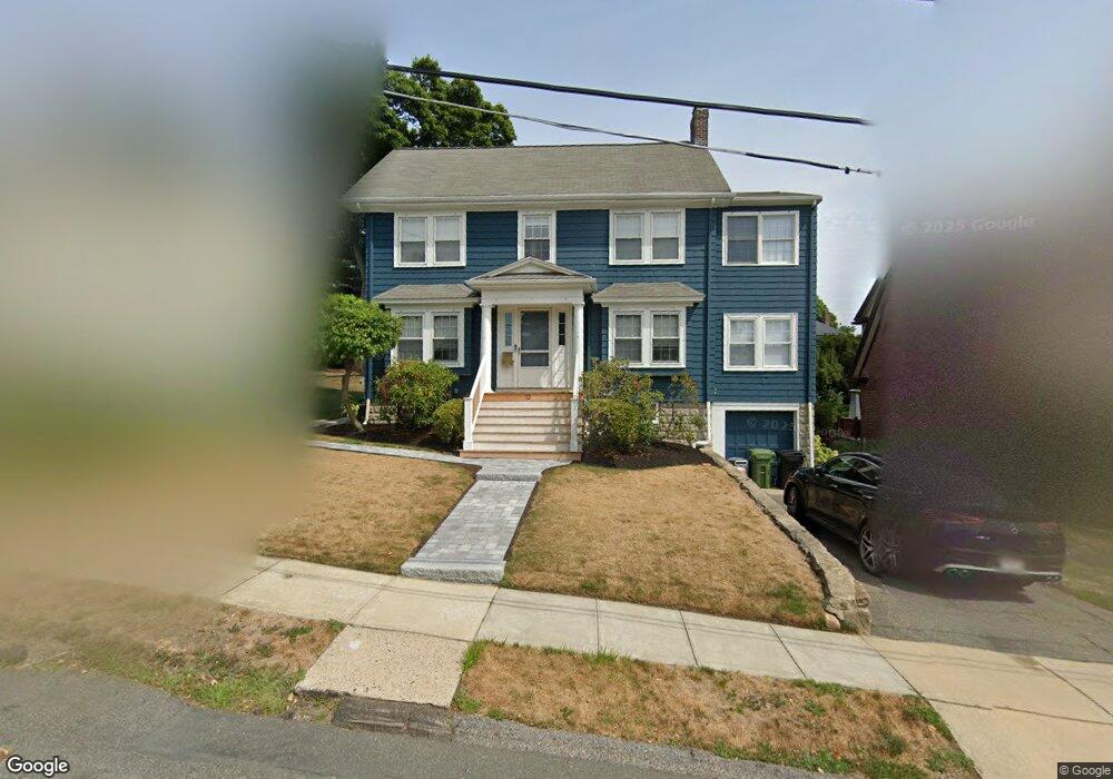
12 Standish Rd Watertown, MA 02472
West Watertown NeighborhoodEstimated Value: $1,211,000 - $1,416,000
4
Beds
2
Baths
2,293
Sq Ft
$573/Sq Ft
Est. Value
About This Home
This home is located at 12 Standish Rd, Watertown, MA 02472 and is currently estimated at $1,313,102, approximately $572 per square foot. 12 Standish Rd is a home located in Middlesex County with nearby schools including The Kendall School and Beacon High School.
Ownership History
Date
Name
Owned For
Owner Type
Purchase Details
Closed on
Aug 16, 2022
Sold by
Jarvis Karla L
Bought by
Rckj T T and Rckj Jarvis
Current Estimated Value
Purchase Details
Closed on
Sep 14, 2009
Sold by
Meller Jeffrey B L and Meller Christine A
Bought by
Jarvis Richard C and Jarvis Karla L
Home Financials for this Owner
Home Financials are based on the most recent Mortgage that was taken out on this home.
Original Mortgage
$480,000
Interest Rate
5.36%
Mortgage Type
Purchase Money Mortgage
Purchase Details
Closed on
Jul 17, 1998
Sold by
Hawley Brannan Rt
Bought by
Meller Jeffrey Bl and Meller Christine Al
Create a Home Valuation Report for This Property
The Home Valuation Report is an in-depth analysis detailing your home's value as well as a comparison with similar homes in the area
Home Values in the Area
Average Home Value in this Area
Purchase History
| Date | Buyer | Sale Price | Title Company |
|---|---|---|---|
| Rckj T T | -- | None Available | |
| Rckj T T | -- | None Available | |
| Jarvis Richard C | $600,000 | -- | |
| Jarvis Richard C | $600,000 | -- | |
| Jarvis Richard C | $600,000 | -- | |
| Meller Jeffrey Bl | $357,500 | -- | |
| Meller Jeffrey Bl | $357,500 | -- |
Source: Public Records
Mortgage History
| Date | Status | Borrower | Loan Amount |
|---|---|---|---|
| Previous Owner | Meller Jeffrey Bl | $483,100 | |
| Previous Owner | Jarvis Richard C | $480,000 | |
| Previous Owner | Meller Jeffrey Bl | $93,000 |
Source: Public Records
Tax History Compared to Growth
Tax History
| Year | Tax Paid | Tax Assessment Tax Assessment Total Assessment is a certain percentage of the fair market value that is determined by local assessors to be the total taxable value of land and additions on the property. | Land | Improvement |
|---|---|---|---|---|
| 2025 | $12,836 | $1,099,000 | $607,200 | $491,800 |
| 2024 | $12,064 | $1,031,100 | $582,000 | $449,100 |
| 2023 | $12,741 | $938,200 | $545,600 | $392,600 |
| 2022 | $11,648 | $879,100 | $502,000 | $377,100 |
| 2021 | $10,323 | $842,700 | $465,600 | $377,100 |
| 2020 | $10,230 | $842,700 | $465,600 | $377,100 |
| 2019 | $9,936 | $771,400 | $465,600 | $305,800 |
| 2018 | $9,849 | $731,200 | $465,600 | $265,600 |
| 2017 | $9,955 | $716,700 | $451,100 | $265,600 |
| 2016 | $8,871 | $648,500 | $407,400 | $241,100 |
| 2015 | $9,146 | $608,500 | $367,400 | $241,100 |
| 2014 | $8,885 | $593,900 | $352,800 | $241,100 |
Source: Public Records
Map
Nearby Homes
- 152 Bellevue Rd
- 68 Lovell Rd
- 5 Mason Rd
- 68 Barnard Ave
- 121 Channing Rd
- 60 Everett Ave
- 46 Hall Ave Unit 2
- 199 Palfrey St
- 25 Barnard Ave
- 30 Merrill Rd
- 214 Palfrey St
- 50 Carroll St Unit 50
- 118 Spring St Unit 118
- 11 Broadway Unit 11
- 91 Fayette St
- 18 Wilson Ave Unit 2
- 103 Harnden Ave Unit 103
- 456 Belmont St Unit 10
- 456 Belmont St Unit 21
- 71 Whites Ave Unit 71