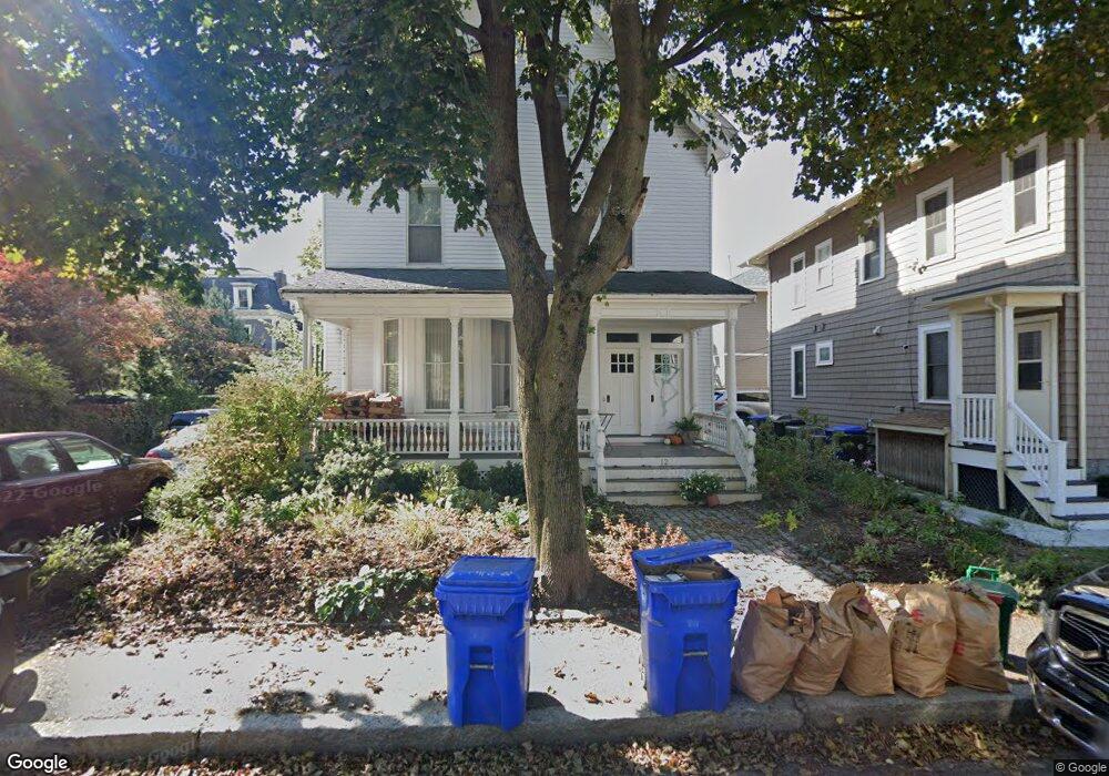
12 Stanton Rd Brookline, MA 02445
Brookline Village NeighborhoodEstimated Value: $2,005,000 - $2,773,851
6
Beds
3
Baths
3,106
Sq Ft
$764/Sq Ft
Est. Value
About This Home
This home is located at 12 Stanton Rd, Brookline, MA 02445 and is currently estimated at $2,372,213, approximately $763 per square foot. 12 Stanton Rd is a home located in Norfolk County with nearby schools including Pierce School, St. Mary of the Assumption Elementary School, and Maimonides School.
Ownership History
Date
Name
Owned For
Owner Type
Purchase Details
Closed on
Aug 28, 1997
Sold by
Houlihan Exr James F and Houlihan Richard G
Bought by
Vartanian Joanna and Vartanian Timothy K
Current Estimated Value
Home Financials for this Owner
Home Financials are based on the most recent Mortgage that was taken out on this home.
Original Mortgage
$379,000
Interest Rate
7.41%
Mortgage Type
Purchase Money Mortgage
Create a Home Valuation Report for This Property
The Home Valuation Report is an in-depth analysis detailing your home's value as well as a comparison with similar homes in the area
Home Values in the Area
Average Home Value in this Area
Purchase History
| Date | Buyer | Sale Price | Title Company |
|---|---|---|---|
| Vartanian Joanna | $452,025 | -- |
Source: Public Records
Mortgage History
| Date | Status | Borrower | Loan Amount |
|---|---|---|---|
| Open | Vartanian Joanna | $410,000 | |
| Closed | Vartanian Joanna | $377,000 | |
| Closed | Vartanian Joanna | $379,000 | |
| Closed | Vartanian Joanna | $379,000 |
Source: Public Records
Tax History Compared to Growth
Tax History
| Year | Tax Paid | Tax Assessment Tax Assessment Total Assessment is a certain percentage of the fair market value that is determined by local assessors to be the total taxable value of land and additions on the property. | Land | Improvement |
|---|---|---|---|---|
| 2025 | $22,714 | $2,301,300 | $1,232,600 | $1,068,700 |
| 2024 | $22,288 | $2,281,300 | $1,185,200 | $1,096,100 |
| 2023 | $20,619 | $2,068,100 | $949,400 | $1,118,700 |
| 2022 | $20,071 | $1,969,700 | $904,200 | $1,065,500 |
| 2021 | $18,560 | $1,893,900 | $869,400 | $1,024,500 |
| 2020 | $17,494 | $1,851,200 | $790,300 | $1,060,900 |
| 2019 | $16,520 | $1,763,100 | $752,700 | $1,010,400 |
| 2018 | $15,618 | $1,651,000 | $684,200 | $966,800 |
| 2017 | $15,104 | $1,528,700 | $645,500 | $883,200 |
| 2016 | $14,481 | $1,389,700 | $603,300 | $786,400 |
| 2015 | $13,493 | $1,263,400 | $563,800 | $699,600 |
| 2014 | $13,214 | $1,160,100 | $512,600 | $647,500 |
Source: Public Records
Map
Nearby Homes
- 72 Cypress St Unit 1
- 71 Greenough St Unit 71-1
- 9 Greenough St
- 37 Waverly St Unit 39
- 11 Goodwin Place Unit 11-2
- 87 Greenough St Unit 1
- 87 Greenough St Unit 2
- 12 Goodwin Place Unit 12-1
- 12 Goodwin Place Unit 12-2
- 21 Hancock Rd
- 57 Harvard Ave Unit 1
- 5 Auburn Ct Unit 1
- 24 Auburn St Unit 1
- 24 Auburn St Unit 2
- 24 Auburn St Unit 3
- 105 Sumner Rd
- 80 Park St Unit 23
- 18 Cushing Rd
- 14 Linden St Unit 8
- 120 Brook St Unit 1
- 39 Cypress St
- 39 Cypress St Unit 2
- 39 Cypress St Unit 3
- 39 Cypress St Unit ID1238138P
- 39 Cypress St Unit 1
- 41 Cypress St Unit 2
- 41 Cypress St Unit 1
- 11 Stanton Rd
- 4 Lincoln Rd
- 19 Stanton Rd
- 47 Cypress St Unit 3
- 47 Cypress St Unit 1
- 47 Cypress St Unit 3,47
- 8 Lincoln Rd Unit 2
- 8 Lincoln Rd Unit 1
- 8 Lincoln Rd
- 49 Cypress St Unit 2
- 35 Cypress St
- 12 Lincoln Rd Unit 1
- 12 Lincoln Rd