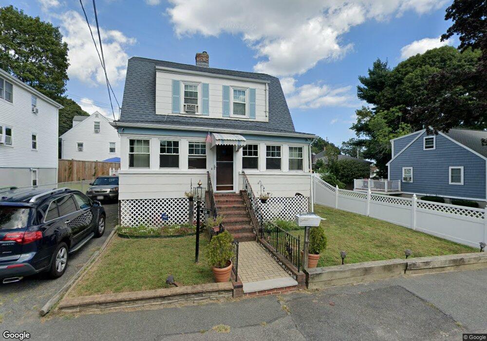
12 Stone St Revere, MA 02151
West Revere NeighborhoodEstimated Value: $577,031 - $618,000
2
Beds
1
Bath
1,152
Sq Ft
$516/Sq Ft
Est. Value
About This Home
This home is located at 12 Stone St, Revere, MA 02151 and is currently estimated at $594,258, approximately $515 per square foot. 12 Stone St is a home located in Suffolk County with nearby schools including Abraham Lincoln School, Staff Sargent James J. Hill Elementary School, and Susan B. Anthony Middle School.
Ownership History
Date
Name
Owned For
Owner Type
Purchase Details
Closed on
Feb 5, 1999
Sold by
Diplatzi Paul A and Diplatzi Charlene L
Bought by
Cross Gene A and Cross Hattie M
Current Estimated Value
Home Financials for this Owner
Home Financials are based on the most recent Mortgage that was taken out on this home.
Original Mortgage
$147,155
Interest Rate
6.74%
Mortgage Type
Purchase Money Mortgage
Purchase Details
Closed on
Jul 18, 1995
Sold by
Fhlmc
Bought by
Deplatzi Paul A
Purchase Details
Closed on
Dec 7, 1994
Sold by
Robinson Janine P
Bought by
Fhlmc
Purchase Details
Closed on
Sep 5, 1991
Sold by
Aloise Jeanette M
Bought by
Robinson Nathanial D and Robinson Janine P
Create a Home Valuation Report for This Property
The Home Valuation Report is an in-depth analysis detailing your home's value as well as a comparison with similar homes in the area
Home Values in the Area
Average Home Value in this Area
Purchase History
| Date | Buyer | Sale Price | Title Company |
|---|---|---|---|
| Cross Gene A | $154,900 | -- | |
| Cross Gene A | $154,900 | -- | |
| Deplatzi Paul A | $87,000 | -- | |
| Fhlmc | $76,500 | -- | |
| Fhlmc | $76,500 | -- | |
| Robinson Nathanial D | $135,000 | -- |
Source: Public Records
Mortgage History
| Date | Status | Borrower | Loan Amount |
|---|---|---|---|
| Open | Robinson Nathanial D | $118,000 | |
| Closed | Robinson Nathanial D | $147,155 |
Source: Public Records
Tax History Compared to Growth
Tax History
| Year | Tax Paid | Tax Assessment Tax Assessment Total Assessment is a certain percentage of the fair market value that is determined by local assessors to be the total taxable value of land and additions on the property. | Land | Improvement |
|---|---|---|---|---|
| 2025 | $4,681 | $516,100 | $285,200 | $230,900 |
| 2024 | $4,530 | $497,300 | $269,400 | $227,900 |
| 2023 | $4,253 | $447,200 | $225,000 | $222,200 |
| 2022 | $4,247 | $408,400 | $213,900 | $194,500 |
| 2021 | $4,093 | $370,100 | $198,100 | $172,000 |
| 2020 | $4,167 | $370,100 | $198,100 | $172,000 |
| 2019 | $4,051 | $334,500 | $180,600 | $153,900 |
| 2018 | $3,891 | $300,200 | $163,200 | $137,000 |
| 2017 | $3,754 | $268,300 | $142,600 | $125,700 |
| 2016 | $3,448 | $238,600 | $129,900 | $108,700 |
| 2015 | $3,531 | $238,600 | $129,900 | $108,700 |
Source: Public Records
Map
Nearby Homes
- 35 Liberty Ave
- 15 Stone St
- 133 Salem St Unit 418
- 133 Salem St Unit 412
- 133 Salem St Unit 213
- 133 Salem St Unit 416
- 133 Salem St Unit 307
- 133 Salem St Unit 417
- 133 Salem St Unit 414
- 133 Salem St Unit 315
- 133 Salem St Unit 102
- 133 Salem St Unit 317
- 109 Salem St Unit 405
- 292 Salem St Unit 101
- 2 Ashford St
- 184 Breedens Ln
- 32-34 Mount Vernon St
- 28 Eustis St
- 563 Lynn St
- 4 Anderson Way Unit 2