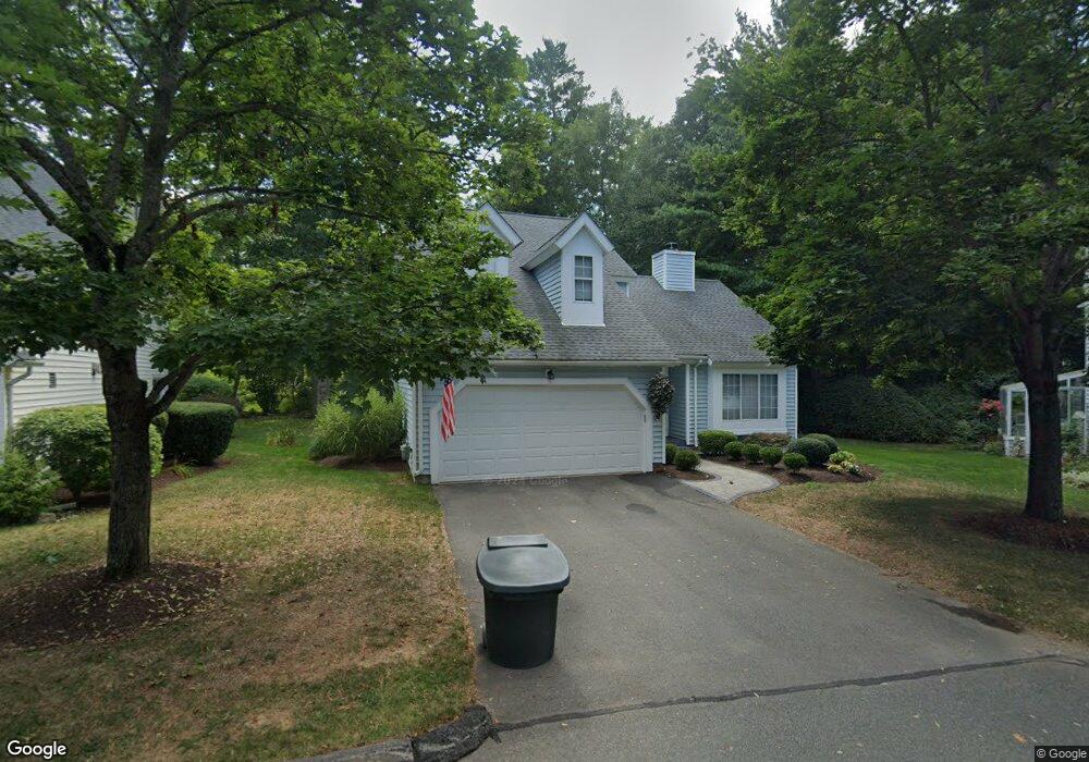
12 Stratton Forest Way Simsbury, CT 06070
Estimated Value: $394,735 - $435,000
2
Beds
3
Baths
1,592
Sq Ft
$261/Sq Ft
Est. Value
About This Home
This home is located at 12 Stratton Forest Way, Simsbury, CT 06070 and is currently estimated at $415,684, approximately $261 per square foot. 12 Stratton Forest Way is a home located in Hartford County with nearby schools including Central School, Henry James Memorial School, and Simsbury High School.
Ownership History
Date
Name
Owned For
Owner Type
Purchase Details
Closed on
Sep 23, 2015
Sold by
Mcgraw 2Nd Richard P
Bought by
Mcgraw 2Nd Richard P and Morganti Kerry C
Current Estimated Value
Purchase Details
Closed on
Apr 19, 2012
Sold by
Rlv Assoc Inc
Bought by
Vandervoorn Cornelius J
Purchase Details
Closed on
Dec 2, 1993
Sold by
Jennings Joyce
Bought by
Michael William
Home Financials for this Owner
Home Financials are based on the most recent Mortgage that was taken out on this home.
Original Mortgage
$128,800
Interest Rate
6.69%
Mortgage Type
Unknown
Create a Home Valuation Report for This Property
The Home Valuation Report is an in-depth analysis detailing your home's value as well as a comparison with similar homes in the area
Home Values in the Area
Average Home Value in this Area
Purchase History
| Date | Buyer | Sale Price | Title Company |
|---|---|---|---|
| Mcgraw 2Nd Richard P | -- | -- | |
| Vandervoorn Cornelius J | -- | -- | |
| Michael William | $161,000 | -- |
Source: Public Records
Mortgage History
| Date | Status | Borrower | Loan Amount |
|---|---|---|---|
| Previous Owner | Michael William | $128,800 |
Source: Public Records
Tax History Compared to Growth
Tax History
| Year | Tax Paid | Tax Assessment Tax Assessment Total Assessment is a certain percentage of the fair market value that is determined by local assessors to be the total taxable value of land and additions on the property. | Land | Improvement |
|---|---|---|---|---|
| 2025 | $7,929 | $232,120 | $0 | $232,120 |
| 2024 | $7,732 | $232,120 | $0 | $232,120 |
| 2023 | $7,386 | $232,120 | $0 | $232,120 |
| 2022 | $5,852 | $151,490 | $0 | $151,490 |
| 2021 | $5,852 | $151,490 | $0 | $151,490 |
| 2020 | $5,619 | $151,490 | $0 | $151,490 |
| 2019 | $5,654 | $151,490 | $0 | $151,490 |
| 2018 | $5,695 | $151,490 | $0 | $151,490 |
| 2017 | $5,684 | $146,650 | $0 | $146,650 |
| 2016 | $5,444 | $146,650 | $0 | $146,650 |
| 2015 | $5,444 | $146,650 | $0 | $146,650 |
| 2014 | $5,447 | $146,650 | $0 | $146,650 |
Source: Public Records
Map
Nearby Homes
- 16 Stratton Forest Way
- 1 Ashton Cir
- 6 Mill Pond Ln Unit B
- 3 Stebbins Brook Ln
- 4 Stebbins Brook Ln
- 40 Firetown Rd Unit 39
- 1 West St Unit 206
- 1 Mathers Crossing
- 5 Fox Den Rd
- 18 Meadowlark Rd
- 15 Sand Hill Rd
- 141 Firetown Rd
- 308 Hopmeadow St
- 12 Simsbury Manor Dr
- 1 Riverwalk Dr
- 302 Bushy Hill Rd
- 301 Bushy Hill Rd
- 15 Pinnacle Mountain Rd
- 113 Old Farms Rd
- 9 Cobtail Way
- 6 Stratton Forest Way
- 6 Stratton Forest Way Unit 6
- 6 Southbridge Ct
- 12 Southbridge Ct
- 16 Southbridge Ct
- 14 Southbridge Ct
- 32 Southbridge Ct
- 18 Southbridge Ct
- 10 Southbridge Ct
- 26 Southbridge Ct
- 8 Southbridge Ct
- 24 Southbridge Ct
- 34 Southbridge Ct
- 30 Southbridge Ct
- 28 Southbridge Ct
- 24 Southbridge Ct Unit 24
- 34 Southbridge Ct Unit 34
- 18 Southbridge Ct Unit 18
- 28 Southbridge Ct Unit 28
- 10 Southbridge Ct Unit 10