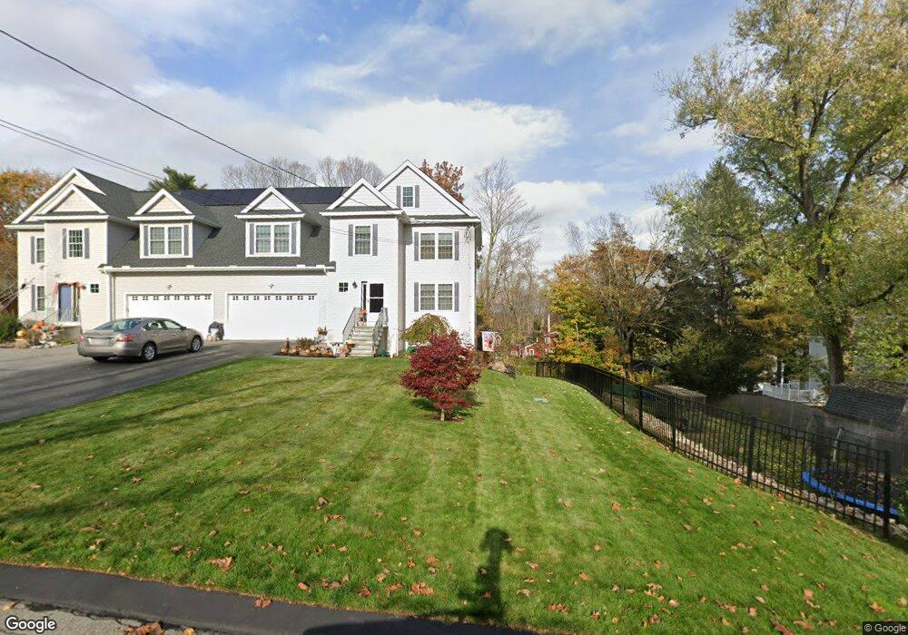
12 Swetts Hill Amesbury, MA 01913
Estimated Value: $1,060,000 - $1,170,000
5
Beds
3
Baths
2,745
Sq Ft
$409/Sq Ft
Est. Value
About This Home
This home is located at 12 Swetts Hill, Amesbury, MA 01913 and is currently estimated at $1,122,381, approximately $408 per square foot. 12 Swetts Hill is a home located in Essex County with nearby schools including Amesbury High School and Amesbury Seventh-Day Adventist School.
Ownership History
Date
Name
Owned For
Owner Type
Purchase Details
Closed on
Aug 2, 2022
Sold by
Licare Nicole A and Licare Robert C
Bought by
Licare Ft
Current Estimated Value
Purchase Details
Closed on
Jul 7, 2005
Sold by
Bandar Dan and Gordon Michael
Bought by
Licare Robert C
Home Financials for this Owner
Home Financials are based on the most recent Mortgage that was taken out on this home.
Original Mortgage
$510,000
Interest Rate
5.71%
Mortgage Type
Purchase Money Mortgage
Create a Home Valuation Report for This Property
The Home Valuation Report is an in-depth analysis detailing your home's value as well as a comparison with similar homes in the area
Home Values in the Area
Average Home Value in this Area
Purchase History
| Date | Buyer | Sale Price | Title Company |
|---|---|---|---|
| Licare Ft | -- | None Available | |
| Licare Robert C | $695,000 | -- |
Source: Public Records
Mortgage History
| Date | Status | Borrower | Loan Amount |
|---|---|---|---|
| Previous Owner | Licare Robert C | $417,000 | |
| Previous Owner | Licare Robert C | $125,000 | |
| Previous Owner | Licare Robert C | $510,000 |
Source: Public Records
Tax History Compared to Growth
Tax History
| Year | Tax Paid | Tax Assessment Tax Assessment Total Assessment is a certain percentage of the fair market value that is determined by local assessors to be the total taxable value of land and additions on the property. | Land | Improvement |
|---|---|---|---|---|
| 2025 | $14,448 | $944,300 | $295,100 | $649,200 |
| 2024 | $13,773 | $880,600 | $278,600 | $602,000 |
| 2023 | $12,610 | $771,700 | $242,200 | $529,500 |
| 2022 | $12,102 | $684,100 | $211,300 | $472,800 |
| 2021 | $11,556 | $633,200 | $164,300 | $468,900 |
| 2020 | $10,628 | $618,600 | $158,200 | $460,400 |
| 2019 | $10,732 | $584,200 | $158,200 | $426,000 |
| 2018 | $10,296 | $542,200 | $150,600 | $391,600 |
| 2017 | $10,542 | $528,400 | $150,600 | $377,800 |
| 2016 | $10,385 | $512,100 | $150,600 | $361,500 |
| 2015 | $10,157 | $494,500 | $150,600 | $343,900 |
| 2014 | $9,854 | $469,900 | $150,600 | $319,300 |
Source: Public Records
Map
Nearby Homes
- 60 Merrimac St Unit 604
- 35 Merrimac St
- 47 Cutter Ln Unit 47
- 19 Cutter Ln Unit 19
- 13 Bailey Pond Ln Unit 13
- 28 Beacon St
- 356 Main St
- 3 Laurel Place
- 382 Main St
- 394 Main St
- 45 Macy St Unit b101
- 45 Macy St Unit 301C
- 45 Macy St Unit 302C
- 47 Macy St
- 4 Greenwood St
- 49 W Greenwood St
- 486 Main St
- 8 Brown Ave
- 4 Larnard Ct
- 21 Clarks Rd Unit 203
- 11 Summit Ave
- 10 Swetts Hill
- 65 Merrimac St
- 17 Summit Ave
- 15 Summit Ave
- 63 Merrimac St
- 9 Swetts Hill
- 5 Swetts Hill
- 19 Summit Ave
- 8 Swetts Hill
- 14 Summit Ave
- 14 Summit Ave Unit 2
- 14 Summit Ave Unit 1
- 56 Merrimac St
- 6 Swetts Hill
- 54 Merrimac St
- 16 Summit Ave
- 3 Swetts Hill
- 21 Summit Ave
- 4 1/2 Swetts Hill