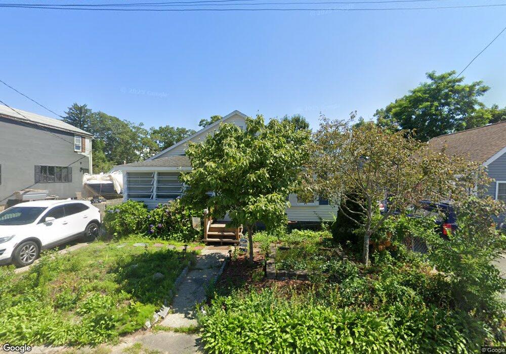
12 Swift Ave Wareham, MA 02571
Wareham Center NeighborhoodEstimated Value: $288,000 - $326,000
2
Beds
1
Bath
600
Sq Ft
$509/Sq Ft
Est. Value
About This Home
This home is located at 12 Swift Ave, Wareham, MA 02571 and is currently estimated at $305,483, approximately $509 per square foot. 12 Swift Ave is a home located in Plymouth County.
Ownership History
Date
Name
Owned For
Owner Type
Purchase Details
Closed on
Jun 12, 2019
Sold by
Harootunian Harold and Harootunian Holly
Bought by
Lawrence Tracy and Elifford Bruce E
Current Estimated Value
Purchase Details
Closed on
Jun 18, 1998
Sold by
Department Of Housing & Urban Dev
Bought by
Orourke Robert M
Purchase Details
Closed on
Jun 25, 1997
Sold by
Abel Jaems W
Bought by
Norwest Mtg Inc
Purchase Details
Closed on
Aug 3, 1990
Sold by
Beal Raymond E
Bought by
Abel James W
Create a Home Valuation Report for This Property
The Home Valuation Report is an in-depth analysis detailing your home's value as well as a comparison with similar homes in the area
Home Values in the Area
Average Home Value in this Area
Purchase History
| Date | Buyer | Sale Price | Title Company |
|---|---|---|---|
| Lawrence Tracy | $160,000 | -- | |
| Lawrence Tracy | $160,000 | -- | |
| Lawrence Tracy | $160,000 | -- | |
| Orourke Robert M | $33,513 | -- | |
| Orourke Robert M | $33,513 | -- | |
| Norwest Mtg Inc | $72,704 | -- | |
| Norwest Mtg Inc | $72,704 | -- | |
| Abel James W | $70,000 | -- |
Source: Public Records
Mortgage History
| Date | Status | Borrower | Loan Amount |
|---|---|---|---|
| Previous Owner | Abel James W | $18,000 | |
| Previous Owner | Abel James W | $80,000 |
Source: Public Records
Tax History
| Year | Tax Paid | Tax Assessment Tax Assessment Total Assessment is a certain percentage of the fair market value that is determined by local assessors to be the total taxable value of land and additions on the property. | Land | Improvement |
|---|---|---|---|---|
| 2025 | $2,793 | $254,400 | $91,200 | $163,200 |
| 2024 | $2,742 | $234,800 | $67,900 | $166,900 |
| 2023 | $2,367 | $208,600 | $61,700 | $146,900 |
| 2022 | $2,367 | $173,800 | $61,700 | $112,100 |
| 2021 | $2,213 | $158,100 | $61,700 | $96,400 |
| 2020 | $1,855 | $135,300 | $61,700 | $73,600 |
| 2019 | $1,572 | $115,900 | $46,400 | $69,500 |
| 2018 | $1,453 | $103,500 | $46,400 | $57,100 |
| 2017 | $1,472 | $105,300 | $46,400 | $58,900 |
| 2016 | $1,440 | $102,200 | $49,800 | $52,400 |
| 2015 | $1,382 | $100,900 | $49,800 | $51,100 |
| 2014 | $1,332 | $100,200 | $37,100 | $63,100 |
Source: Public Records
Map
Nearby Homes
- 21 Bayview St
- 43 Shore Ave
- 20 Grant St
- 10 Barnes St
- 6 Allen Ave
- 15 Broadmarsh Ave
- 58 Shady Ln
- 0 Cromesett Rd (Off) Unit 73385395
- 1 Nimrod Way
- 4 Roosevelt St
- 14 Briarwood Dr
- 233 Marion Rd
- 12 Taft St
- 9 Woodville Way
- 6 Bourne Terrace
- 10 Longmeadow Dr
- 10 Oak St
- 0 Cross Neck Rd Unit 73420524
- 0 Cross Neck Rd Unit 73466177
- 0 Cross Neck Rd Unit 73420525
Your Personal Tour Guide
Ask me questions while you tour the home.