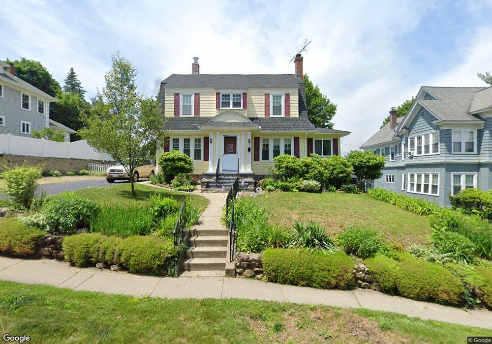
12 Tahanto Rd Worcester, MA 01602
Newton Square NeighborhoodEstimated Value: $483,000 - $509,000
4
Beds
2
Baths
1,819
Sq Ft
$274/Sq Ft
Est. Value
About This Home
This home is located at 12 Tahanto Rd, Worcester, MA 01602 and is currently estimated at $498,877, approximately $274 per square foot. 12 Tahanto Rd is a home located in Worcester County with nearby schools including Chandler Magnet, Jacob Hiatt Magnet School, and May Street Elementary School.
Ownership History
Date
Name
Owned For
Owner Type
Purchase Details
Closed on
Nov 21, 1996
Sold by
Est Lonstein Lorraine and Lonstein William A
Bought by
Elliott David T and Elliott Ann Marie
Current Estimated Value
Create a Home Valuation Report for This Property
The Home Valuation Report is an in-depth analysis detailing your home's value as well as a comparison with similar homes in the area
Home Values in the Area
Average Home Value in this Area
Purchase History
| Date | Buyer | Sale Price | Title Company |
|---|---|---|---|
| Elliott David T | $105,000 | -- |
Source: Public Records
Mortgage History
| Date | Status | Borrower | Loan Amount |
|---|---|---|---|
| Open | Elliott David T | $71,000 | |
| Closed | Elliott David T | $88,500 | |
| Closed | Elliott David T | $3,500 |
Source: Public Records
Tax History Compared to Growth
Tax History
| Year | Tax Paid | Tax Assessment Tax Assessment Total Assessment is a certain percentage of the fair market value that is determined by local assessors to be the total taxable value of land and additions on the property. | Land | Improvement |
|---|---|---|---|---|
| 2025 | $5,556 | $421,200 | $118,700 | $302,500 |
| 2024 | $5,446 | $396,100 | $118,700 | $277,400 |
| 2023 | $5,233 | $364,900 | $103,200 | $261,700 |
| 2022 | $4,831 | $317,600 | $82,600 | $235,000 |
| 2021 | $4,650 | $285,600 | $66,100 | $219,500 |
| 2020 | $4,512 | $265,400 | $66,100 | $199,300 |
| 2019 | $4,507 | $250,400 | $59,500 | $190,900 |
| 2018 | $4,485 | $237,200 | $59,500 | $177,700 |
| 2017 | $4,315 | $224,500 | $59,500 | $165,000 |
| 2016 | $4,293 | $208,300 | $43,700 | $164,600 |
| 2015 | $4,181 | $208,300 | $43,700 | $164,600 |
| 2014 | $4,123 | $211,000 | $43,700 | $167,300 |
Source: Public Records
Map
Nearby Homes
- 10 Tahanto Rd Unit 3
- 10 Tahanto Rd Unit 2
- 10 Tahanto Rd Unit 1
- 14 Tahanto Rd
- 8 Tahanto Rd Unit 3
- 8 Tahanto Rd Unit 1
- 8 Tahanto Rd
- 8 Tahanto Rd
- 15 Maplewood Rd
- 13 Maplewood Rd
- 16 Tahanto Rd
- 9 Maplewood Rd
- 15 Tahanto Rd
- 11 Tahanto Rd
- 17 Tahanto Rd
- 000 Maplewood Rd Unit 3
- 000 Maplewood Rd Unit 2
- 18 Tahanto Rd
- 19 Tahanto Rd
- 6 Tahanto Rd