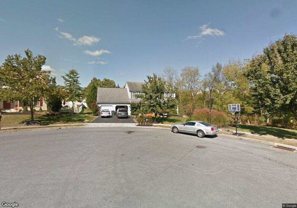
12 Taylor Dr Reading, PA 19606
Estimated Value: $460,738 - $527,000
4
Beds
3
Baths
2,942
Sq Ft
$165/Sq Ft
Est. Value
About This Home
This home is located at 12 Taylor Dr, Reading, PA 19606 and is currently estimated at $484,935, approximately $164 per square foot. 12 Taylor Dr is a home located in Berks County with nearby schools including Owatin Creek Elementary School, Exeter Township Junior High School, and Exeter Township Senior High School.
Ownership History
Date
Name
Owned For
Owner Type
Purchase Details
Closed on
Mar 11, 2004
Sold by
Boarder Matthew D and Boarder Cheryl
Bought by
Boarder Matthew D
Current Estimated Value
Purchase Details
Closed on
Jun 20, 2001
Sold by
Forino Co Lp and Smith John G
Bought by
Boarder Matthew D and Boarder Cheryl
Home Financials for this Owner
Home Financials are based on the most recent Mortgage that was taken out on this home.
Original Mortgage
$90,000
Outstanding Balance
$34,458
Interest Rate
7.21%
Estimated Equity
$450,477
Create a Home Valuation Report for This Property
The Home Valuation Report is an in-depth analysis detailing your home's value as well as a comparison with similar homes in the area
Home Values in the Area
Average Home Value in this Area
Purchase History
| Date | Buyer | Sale Price | Title Company |
|---|---|---|---|
| Boarder Matthew D | -- | -- | |
| Boarder Matthew D | $180,547 | -- |
Source: Public Records
Mortgage History
| Date | Status | Borrower | Loan Amount |
|---|---|---|---|
| Open | Boarder Matthew D | $90,000 |
Source: Public Records
Tax History Compared to Growth
Tax History
| Year | Tax Paid | Tax Assessment Tax Assessment Total Assessment is a certain percentage of the fair market value that is determined by local assessors to be the total taxable value of land and additions on the property. | Land | Improvement |
|---|---|---|---|---|
| 2025 | $2,660 | $179,700 | $47,300 | $132,400 |
| 2024 | $8,534 | $179,700 | $47,300 | $132,400 |
| 2023 | $8,255 | $179,700 | $47,300 | $132,400 |
| 2022 | $8,163 | $179,700 | $47,300 | $132,400 |
| 2021 | $8,039 | $179,700 | $47,300 | $132,400 |
| 2020 | $7,950 | $179,700 | $47,300 | $132,400 |
| 2019 | $7,862 | $179,700 | $47,300 | $132,400 |
| 2018 | $7,838 | $179,700 | $47,300 | $132,400 |
| 2017 | $7,725 | $179,700 | $47,300 | $132,400 |
| 2016 | $1,912 | $179,700 | $47,300 | $132,400 |
| 2015 | $1,912 | $179,700 | $47,300 | $132,400 |
| 2014 | $1,845 | $179,700 | $47,300 | $132,400 |
Source: Public Records
Map
Nearby Homes
- 6 Taylor Dr
- 4861 Dunham Dr
- 30 Estates Dr
- 21 Sawgrass Dr
- 4851 Perkiomen Ave
- 40 Gunpowder Ln
- 16 Mulligan Dr
- 222 Poplar Dr
- 0 Perkiomen Ave Unit PABK2061892
- 4536 Del Mar Dr
- 205 Blackwood Dr
- 11 Valley Dr
- 202 W 39th St
- 240 Rugby Rd
- 55 1 Holly Dr
- 404 Lorane Rd
- 4690 Pheasant Run
- 5 Craig Dr
- 60-6 Mint Tier Unit 6
- 207 Lincoln Dr