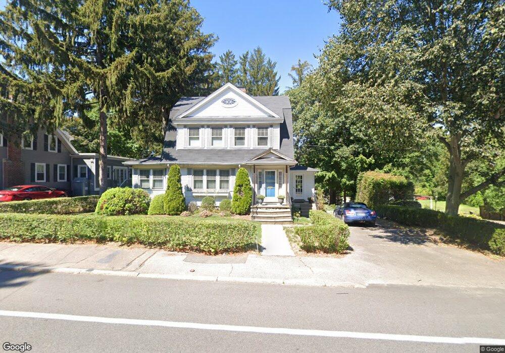
12 Tick Tock Ln East Weymouth, MA 02189
Estimated Value: $847,273 - $1,037,000
--
Bed
2
Baths
2,521
Sq Ft
$365/Sq Ft
Est. Value
About This Home
This home is located at 12 Tick Tock Ln, East Weymouth, MA 02189 and is currently estimated at $921,068, approximately $365 per square foot. 12 Tick Tock Ln is a home located in Norfolk County with nearby schools including Abigail Adams Middle School, Academy Avenue Elementary School, and Weymouth Middle School Chapman.
Ownership History
Date
Name
Owned For
Owner Type
Purchase Details
Closed on
Aug 29, 1997
Sold by
Means Frederick and Means Joyce
Bought by
Mcculloch Scott W and Mcculloch Bonita L
Current Estimated Value
Home Financials for this Owner
Home Financials are based on the most recent Mortgage that was taken out on this home.
Original Mortgage
$150,000
Outstanding Balance
$23,123
Interest Rate
7.41%
Mortgage Type
Purchase Money Mortgage
Estimated Equity
$897,945
Create a Home Valuation Report for This Property
The Home Valuation Report is an in-depth analysis detailing your home's value as well as a comparison with similar homes in the area
Home Values in the Area
Average Home Value in this Area
Purchase History
| Date | Buyer | Sale Price | Title Company |
|---|---|---|---|
| Mcculloch Scott W | $200,000 | -- |
Source: Public Records
Mortgage History
| Date | Status | Borrower | Loan Amount |
|---|---|---|---|
| Open | Mcculloch Scott W | $150,000 |
Source: Public Records
Tax History Compared to Growth
Tax History
| Year | Tax Paid | Tax Assessment Tax Assessment Total Assessment is a certain percentage of the fair market value that is determined by local assessors to be the total taxable value of land and additions on the property. | Land | Improvement |
|---|---|---|---|---|
| 2025 | $8,439 | $835,500 | $236,200 | $599,300 |
| 2024 | $8,255 | $803,800 | $225,000 | $578,800 |
| 2023 | $7,819 | $748,200 | $208,400 | $539,800 |
| 2022 | $7,550 | $658,800 | $192,900 | $465,900 |
| 2021 | $7,060 | $601,400 | $192,900 | $408,500 |
| 2020 | $6,837 | $573,600 | $192,900 | $380,700 |
| 2019 | $6,666 | $550,000 | $185,500 | $364,500 |
| 2018 | $6,633 | $530,600 | $192,700 | $337,900 |
| 2017 | $6,531 | $509,800 | $183,600 | $326,200 |
| 2016 | $6,376 | $498,100 | $176,500 | $321,600 |
| 2015 | $6,054 | $469,300 | $176,500 | $292,800 |
| 2014 | $5,844 | $439,400 | $164,300 | $275,100 |
Source: Public Records
Map
Nearby Homes
- 669 Commercial St
- 693 Commercial St
- 727 Commercial St
- 4 Sutton St
- 35 Seminole Ave
- 38 Idlewell St
- 70 Biscayne Ave
- 51 Beals St Unit 53
- 93 Wilson Ave
- 114 Gilbert Rd
- 54 Katherine St
- 59 Katherine St
- 29-31 Broad Street Place
- 50 Center St
- 294 Commercial St
- 2 Winstead Rd
- 286 Broad St
- 16 Howard St
- 155 Audubon Ave
- 11 Shaw St