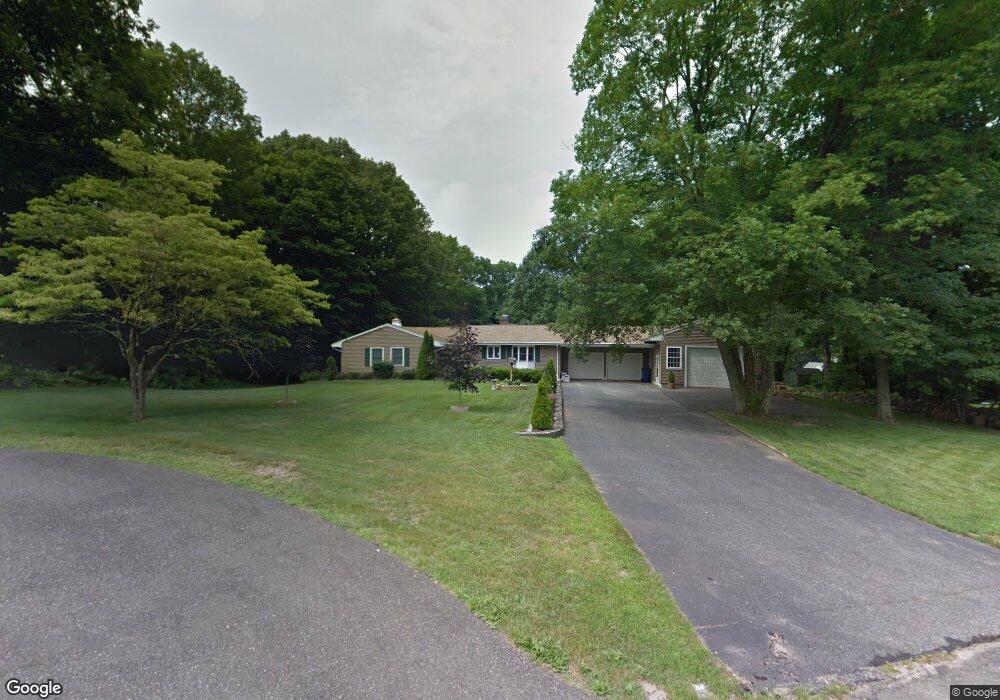
12 Unity Dr Trumbull, CT 06611
Trumbull Center NeighborhoodEstimated Value: $576,603 - $638,000
3
Beds
2
Baths
1,550
Sq Ft
$394/Sq Ft
Est. Value
About This Home
This home is located at 12 Unity Dr, Trumbull, CT 06611 and is currently estimated at $610,901, approximately $394 per square foot. 12 Unity Dr is a home located in Fairfield County with nearby schools including Booth Hill School, Hillcrest Middle School, and Trumbull High School.
Ownership History
Date
Name
Owned For
Owner Type
Purchase Details
Closed on
Jul 1, 2002
Sold by
Khan Shahzoor and Khan Bozena
Bought by
Kusinski Edward and Kusinski Barbara
Current Estimated Value
Purchase Details
Closed on
Sep 30, 1994
Sold by
Arsenault Russell and Arsenault Laurette
Bought by
Khan Shahzoor and Khan Bozena
Home Financials for this Owner
Home Financials are based on the most recent Mortgage that was taken out on this home.
Original Mortgage
$100,000
Interest Rate
8.5%
Mortgage Type
Unknown
Create a Home Valuation Report for This Property
The Home Valuation Report is an in-depth analysis detailing your home's value as well as a comparison with similar homes in the area
Home Values in the Area
Average Home Value in this Area
Purchase History
| Date | Buyer | Sale Price | Title Company |
|---|---|---|---|
| Kusinski Edward | $348,000 | -- | |
| Khan Shahzoor | $200,000 | -- |
Source: Public Records
Mortgage History
| Date | Status | Borrower | Loan Amount |
|---|---|---|---|
| Previous Owner | Khan Shahzoor | $100,000 | |
| Previous Owner | Khan Shahzoor | $100,000 |
Source: Public Records
Tax History
| Year | Tax Paid | Tax Assessment Tax Assessment Total Assessment is a certain percentage of the fair market value that is determined by local assessors to be the total taxable value of land and additions on the property. | Land | Improvement |
|---|---|---|---|---|
| 2025 | $9,593 | $259,560 | $145,880 | $113,680 |
| 2024 | $9,318 | $259,560 | $145,880 | $113,680 |
| 2023 | $9,176 | $259,560 | $145,880 | $113,680 |
| 2022 | $9,034 | $259,560 | $145,880 | $113,680 |
| 2021 | $8,258 | $229,670 | $138,390 | $91,280 |
| 2020 | $8,258 | $229,670 | $138,390 | $91,280 |
| 2018 | $8,077 | $229,670 | $138,390 | $91,280 |
| 2017 | $7,924 | $229,670 | $138,390 | $91,280 |
| 2016 | $7,775 | $229,670 | $138,390 | $91,280 |
| 2015 | $7,694 | $228,300 | $138,400 | $89,900 |
| 2014 | $7,529 | $228,300 | $138,400 | $89,900 |
Source: Public Records
Map
Nearby Homes
- 9 Sunnyridge Pkwy
- 40 Puritan Rd
- 11 Knollcrest Dr
- 22 Beverly Rd
- 7 E Lake Rd
- 220 Hilltop Cir
- 0 Lot #4 & Lot #5 W Mischa Rd Unit 24138429
- 68 Old Dike Rd
- 3 Wheeler Dr
- 877 White Plains Rd
- 2322 Nichols Ave
- 123 Beverly Dr
- 3699 Broadbridge Ave Unit 101
- 85 Teeter Rock Rd
- 58 Daniels Farm Rd
- 46 Oakleaf St
- 285 Hillcrest Rd
- 250 Dayton Rd
- 280 Goldbach Dr
- 0 Pinewood Trail
Your Personal Tour Guide
Ask me questions while you tour the home.