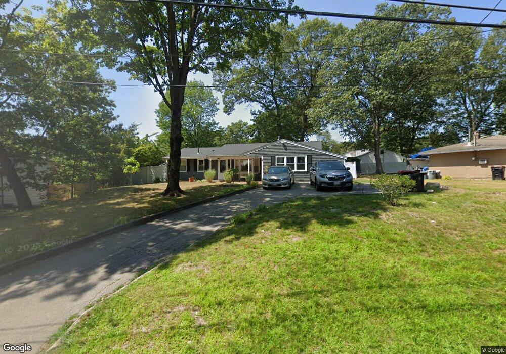
12 Upton St Brockton, MA 02302
Montello NeighborhoodEstimated Value: $497,032 - $548,000
3
Beds
1
Bath
1,368
Sq Ft
$378/Sq Ft
Est. Value
About This Home
This home is located at 12 Upton St, Brockton, MA 02302 and is currently estimated at $517,258, approximately $378 per square foot. 12 Upton St is a home located in Plymouth County with nearby schools including Brookfield Elementary School, Mary E. Baker Elementary School, and Downey Elementary School.
Ownership History
Date
Name
Owned For
Owner Type
Purchase Details
Closed on
Aug 29, 2008
Sold by
Craveiro Lora and Craveiro Brooke A
Bought by
Austin Sheila
Current Estimated Value
Purchase Details
Closed on
Apr 27, 2000
Sold by
Pires Francisco S
Bought by
Craveiro Brooke A and Craveiro Lora L
Purchase Details
Closed on
Sep 26, 1997
Sold by
Department Of Housing & Urban Dev
Bought by
Francisco Pires
Purchase Details
Closed on
Feb 25, 1997
Sold by
Estabrooks Thomas E
Bought by
Fleet Mtg Corp
Purchase Details
Closed on
Jul 1, 1991
Sold by
Wixon Jeffrey and Wixon William N
Bought by
Estabrooks Thomas E and Estabrooks Julie
Purchase Details
Closed on
Oct 14, 1988
Sold by
Phillips Kenneth F
Bought by
Wixon Jeffrey
Create a Home Valuation Report for This Property
The Home Valuation Report is an in-depth analysis detailing your home's value as well as a comparison with similar homes in the area
Home Values in the Area
Average Home Value in this Area
Purchase History
| Date | Buyer | Sale Price | Title Company |
|---|---|---|---|
| Austin Sheila | $211,000 | -- | |
| Craveiro Brooke A | $121,800 | -- | |
| Francisco Pires | $62,000 | -- | |
| Fleet Mtg Corp | $131,925 | -- | |
| Estabrooks Thomas E | $106,000 | -- | |
| Wixon Jeffrey | $119,500 | -- |
Source: Public Records
Mortgage History
| Date | Status | Borrower | Loan Amount |
|---|---|---|---|
| Open | Wixon Jeffrey | $209,477 | |
| Closed | Wixon Jeffrey | $212,907 |
Source: Public Records
Tax History
| Year | Tax Paid | Tax Assessment Tax Assessment Total Assessment is a certain percentage of the fair market value that is determined by local assessors to be the total taxable value of land and additions on the property. | Land | Improvement |
|---|---|---|---|---|
| 2025 | $5,176 | $427,400 | $146,200 | $281,200 |
| 2024 | $5,154 | $428,800 | $146,200 | $282,600 |
| 2023 | $4,965 | $382,500 | $111,300 | $271,200 |
| 2022 | $4,715 | $337,500 | $101,200 | $236,300 |
| 2021 | $4,320 | $297,900 | $95,800 | $202,100 |
| 2020 | $4,360 | $287,800 | $91,700 | $196,100 |
| 2019 | $3,855 | $248,100 | $86,100 | $162,000 |
| 2018 | $3,798 | $246,400 | $86,100 | $160,300 |
| 2017 | $3,798 | $235,900 | $86,100 | $149,800 |
| 2016 | $3,335 | $192,100 | $82,200 | $109,900 |
| 2015 | $3,452 | $190,200 | $82,200 | $108,000 |
| 2014 | $3,352 | $184,900 | $82,200 | $102,700 |
Source: Public Records
Map
Nearby Homes
- 20 Upton St
- 416 E Ashland St
- 15 Eastfield Dr
- 412 E Ashland St
- 29 Dickinson Rd
- 406 E Ashland St
- 426 E Ashland St
- 19 Upton St
- 413 E Ashland St
- 30 Upton St
- 407 E Ashland St
- 421 E Ashland St
- 27 Upton St
- 35 Eastfield Dr
- 20 Eastfield Dr
- 14 Eastfield Dr
- 431 E Ashland St
- 386 E Ashland St
- 397 E Ashland St
- 33 Upton St
Your Personal Tour Guide
Ask me questions while you tour the home.