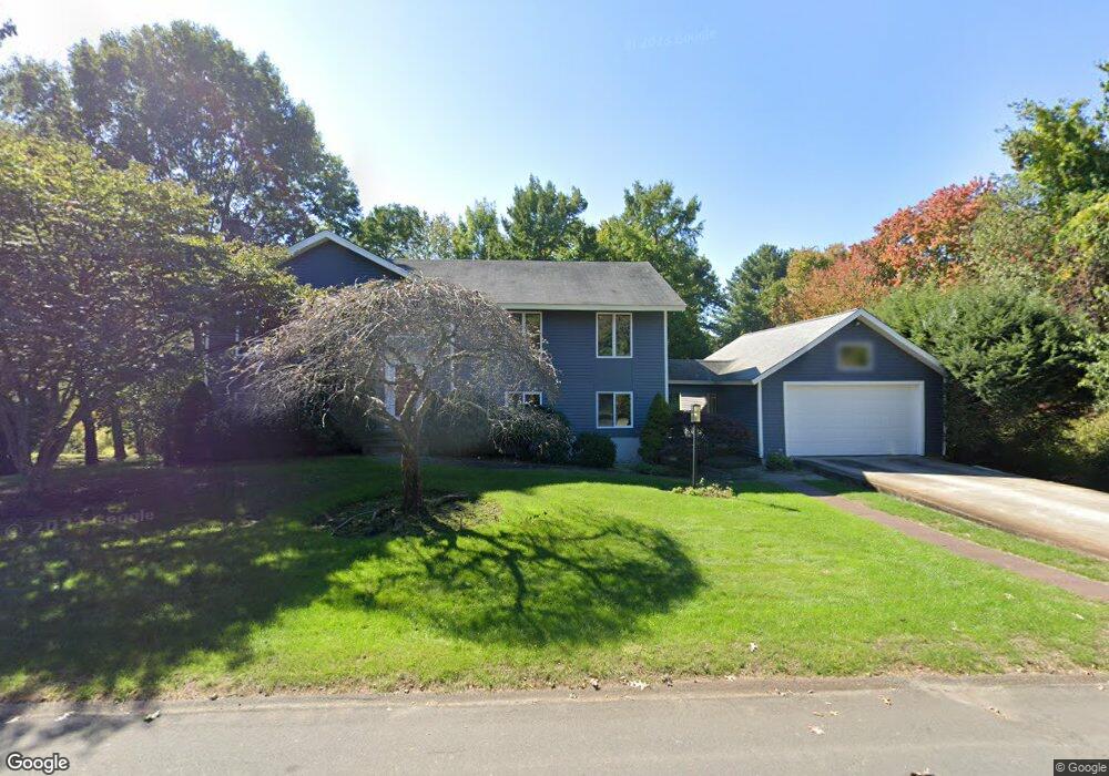
12 Village Cir Lexington, MA 02420
Countryside NeighborhoodEstimated Value: $1,452,000 - $1,739,000
5
Beds
2
Baths
2,700
Sq Ft
$585/Sq Ft
Est. Value
About This Home
This home is located at 12 Village Cir, Lexington, MA 02420 and is currently estimated at $1,578,606, approximately $584 per square foot. 12 Village Cir is a home located in Middlesex County with nearby schools including Harrington Elementary School, Jonas Clarke Middle School, and Lexington High School.
Ownership History
Date
Name
Owned For
Owner Type
Purchase Details
Closed on
Sep 9, 2005
Sold by
Weinstein Lee and Weinstein Rachel
Bought by
Gornstein Eric and Gornstein Natalie
Current Estimated Value
Home Financials for this Owner
Home Financials are based on the most recent Mortgage that was taken out on this home.
Original Mortgage
$620,000
Outstanding Balance
$330,450
Interest Rate
5.79%
Mortgage Type
Purchase Money Mortgage
Estimated Equity
$1,248,156
Purchase Details
Closed on
Dec 15, 2004
Sold by
Kleinschmidt Jean
Bought by
Weinstein Lee and Weinstein Rachel
Home Financials for this Owner
Home Financials are based on the most recent Mortgage that was taken out on this home.
Original Mortgage
$600,000
Interest Rate
5.68%
Mortgage Type
Purchase Money Mortgage
Create a Home Valuation Report for This Property
The Home Valuation Report is an in-depth analysis detailing your home's value as well as a comparison with similar homes in the area
Home Values in the Area
Average Home Value in this Area
Purchase History
| Date | Buyer | Sale Price | Title Company |
|---|---|---|---|
| Gornstein Eric | $775,000 | -- | |
| Weinstein Lee | $750,000 | -- |
Source: Public Records
Mortgage History
| Date | Status | Borrower | Loan Amount |
|---|---|---|---|
| Open | Gornstein Eric | $620,000 | |
| Previous Owner | Weinstein Lee | $600,000 |
Source: Public Records
Tax History Compared to Growth
Tax History
| Year | Tax Paid | Tax Assessment Tax Assessment Total Assessment is a certain percentage of the fair market value that is determined by local assessors to be the total taxable value of land and additions on the property. | Land | Improvement |
|---|---|---|---|---|
| 2025 | $16,718 | $1,367,000 | $744,000 | $623,000 |
| 2024 | $16,244 | $1,326,000 | $708,000 | $618,000 |
| 2023 | $15,366 | $1,182,000 | $644,000 | $538,000 |
| 2022 | $14,393 | $1,043,000 | $585,000 | $458,000 |
| 2021 | $4,831 | $1,027,000 | $557,000 | $470,000 |
| 2020 | $14,064 | $1,001,000 | $557,000 | $444,000 |
| 2019 | $13,470 | $954,000 | $531,000 | $423,000 |
| 2018 | $12,970 | $907,000 | $506,000 | $401,000 |
| 2017 | $12,737 | $879,000 | $482,000 | $397,000 |
| 2016 | $12,279 | $841,000 | $459,000 | $382,000 |
| 2015 | $11,219 | $755,000 | $417,000 | $338,000 |
| 2014 | $10,469 | $675,000 | $379,000 | $296,000 |
Source: Public Records
Map
Nearby Homes
- 22 Bryant Rd
- 5 Carnegie Place
- 218 Lowell St
- 25 Maple St
- 7 Whipple Rd
- 197 Woburn St
- 20 Marrett Rd
- 35 Tower Rd
- 8 Blueberry Ln
- 22 Tyler Rd
- 36 Independence Ave
- 15 Peachtree Rd
- 475 Massachusetts Ave Unit B
- 30 Whipple Rd
- 10 Eliot Rd
- 71 Webb St
- 1 Tricorne Rd
- 0 Reed St
- 500 Lexington St Unit 6
- 1437 Massachusetts Ave
- 853 Emerson Gardens Rd
- 851 Emerson Gardens Rd
- 855 Emerson Gardens Rd
- 849 Emerson Gardens Rd
- 9 Village Cir
- 857 Emerson Gardens Rd
- 73 Emerson Gardens
- 75 Emerson Gardens
- 70 Emerson Gardens
- 68 Emerson Gardens
- 42 Emerson Gardens
- 36 Emerson Gardens
- 70 Emerson Gardens Unit RD
- 70 Emerson Gardens Unit 70
- 42 Emerson Gardens Unit 42
- 70 Emerson Gardens
- 68 Emerson Gardens Unit 68
- 42 Emerson Gardens
- 70 Emerson Gardens Rd Unit 70
- 69 Emerson Gardens Rd Unit 69