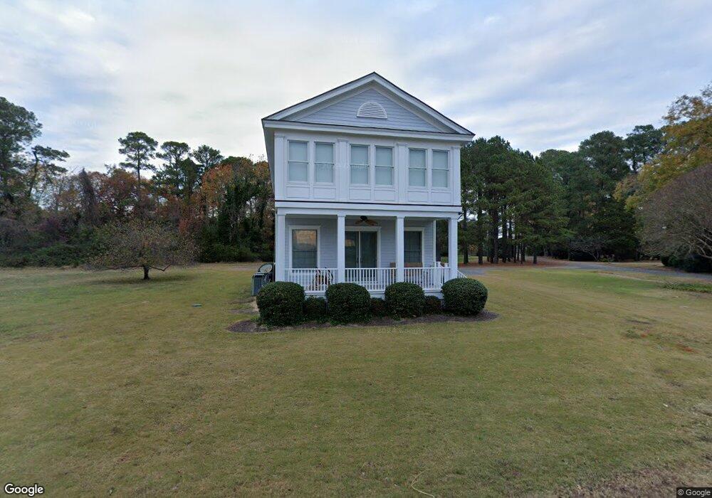
12 W Highbank Rd White Stone, VA 22578
Estimated Value: $649,142 - $852,000
2
Beds
3
Baths
2,000
Sq Ft
$382/Sq Ft
Est. Value
About This Home
This home is located at 12 W Highbank Rd, White Stone, VA 22578 and is currently estimated at $764,714, approximately $382 per square foot. 12 W Highbank Rd is a home located in Lancaster County with nearby schools including Lancaster Primary School, Lancaster Middle School, and Lancaster High School.
Ownership History
Date
Name
Owned For
Owner Type
Purchase Details
Closed on
Jun 25, 2008
Sold by
Skowron Robert W and Lunsford Carl R
Bought by
Williams Gale Legrand
Current Estimated Value
Home Financials for this Owner
Home Financials are based on the most recent Mortgage that was taken out on this home.
Original Mortgage
$352,000
Outstanding Balance
$227,086
Interest Rate
6.07%
Mortgage Type
New Conventional
Estimated Equity
$537,628
Create a Home Valuation Report for This Property
The Home Valuation Report is an in-depth analysis detailing your home's value as well as a comparison with similar homes in the area
Home Values in the Area
Average Home Value in this Area
Purchase History
| Date | Buyer | Sale Price | Title Company |
|---|---|---|---|
| Williams Gale Legrand | $440,000 | -- |
Source: Public Records
Mortgage History
| Date | Status | Borrower | Loan Amount |
|---|---|---|---|
| Open | Williams Gale Legrand | $352,000 |
Source: Public Records
Tax History Compared to Growth
Tax History
| Year | Tax Paid | Tax Assessment Tax Assessment Total Assessment is a certain percentage of the fair market value that is determined by local assessors to be the total taxable value of land and additions on the property. | Land | Improvement |
|---|---|---|---|---|
| 2024 | $3,259 | $592,600 | $80,000 | $512,600 |
| 2023 | $2,179 | $345,800 | $75,000 | $270,800 |
| 2022 | $2,179 | $345,800 | $75,000 | $270,800 |
| 2021 | $2,131 | $338,200 | $75,000 | $263,200 |
| 2020 | $2,131 | $338,200 | $75,000 | $263,200 |
| 2019 | $2,131 | $338,200 | $75,000 | $263,200 |
| 2018 | $1,912 | $324,100 | $76,500 | $247,600 |
| 2017 | $1,912 | $324,100 | $76,500 | $247,600 |
| 2016 | -- | $324,100 | $76,500 | $247,600 |
| 2014 | -- | $0 | $0 | $0 |
| 2013 | -- | $0 | $0 | $0 |
Source: Public Records
Map
Nearby Homes
- 5834 Rivers Landing Terrace
- 20825 Mary Ball Rd
- 1349 James Wharf Rd
- 375 Newtown Rd
- 00 James Wharf Rd
- Lot 7 James Wharf Rd
- 0 James Wharf Rd Unit VALV2000802
- 610 Beach Rd
- 0 Jacks Cove Ln
- 66 Mary Ball Rd
- 0 Mary Ball Rd
- Lot 28D Mary Ball Rd
- 108 Spindrift Rd
- 70 & 71 Sandlin Dr
- Map33 Yopps Cove Rd
- 0 Yopps Cove Rd
- 00 Chesapeake Dr
- 19 Cedardale Ln
- 667 Chesapeake Dr
- 391 Steamboat Rd
- 25 W Highbank Rd
- 15 W Highbank Rd
- 25 High Bank Rd
- 25 W High Bank Rd
- 35 High Bank Rd
- 35 W Highbank Rd
- 379 W High Bank Rd
- 379 High Bank Rd
- 380 W High Bank Rd
- 380 High Bank Rd
- 386 High Bank Rd
- 00 W High Bank Rd
- 392 High Bank Rd
- 398 High Bank Rd
- 404 High Bank Rd
- 327 Old Ferry Rd
- 410 High Bank Rd
- 5836 Riverview Ct
- 5836 Riverview Ct
- 5800 Rivers Landing Terrace