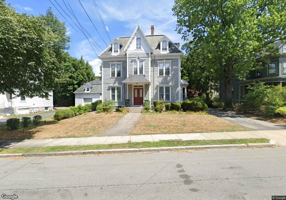
12 Walnut St Unit A Watertown, MA 02472
East Watertown NeighborhoodEstimated Value: $1,543,657 - $1,728,000
5
Beds
4
Baths
3,061
Sq Ft
$526/Sq Ft
Est. Value
About This Home
This home is located at 12 Walnut St Unit A, Watertown, MA 02472 and is currently estimated at $1,608,664, approximately $525 per square foot. 12 Walnut St Unit A is a home located in Middlesex County with nearby schools including St. Stephen's Armenian Elementary School, The Kendall School, and Atrium School.
Ownership History
Date
Name
Owned For
Owner Type
Purchase Details
Closed on
Jun 12, 2025
Sold by
Keach Development Llc
Bought by
Lesaux Nonie and Furlong Scott
Current Estimated Value
Home Financials for this Owner
Home Financials are based on the most recent Mortgage that was taken out on this home.
Original Mortgage
$1,203,750
Outstanding Balance
$1,200,468
Interest Rate
6.5%
Mortgage Type
Purchase Money Mortgage
Estimated Equity
$408,196
Purchase Details
Closed on
Jan 31, 2025
Sold by
Keach Development Llc
Bought by
Gray Gary S and Gray Kathleen S
Purchase Details
Closed on
Feb 22, 2024
Sold by
Harutunian Ruth
Bought by
Keach Development Llc
Home Financials for this Owner
Home Financials are based on the most recent Mortgage that was taken out on this home.
Original Mortgage
$2,300,500
Interest Rate
6.66%
Mortgage Type
Construction
Purchase Details
Closed on
Jan 24, 1984
Bought by
Harutunian Ruth
Create a Home Valuation Report for This Property
The Home Valuation Report is an in-depth analysis detailing your home's value as well as a comparison with similar homes in the area
Home Values in the Area
Average Home Value in this Area
Purchase History
| Date | Buyer | Sale Price | Title Company |
|---|---|---|---|
| Lesaux Nonie | $1,605,000 | None Available | |
| Lesaux Nonie | $1,605,000 | None Available | |
| Gray Gary S | $1,650,000 | None Available | |
| Gray Gary S | $1,650,000 | None Available | |
| Keach Development Llc | $1,210,000 | None Available | |
| Keach Development Llc | $1,210,000 | None Available | |
| Keach Development Llc | $1,210,000 | None Available | |
| Harutunian Ruth | -- | -- |
Source: Public Records
Mortgage History
| Date | Status | Borrower | Loan Amount |
|---|---|---|---|
| Open | Lesaux Nonie | $1,203,750 | |
| Closed | Lesaux Nonie | $1,203,750 | |
| Previous Owner | Keach Development Llc | $2,300,500 |
Source: Public Records
Tax History Compared to Growth
Tax History
| Year | Tax Paid | Tax Assessment Tax Assessment Total Assessment is a certain percentage of the fair market value that is determined by local assessors to be the total taxable value of land and additions on the property. | Land | Improvement |
|---|---|---|---|---|
| 2025 | $13,639 | $1,167,700 | $578,100 | $589,600 |
| 2024 | $14,750 | $1,260,700 | $568,100 | $692,600 |
| 2023 | $16,674 | $1,227,800 | $543,700 | $684,100 |
| 2022 | $15,672 | $1,182,800 | $492,300 | $690,500 |
| 2021 | $13,980 | $1,141,200 | $476,100 | $665,100 |
| 2020 | $13,475 | $1,110,000 | $459,800 | $650,200 |
| 2019 | $12,953 | $1,005,700 | $459,800 | $545,900 |
| 2018 | $12,421 | $922,100 | $427,400 | $494,700 |
| 2017 | $12,076 | $869,400 | $374,700 | $494,700 |
| 2016 | $11,616 | $849,100 | $354,400 | $494,700 |
| 2015 | $10,177 | $677,100 | $313,800 | $363,300 |
| 2014 | $9,826 | $656,800 | $293,500 | $363,300 |
Source: Public Records
Map
Nearby Homes
- 235 Mount Auburn St
- 11 Broadway Unit 11
- 84 Boylston St
- 24-26 Louise St
- 194 N Beacon St
- 180-182 Walnut St
- 93 Spring St Unit 29
- 14 Royal St
- 71 Palfrey St Unit 71
- 21 Fayette St Unit 1
- 14 N Beacon Ct
- 27 Ladd St Unit 27
- 25 Ladd St Unit 25
- 25 Ladd St
- 61-63 Church St
- 456 Belmont St Unit 10
- 456 Belmont St Unit 21
- 85 Dexter Ave Unit 87
- 85 Dexter Ave
- 57 Quimby St
- 12 Walnut St Unit B
- 16 Walnut St
- 253 Mount Auburn St
- 259 Mount Auburn St
- 24 Walnut St Unit 24
- 24 Walnut St
- 24 Walnut St Unit 2
- 21 Walnut St
- 21 Walnut St
- 21 Walnut St Unit 21
- 21 Walnut St Unit 2
- 21 Walnut St Unit 1
- 21 Walnut St Unit 2&3
- 29 Lincoln St
- 265 Mount Auburn St
- 11 Lincoln St
- 11 Lincoln St Unit 1
- 28 Walnut St Unit 30
- 9 Lincoln St Unit 9
- 37 Center St