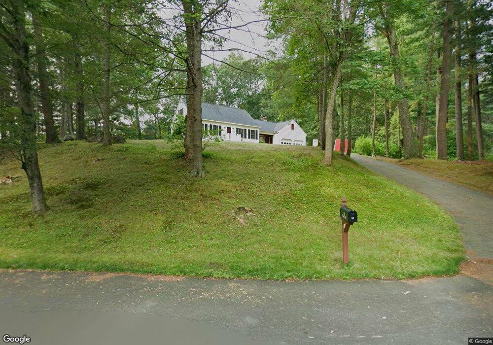
12 Wayne Rd Westford, MA 01886
Estimated Value: $739,994 - $876,000
4
Beds
2
Baths
1,827
Sq Ft
$442/Sq Ft
Est. Value
About This Home
This home is located at 12 Wayne Rd, Westford, MA 01886 and is currently estimated at $807,749, approximately $442 per square foot. 12 Wayne Rd is a home located in Middlesex County with nearby schools including Col John Robinson, John A. Crisafulli Elementary School, and Blanchard Middle School.
Ownership History
Date
Name
Owned For
Owner Type
Purchase Details
Closed on
Mar 31, 1989
Sold by
Connolly Brian E
Bought by
Brax Bruce C
Current Estimated Value
Home Financials for this Owner
Home Financials are based on the most recent Mortgage that was taken out on this home.
Original Mortgage
$160,000
Interest Rate
10.63%
Mortgage Type
Purchase Money Mortgage
Purchase Details
Closed on
Jun 25, 1987
Sold by
Friel Michael J
Bought by
Connolly Brian E
Home Financials for this Owner
Home Financials are based on the most recent Mortgage that was taken out on this home.
Original Mortgage
$145,000
Interest Rate
10.5%
Mortgage Type
Purchase Money Mortgage
Create a Home Valuation Report for This Property
The Home Valuation Report is an in-depth analysis detailing your home's value as well as a comparison with similar homes in the area
Home Values in the Area
Average Home Value in this Area
Purchase History
| Date | Buyer | Sale Price | Title Company |
|---|---|---|---|
| Brax Bruce C | $222,000 | -- | |
| Connolly Brian E | $212,000 | -- |
Source: Public Records
Mortgage History
| Date | Status | Borrower | Loan Amount |
|---|---|---|---|
| Closed | Connolly Brian E | $120,000 | |
| Closed | Connolly Brian E | $160,000 | |
| Previous Owner | Connolly Brian E | $145,000 |
Source: Public Records
Tax History
| Year | Tax Paid | Tax Assessment Tax Assessment Total Assessment is a certain percentage of the fair market value that is determined by local assessors to be the total taxable value of land and additions on the property. | Land | Improvement |
|---|---|---|---|---|
| 2025 | $8,461 | $628,100 | $353,000 | $275,100 |
| 2024 | $8,237 | $598,200 | $336,200 | $262,000 |
| 2023 | $8,118 | $550,000 | $320,100 | $229,900 |
| 2022 | $8,004 | $496,500 | $273,100 | $223,400 |
| 2021 | $6,988 | $461,600 | $273,100 | $188,500 |
| 2020 | $6,789 | $461,600 | $273,100 | $188,500 |
| 2019 | $6,920 | $417,900 | $273,100 | $144,800 |
| 2018 | $10,915 | $407,800 | $263,000 | $144,800 |
| 2017 | $6,400 | $390,000 | $263,000 | $127,000 |
| 2016 | $6,199 | $380,300 | $251,600 | $128,700 |
| 2015 | $6,040 | $371,900 | $241,600 | $130,300 |
| 2014 | $6,049 | $364,400 | $232,500 | $131,900 |
Source: Public Records
Map
Nearby Homes
- 252 Concord Rd Unit Lot 3A
- 4 Jarvis Way
- 84 Powers Rd
- 22 Phillips Dr
- 24 Alcorn Crossing
- 360 Littleton Rd Unit E5
- 360 Littleton Rd Unit C7
- 322 West St
- 875 Acton St
- 62 Main St
- 99 Mobile Ave
- 45 Hartland Way Unit 45
- 27 Hartland Way Unit 201
- 27 Hartland Way Unit 309
- 20 Marshall Path
- 559 Great Elm Way Unit 559
- 425 Great Elm Way Unit 425
- 232 Old Beaverbrook Unit 232
- 7 Beaver Dam Dr
- 21 Nashoba Rd
Your Personal Tour Guide
Ask me questions while you tour the home.