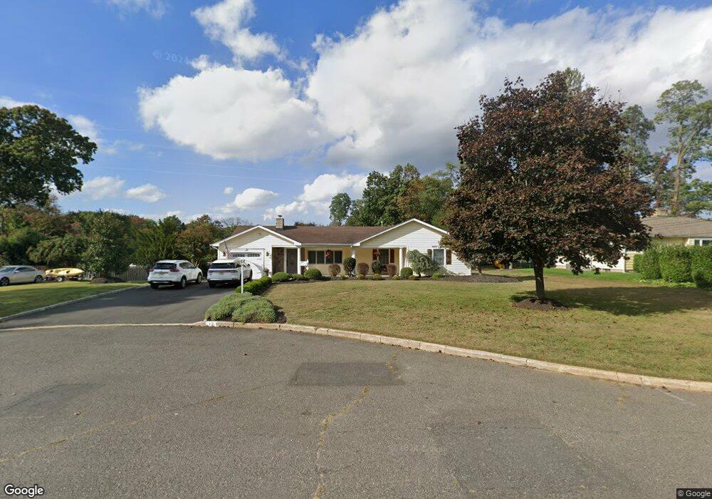
12 Westwood Dr Lincroft, NJ 07738
Estimated Value: $895,000 - $944,000
4
Beds
2
Baths
2,150
Sq Ft
$431/Sq Ft
Est. Value
About This Home
This home is located at 12 Westwood Dr, Lincroft, NJ 07738 and is currently estimated at $927,628, approximately $431 per square foot. 12 Westwood Dr is a home located in Monmouth County with nearby schools including Lincroft Elementary School, Thompson Middle School, and Middletown - South High School.
Ownership History
Date
Name
Owned For
Owner Type
Purchase Details
Closed on
Jan 15, 1999
Sold by
Taylor Carol
Bought by
Freibott George and Freibott Tejal
Current Estimated Value
Home Financials for this Owner
Home Financials are based on the most recent Mortgage that was taken out on this home.
Original Mortgage
$168,405
Outstanding Balance
$38,859
Interest Rate
6.7%
Mortgage Type
FHA
Estimated Equity
$888,769
Create a Home Valuation Report for This Property
The Home Valuation Report is an in-depth analysis detailing your home's value as well as a comparison with similar homes in the area
Home Values in the Area
Average Home Value in this Area
Purchase History
| Date | Buyer | Sale Price | Title Company |
|---|---|---|---|
| Freibott George | $183,000 | -- |
Source: Public Records
Mortgage History
| Date | Status | Borrower | Loan Amount |
|---|---|---|---|
| Open | Freibott George | $168,405 |
Source: Public Records
Tax History Compared to Growth
Tax History
| Year | Tax Paid | Tax Assessment Tax Assessment Total Assessment is a certain percentage of the fair market value that is determined by local assessors to be the total taxable value of land and additions on the property. | Land | Improvement |
|---|---|---|---|---|
| 2025 | $12,951 | $977,000 | $544,800 | $432,200 |
| 2024 | $12,595 | $787,300 | $363,000 | $424,300 |
| 2023 | $12,595 | $724,700 | $347,000 | $377,700 |
| 2022 | $12,388 | $600,400 | $240,700 | $359,700 |
| 2021 | $12,388 | $595,600 | $275,700 | $319,900 |
| 2020 | $12,580 | $588,400 | $275,700 | $312,700 |
| 2019 | $12,098 | $572,800 | $282,000 | $290,800 |
| 2018 | $11,830 | $545,900 | $268,600 | $277,300 |
| 2017 | $11,481 | $524,500 | $252,000 | $272,500 |
| 2016 | $11,030 | $517,600 | $252,000 | $265,600 |
| 2015 | $11,373 | $515,300 | $252,000 | $263,300 |
| 2014 | $10,469 | $462,600 | $222,000 | $240,600 |
Source: Public Records
Map
Nearby Homes
- 509 Newman Springs Rd
- 25 Hamilton Hill Rd
- 110 Whispering Pines Dr
- 45 Turnberry Dr
- 13 Joseph Dr
- 25 Parkview Terrace
- 80 Boxwood Terrace
- 119 Lindy Ln
- 36 James St
- 63 Eckert Dr
- 60 Privet Place
- 31 Rosalie Ave
- 107 Lawley Dr
- 59 Boxwood Terrace
- 210 Parkview Terrace
- 164 Arrowwood Ct
- 39 Boxwood Terrace
- 34 Boxwood Terrace Unit 186
- 17 High Point Rd
- 75 Harbor Green Cir
- 14 Westwood Dr
- 10 Westwood Dr
- 66 Leedsville Dr
- 68 Leedsville Dr
- 70 Leedsville Dr
- 8 Westwood Dr
- 48 Hilltop Cir
- 15 Westwood Dr
- 9 Westwood Dr
- 46 Hilltop Cir
- 72 Leedsville Dr
- 7 Westwood Dr
- 17 Westwood Dr
- 69 Leedsville Dr
- 5 Westwood Dr
- 67 Leedsville Dr
- 44 Hilltop Cir
- 74 Leedsville Dr
- 71 Leedsville Dr
- 49 Hilltop Cir